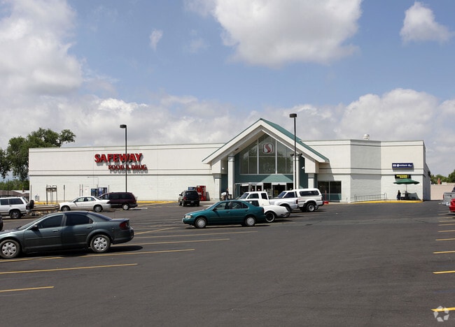
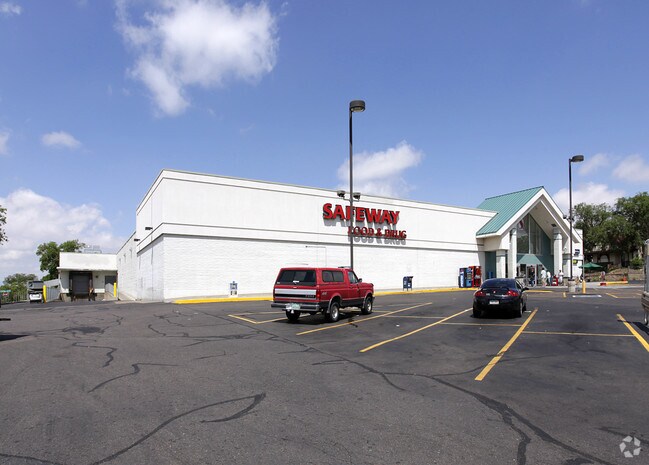
Property Record
1301 E 7Th St, Pueblo, CO 81001

Property Detail
1301 E 7Th St
0-4-29-3-34-023
PARCEL A REARRANGEMENT OF PROPERTY BOUNDARIES RPB-19-06,FORMERLY #04-293-34-020 THRU 022
Charitableorganization
PUEBLO
B and X Area of moderate flood hazard, usually the area between the limits of the 100-year and 500-year floods.
Colorado
2024
3.18 AC
2024
Colorado East Area
001100
Other Market Areas
65,508 SF
Pueblo, CO
NEARBY LISTINGS FOR SALE OR LEASE
DEMOGRAPHICS near 1301 E 7Th St
1 mile
3 mile
5 mile
2025 Total Population
12,692
59,357
107,423
2030 Population
12,708
59,344
107,227
Pop Growth 2025-2030
+ 0.13%
(0.02%)
(0.18%)
Average Age
38
40
41
2025 Total Households
4,968
24,179
44,151
HH Growth 2025-2030
+ 0.08%
(0.02%)
(0.16%)
Median Household Inc
$38,077
$48,670
$57,148
Avg Household Size
2.50
2.30
2.30
2025 Avg HH Vehicles
2.00
2.00
2.00
Median Home Value
$162,582
$232,830
$266,655
Median Year Built
1953
1956
1964
Nearby Places
Map Layers
Map Styles
 Street
 Aerial
Transit
 Traffic
 Biking
Places
Listings with unknown addresses are not visible on the map
- Restaurants
- Banks
- Shops
- Fitness
- Groceries
SALE & LEASE HISTORY
LISTING DATE
SALE/LEASE

Jan 30, 2017
For Sale
Nearby Properties
Address
Land Use
TOTAL SIZE
Lot Size
Zoning
Address
Land Use
TOTAL SIZE
Lot Size
Zoning
17,710 SF
49.97 AC
Address
Land Use
TOTAL SIZE
Lot Size
Zoning
486,484 SF
3.75 AC
R5:RES/MUL
Address
Land Use
TOTAL SIZE
Lot Size
Zoning
168,237 SF
3.69 AC
S-1
Address
Land Use
TOTAL SIZE
Lot Size
Zoning
53,269 SF
4.51 AC
Address
Land Use
TOTAL SIZE
Lot Size
Zoning
4,492,279 SF
488.39 AC
Address
Land Use
TOTAL SIZE
Lot Size
Zoning
122,704 SF
2.72 AC
B4:COMM/RE
Address
Land Use
TOTAL SIZE
Lot Size
Zoning
13,060 SF
11.06 AC
S-1
Address
Land Use
TOTAL SIZE
Lot Size
Zoning
54,250 SF
2.06 AC
B4:COMM/RE
Address
Land Use
TOTAL SIZE
Lot Size
Zoning
71,345 SF
5.17 AC
Address
Land Use
TOTAL SIZE
Lot Size
Zoning
71,936 SF
3.43 AC
R4:RES/MUL
Address
Land Use
TOTAL SIZE
Lot Size
Zoning
42,289 SF
0.54 AC
B4:COMM/RE
Address
Land Use
TOTAL SIZE
Lot Size
Zoning
40,986 SF
0.65 AC
R5:RES/MUL
Address
Land Use
TOTAL SIZE
Lot Size
Zoning
26,255 SF
2.08 AC
Address
Land Use
TOTAL SIZE
Lot Size
Zoning
44,544 SF
4 AC
R5:RES/MUL
Address
Land Use
TOTAL SIZE
Lot Size
Zoning
94,278 SF
2.11 AC
R-5
Address
Land Use
TOTAL SIZE
Lot Size
Zoning
200,121 SF
21.03 AC
B4:COMM/RE
Address
Land Use
TOTAL SIZE
Lot Size
Zoning
25,172 SF
1.42 AC
R5:RES/MUL
Address
Land Use
TOTAL SIZE
Lot Size
Zoning
17,906 SF
0.86 AC
PUD
Address
Land Use
TOTAL SIZE
Lot Size
Zoning
27,682 SF
1.85 AC
S-1
Address
Land Use
TOTAL SIZE
Lot Size
Zoning
25,714 SF
17.61 AC
Address
Land Use
TOTAL SIZE
Lot Size
Zoning
23,025 SF
1.21 AC
R5:RES/MUL
Address
Land Use
TOTAL SIZE
Lot Size
Zoning
13,178 SF
1.10 AC
R2:RES/1 F
Address
Land Use
TOTAL SIZE
Lot Size
Zoning
84,872 SF
0.76 AC
B4:COMM/RE
Address
Land Use
TOTAL SIZE
Lot Size
Zoning
35,530 SF
0.55 AC
R-4
Address
Land Use
TOTAL SIZE
Lot Size
Zoning
35,530 SF
0.54 AC
S1:SPC/PUB
Address
Land Use
TOTAL SIZE
Lot Size
Zoning
117,715 SF
3.58 AC
Address
Land Use
TOTAL SIZE
Lot Size
Zoning
22,611 SF
6.85 AC
S1:SPC/PUB
Address
Land Use
TOTAL SIZE
Lot Size
Zoning
13,216 SF
0.55 AC
B4:COMM/RE
Address
Land Use
TOTAL SIZE
Lot Size
Zoning
25,983 SF
0.97 AC
B4:COMM/RE
The World's #1 Commercial Real Estate Marketplace
Connect with us
© 2026 CoStar Group
The information above has been obtained from sources believed reliable. While we do not doubt its accuracy we have not verified it and make no guarantee, warranty or representation about it. It is your responsibility to independently confirm its accuracy and completeness. Any projections, opinions, assumptions, or estimates used are for example only and do not represent the current or future performance of the property. The value of this transaction to you depends on tax and other factors which should be evaluated by your tax, financial, and legal advisors. You and your advisors should conduct a careful, independent investigation of the property to determine to your satisfaction the suitability of the property for your needs.