Property Record
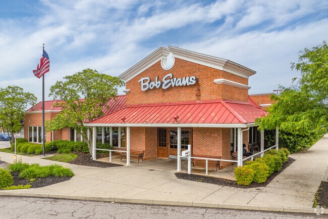
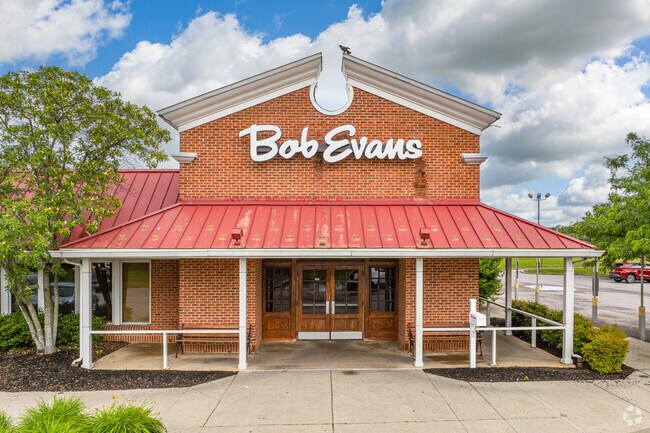
1301 Governors Pl, Bear, DE 19701

Property Detail
1301 Governors Pl
10-039.00-045
New Castle
Restaurantbuilding
Delaware
CR
a4
B and X Area of moderate flood hazard, usually the area between the limits of the 100-year and 500-year floods.
1.34 AC
2025
South New Castle County
2025
Philadelphia
014906
Philadelphia-Camden-Wilmington, PA-NJ-DE-MD
6,676 SF
NEARBY LISTINGS FOR SALE OR LEASE
DEMOGRAPHICS near 1301 Governors Pl
1 mile
3 mile
5 mile
2025 Total Population
10,908
85,094
147,451
2030 Population
11,103
88,105
152,002
Pop Growth 2025-2030
+ 1.79%
+ 3.54%
+ 3.09%
Average Age
39
40
40
2025 Total Households
4,348
32,961
57,309
HH Growth 2025-2030
+ 1.89%
+ 3.85%
+ 3.35%
Median Household Inc
$75,391
$81,487
$83,183
Avg Household Size
2.50
2.50
2.50
2025 Avg HH Vehicles
2.00
2.00
2.00
Median Home Value
$267,329
$318,171
$318,616
Median Year Built
1989
1990
1986
Nearby Places
Map Layers
Map Styles
 Street
 Aerial
Layers
 Traffic
 Biking
Places
Listings with unknown addresses are not visible on the map
- Restaurants
- Banks
- Shops
- Fitness
- Groceries
PUBLIC TRANSPORTATION
COMMUTER RAIL
Churchmans Crossing (R2 - Southeastern Pennsylvania Transportation Authority Regional Rail (SEPTA Regional Rail))
Drive
Walk
Distance
Churchmans Crossing (R2 - Southeastern Pennsylvania Transportation Authority Regional Rail (SEPTA Regional Rail))
11 min
6.4 mi
Newark (R2 - Southeastern Pennsylvania Transportation Authority Regional Rail (SEPTA Regional Rail))
Drive
Walk
Distance
Newark (R2 - Southeastern Pennsylvania Transportation Authority Regional Rail (SEPTA Regional Rail))
15 min
9.5 mi
AIRPORT
Philadelphia International
Drive
Walk
Distance
Philadelphia International
45 min
32.8 mi
Freight Ports
Port of Wilmington, RI
Drive
Walk
Distance
Port of Wilmington, RI
20 min
12.7 mi
Nearby Properties
Address
Land Use
TOTAL SIZE
Lot Size
Zoning
Address
Land Use
TOTAL SIZE
Lot Size
Zoning
326,520 SF
125.02 AC
EX
Address
Land Use
TOTAL SIZE
Lot Size
Zoning
Address
Land Use
TOTAL SIZE
Lot Size
Zoning
Address
Land Use
TOTAL SIZE
Lot Size
Zoning
735,703 SF
49.15 AC
NCAP
Address
Land Use
TOTAL SIZE
Lot Size
Zoning
4,676 SF
42.81 AC
NCAP
Address
Land Use
TOTAL SIZE
Lot Size
Zoning
259,722 SF
20.72 AC
NCAP
Address
Land Use
TOTAL SIZE
Lot Size
Zoning
33,790 SF
45.17 AC
S
Address
Land Use
TOTAL SIZE
Lot Size
Zoning
76,357 SF
145.10 AC
CR
Address
Land Use
TOTAL SIZE
Lot Size
Zoning
294,518 SF
29.44 AC
ST
Address
Land Use
TOTAL SIZE
Lot Size
Zoning
343,216 SF
27.10 AC
ST
Address
Land Use
TOTAL SIZE
Lot Size
Zoning
333,334 SF
20.57 AC
NCPUD
Address
Land Use
TOTAL SIZE
Lot Size
Zoning
135,764 SF
18.59 AC
NCAP
Address
Land Use
TOTAL SIZE
Lot Size
Zoning
Address
Land Use
TOTAL SIZE
Lot Size
Zoning
234,941 SF
19.54 AC
NCPUD
Address
Land Use
TOTAL SIZE
Lot Size
Zoning
Address
Land Use
TOTAL SIZE
Lot Size
Zoning
293,376 SF
149.74 AC
I
Address
Land Use
TOTAL SIZE
Lot Size
Zoning
294.01 AC
HI
Address
Land Use
TOTAL SIZE
Lot Size
Zoning
18,476 SF
18 AC
NCAP
Address
Land Use
TOTAL SIZE
Lot Size
Zoning
138,735 SF
20.38 AC
CR
Address
Land Use
TOTAL SIZE
Lot Size
Zoning
62,498 SF
132.23 AC
I
Address
Land Use
TOTAL SIZE
Lot Size
Zoning
276,191 SF
54.91 AC
BP
Address
Land Use
TOTAL SIZE
Lot Size
Zoning
281,611 SF
26.39 AC
NCAP
Address
Land Use
TOTAL SIZE
Lot Size
Zoning
295,200 SF
17.94 AC
NCAP
Address
Land Use
TOTAL SIZE
Lot Size
Zoning
305,422 SF
22.35 AC
NCPUD
Address
Land Use
TOTAL SIZE
Lot Size
Zoning
152,075 SF
35.66 AC
CR
Address
Land Use
TOTAL SIZE
Lot Size
Zoning
6,180 SF
214.27 AC
HI
Address
Land Use
TOTAL SIZE
Lot Size
Zoning
187,286 SF
24.20 AC
CR
Address
Land Use
TOTAL SIZE
Lot Size
Zoning
268,661 SF
28.38 AC
NCAP
Address
Land Use
TOTAL SIZE
Lot Size
Zoning
Address
Land Use
TOTAL SIZE
Lot Size
Zoning
18,101 SF
8.91 AC
NCAP
The World's #1 Commercial Real Estate Marketplace
Connect with us
© 2026 CoStar Group
The information above has been obtained from sources believed reliable. While we do not doubt its accuracy we have not verified it and make no guarantee, warranty or representation about it. It is your responsibility to independently confirm its accuracy and completeness. Any projections, opinions, assumptions, or estimates used are for example only and do not represent the current or future performance of the property. The value of this transaction to you depends on tax and other factors which should be evaluated by your tax, financial, and legal advisors. You and your advisors should conduct a careful, independent investigation of the property to determine to your satisfaction the suitability of the property for your needs.