Property Record
1301 M 43, South Haven, MI 49090


NEARBY LISTINGS FOR SALE OR LEASE
Property Detail
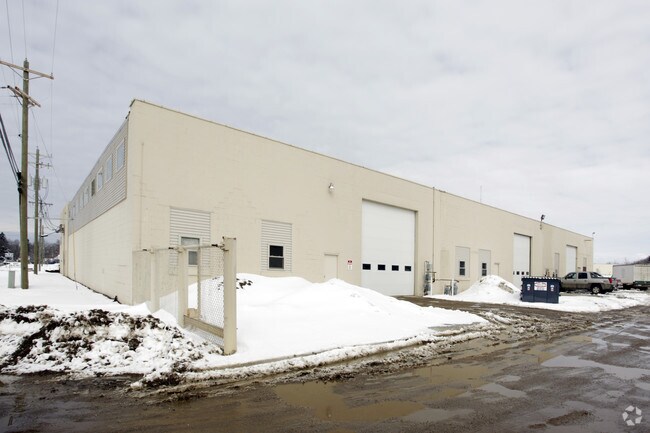
1301 M 43
80-53-622-001-00
B1001 14-1-17 1127-684 1181-844 1335-785 1433-593 1540-769 1556-395 COM AT NW COR OF SEC, TH N89D9'E ALG N SEC L 979.57', TH
Warehouse
Van Buren
X
Michigan
26159C0019D
7.76 AC
2024
Van Buren County
2025
West Michigan
010500
Kalamazoo-Portage, MI
55,032 SF
DEMOGRAPHICS near 1301 M 43
1 Mile
3 Mile
5 Mile
2024 Total Population
2,328
10,505
14,023
2029 Population
2,385
10,945
14,511
Pop Growth 2024-2029
+ 2.45%
+ 4.19%
+ 3.48%
Average Age
43
47
46
2024 Total Households
985
4,861
6,262
HH Growth 2024-2029
+ 2.44%
+ 4.67%
+ 3.94%
Median Household Inc
$43,632
$52,909
$54,927
Avg Household Size
2.20
2.10
2.20
2024 Avg HH Vehicles
2.00
2.00
2.00
Median Home Value
$225,281
$286,956
$268,320
Median Year Built
1959
1972
1974
Nearby Places
Map Layers
Map Styles
 Street
 Aerial
- Restaurants
- Banks
- Shops
- Fitness
- Groceries
PUBLIC TRANSPORTATION
COMMUTER RAIL
DRIVE
WALK
Distance
15 min
9.6 mi
Nearby Properties
Address
Land Use
TOTAL SIZE
Lot Size
Zoning
Address
Land Use
TOTAL SIZE
Lot Size
Zoning
190,640 SF
12.53 AC
Address
Land Use
TOTAL SIZE
Lot Size
Zoning
199,297 SF
28.26 AC
B-4
Address
Land Use
TOTAL SIZE
Lot Size
Zoning
223,972 SF
14.11 AC
B-2
Address
Land Use
TOTAL SIZE
Lot Size
Zoning
50,000 SF
3.11 AC
Address
Land Use
TOTAL SIZE
Lot Size
Zoning
36,203 SF
4.40 AC
RM-1
Address
Land Use
TOTAL SIZE
Lot Size
Zoning
1,428 SF
5.80 AC
HIGH DENSE
Address
Land Use
TOTAL SIZE
Lot Size
Zoning
121,966 SF
19.66 AC
I-2
Address
Land Use
TOTAL SIZE
Lot Size
Zoning
26,272 SF
Address
Land Use
TOTAL SIZE
Lot Size
Zoning
152,748 SF
16.10 AC
I-1
Address
Land Use
TOTAL SIZE
Lot Size
Zoning
39,372 SF
6.84 AC
RM-1
Address
Land Use
TOTAL SIZE
Lot Size
Zoning
38,967 SF
3.90 AC
RM-1
Address
Land Use
TOTAL SIZE
Lot Size
Zoning
38,500 SF
Address
Land Use
TOTAL SIZE
Lot Size
Zoning
4,194 SF
0.53 AC
B-3
Address
Land Use
TOTAL SIZE
Lot Size
Zoning
32,268 SF
2.62 AC
R-2
Address
Land Use
TOTAL SIZE
Lot Size
Zoning
8,340 SF
12.53 AC
Address
Land Use
TOTAL SIZE
Lot Size
Zoning
37,152 SF
5.25 AC
Address
Land Use
TOTAL SIZE
Lot Size
Zoning
2,640 SF
7.80 AC
B-4
Address
Land Use
TOTAL SIZE
Lot Size
Zoning
36,800 SF
2.20 AC
B-3
Address
Land Use
TOTAL SIZE
Lot Size
Zoning
19,602 SF
0.23 AC
CBD
Address
Land Use
TOTAL SIZE
Lot Size
Zoning
32,040 SF
1.60 AC
PUD
Address
Land Use
TOTAL SIZE
Lot Size
Zoning
6,961 SF
0.23 AC
B-3
Address
Land Use
TOTAL SIZE
Lot Size
Zoning
43,920 SF
5.63 AC
RM-1
Address
Land Use
TOTAL SIZE
Lot Size
Zoning
8,976 SF
5.90 AC
RM-1
Address
Land Use
TOTAL SIZE
Lot Size
Zoning
6,705 SF
0.37 AC
RM-1
Address
Land Use
TOTAL SIZE
Lot Size
Zoning
14.14 AC
RM-1
Address
Land Use
TOTAL SIZE
Lot Size
Zoning
26,666 SF
1.56 AC
RM-1
Address
Land Use
TOTAL SIZE
Lot Size
Zoning
20,144 SF
86,684 AC
B-3
Address
Land Use
TOTAL SIZE
Lot Size
Zoning
49,928 SF
5 AC
I-1
Address
Land Use
TOTAL SIZE
Lot Size
Zoning
65,786 SF
5.27 AC
I-1
Address
Land Use
TOTAL SIZE
Lot Size
Zoning
47,389 SF
4.06 AC
B-4
The World's #1 Commercial Real Estate Marketplace
Connect with us
© 2026 CoStar Group
The information above has been obtained from sources believed reliable. While we do not doubt its accuracy we have not verified it and make no guarantee, warranty or representation about it. It is your responsibility to independently confirm its accuracy and completeness. Any projections, opinions, assumptions, or estimates used are for example only and do not represent the current or future performance of the property. The value of this transaction to you depends on tax and other factors which should be evaluated by your tax, financial, and legal advisors. You and your advisors should conduct a careful, independent investigation of the property to determine to your satisfaction the suitability of the property for your needs.