Property Record
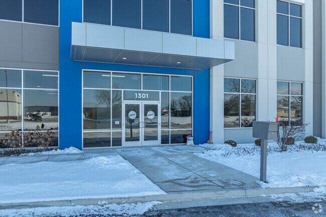
1301 N Abbott Rd, Romeoville, IL 60446


NEARBY LISTINGS FOR SALE OR LEASE
Property Detail
1301 N Abbott Rd
Chicago-Naperville-Elgin, IL-IN-WI
Romeoville Gateway
12-02-26-105-002
LOT 2 IN ROMEOVILLE GATEWAY, BEING A SUB OF PRT OF THE NW1/4 OF SEC. 26, T37N-R10E.
Industrialgeneral
Will
AE
Illinois
17197C0070G
2
2023
28.15 AC
2024
South I-55 Corridor
880202
Chicago
DEMOGRAPHICS near 1301 N Abbott Rd
1 Mile
3 Mile
5 Mile
2024 Total Population
1,994
46,446
140,948
2029 Population
1,978
46,053
139,593
Pop Growth 2024-2029
(0.80%)
(0.85%)
(0.96%)
Average Age
38
37
40
2024 Total Households
692
14,937
48,248
HH Growth 2024-2029
(0.72%)
(0.84%)
(1.01%)
Median Household Inc
$59,789
$80,616
$95,040
Avg Household Size
2.90
3.00
2.90
2024 Avg HH Vehicles
2.00
2.00
2.00
Median Home Value
$162,139
$208,480
$270,970
Median Year Built
1978
1976
1988
Nearby Places
Map Layers
Map Styles
 Street
 Aerial
- Restaurants
- Banks
- Shops
- Fitness
- Groceries
PUBLIC TRANSPORTATION
COMMUTER RAIL
Romeoville (Heritage Corridor - Metra)
DRIVE
WALK
Distance
Romeoville (Heritage Corridor - Metra)
13 min
4.9 mi
Lemont Station (Heritage Corridor Line - Northeast Illinois Regional Commuter Railroad (Metra))
DRIVE
WALK
Distance
Lemont Station (Heritage Corridor Line - Northeast Illinois Regional Commuter Railroad (Metra))
16 min
6.5 mi
AIRPORT
Chicago Midway International
DRIVE
WALK
Distance
Chicago Midway International
32 min
20.2 mi
Chicago O'Hare International
DRIVE
WALK
Distance
Chicago O'Hare International
49 min
31.6 mi
Freight Ports
Port Milwaukee
DRIVE
WALK
Distance
Port Milwaukee
130 min
103.3 mi
SALE & LEASE HISTORY
LISTING DATE
SALE/LEASE

Sep 26, 2017
For Lease
Jun 02, 2021
For Lease
Nearby Properties
Address
Land Use
TOTAL SIZE
Lot Size
Zoning
Address
Land Use
TOTAL SIZE
Lot Size
Zoning
122.95 AC
Address
Land Use
TOTAL SIZE
Lot Size
Zoning
32.82 AC
Address
Land Use
TOTAL SIZE
Lot Size
Zoning
115.36 AC
Address
Land Use
TOTAL SIZE
Lot Size
Zoning
49.82 AC
Address
Land Use
TOTAL SIZE
Lot Size
Zoning
1,107,073 SF
35.03 AC
Address
Land Use
TOTAL SIZE
Lot Size
Zoning
759,709 SF
41.75 AC
Address
Land Use
TOTAL SIZE
Lot Size
Zoning
48.48 AC
Address
Land Use
TOTAL SIZE
Lot Size
Zoning
49.91 AC
Address
Land Use
TOTAL SIZE
Lot Size
Zoning
751,809 SF
36.59 AC
Address
Land Use
TOTAL SIZE
Lot Size
Zoning
806,164 SF
35.45 AC
Address
Land Use
TOTAL SIZE
Lot Size
Zoning
Address
Land Use
TOTAL SIZE
Lot Size
Zoning
698,727 SF
40.97 AC
Address
Land Use
TOTAL SIZE
Lot Size
Zoning
723,073 SF
37.46 AC
Address
Land Use
TOTAL SIZE
Lot Size
Zoning
652,056 SF
26.43 AC
Address
Land Use
TOTAL SIZE
Lot Size
Zoning
691,629 SF
32.73 AC
Address
Land Use
TOTAL SIZE
Lot Size
Zoning
12.52 AC
Address
Land Use
TOTAL SIZE
Lot Size
Zoning
581,000 SF
28.56 AC
Address
Land Use
TOTAL SIZE
Lot Size
Zoning
270,372 SF
12.49 AC
Address
Land Use
TOTAL SIZE
Lot Size
Zoning
557,851 SF
25.47 AC
Address
Land Use
TOTAL SIZE
Lot Size
Zoning
531,348 SF
24.95 AC
Address
Land Use
TOTAL SIZE
Lot Size
Zoning
528,732 SF
24.07 AC
Address
Land Use
TOTAL SIZE
Lot Size
Zoning
453,579 SF
21.23 AC
Address
Land Use
TOTAL SIZE
Lot Size
Zoning
504,722 SF
26.19 AC
Address
Land Use
TOTAL SIZE
Lot Size
Zoning
513,805 SF
23.84 AC
Address
Land Use
TOTAL SIZE
Lot Size
Zoning
165.89 AC
Address
Land Use
TOTAL SIZE
Lot Size
Zoning
506,726 SF
28.54 AC
Address
Land Use
TOTAL SIZE
Lot Size
Zoning
490,436 SF
22.22 AC
Address
Land Use
TOTAL SIZE
Lot Size
Zoning
500,160 SF
25.07 AC
Address
Land Use
TOTAL SIZE
Lot Size
Zoning
600,566 SF
20.17 AC
The World's #1 Commercial Real Estate Marketplace
Connect with us
© 2026 CoStar Group
The information above has been obtained from sources believed reliable. While we do not doubt its accuracy we have not verified it and make no guarantee, warranty or representation about it. It is your responsibility to independently confirm its accuracy and completeness. Any projections, opinions, assumptions, or estimates used are for example only and do not represent the current or future performance of the property. The value of this transaction to you depends on tax and other factors which should be evaluated by your tax, financial, and legal advisors. You and your advisors should conduct a careful, independent investigation of the property to determine to your satisfaction the suitability of the property for your needs.