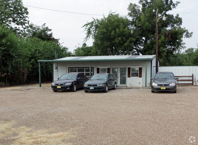
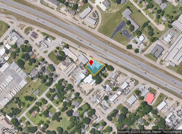
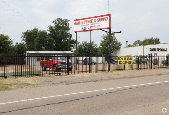
Property Record
1301 N Us Highway 175, Seagoville Dallas Co, TX
NEARBY LISTINGS FOR SALE OR LEASE
Property Detail
1301 N Us Highway 175
Dallas/Ft Worth
Denson
Dallas-Fort Worth-Arlington, TX
DENSON BLK 1 LT 3 ACS 0.473 VOL98247/7066 DD12011998 CO-DC 0125700100300 4CJ03677251
50012570010030000
Dallas
Storebuilding
Texas
2024
3
2025
0.47 AC
805 SF
Southeast Outlying
DEMOGRAPHICS near 1301 N Us Highway 175
1 Mile
3 Mile
5 Mile
2024 Total Population
8,083
28,529
57,451
2029 Population
8,154
28,714
58,240
Pop Growth 2024-2029
+ 0.88%
+ 0.65%
+ 1.37%
Average Age
38
34
33
2024 Total Households
2,120
7,806
16,058
HH Growth 2024-2029
+ 1.23%
+ 0.51%
+ 1.35%
Median Household Inc
$45,662
$52,099
$53,378
Avg Household Size
3.00
3.30
3.40
2024 Avg HH Vehicles
2.00
2.00
2.00
Median Home Value
$172,186
$180,291
$181,447
Median Year Built
1990
1997
1998
Nearby Places
- Restaurants
- Banks
- Shops
- Fitness
- Groceries
PUBLIC TRANSPORTATION
AIRPORT
Dallas Love Field
DRIVE
WALK
Distance
Dallas Love Field
34 min
24.2 mi
Freight Ports
Port of Shreveport
DRIVE
WALK
Distance
Port of Shreveport
198 min
183.1 mi
Nearby Properties
Address
Land Use
TOTAL SIZE
Lot Size
Zoning
Address
Land Use
TOTAL SIZE
Lot Size
Zoning
457,110 SF
100.05 AC
Z293
Address
Land Use
TOTAL SIZE
Lot Size
Zoning
361,155 SF
14.64 AC
Z308
Address
Land Use
TOTAL SIZE
Lot Size
Zoning
372,456 SF
17.34 AC
Z116
Address
Land Use
TOTAL SIZE
Lot Size
Zoning
109,472 SF
6.98 AC
Address
Land Use
TOTAL SIZE
Lot Size
Zoning
400 SF
50.76 AC
MFA
Address
Land Use
TOTAL SIZE
Lot Size
Zoning
321 SF
40.51 AC
MFA
Address
Land Use
TOTAL SIZE
Lot Size
Zoning
106,462 SF
9.58 AC
Z236
Address
Land Use
TOTAL SIZE
Lot Size
Zoning
377,133 SF
16.71 AC
Z131
Address
Land Use
TOTAL SIZE
Lot Size
Zoning
88,320 SF
4.48 AC
Z72
Address
Land Use
TOTAL SIZE
Lot Size
Zoning
216,327 SF
26.31 AC
Address
Land Use
TOTAL SIZE
Lot Size
Zoning
319 SF
37.74 AC
SUP1
Address
Land Use
TOTAL SIZE
Lot Size
Zoning
172,068 SF
17.25 AC
Z137
Address
Land Use
TOTAL SIZE
Lot Size
Zoning
28,126 SF
166.45 AC
Z05
Address
Land Use
TOTAL SIZE
Lot Size
Zoning
96 SF
14.18 AC
I2
Address
Land Use
TOTAL SIZE
Lot Size
Zoning
19,641 SF
4.37 AC
Z236
Address
Land Use
TOTAL SIZE
Lot Size
Zoning
83,266 SF
6.73 AC
Z131
Address
Land Use
TOTAL SIZE
Lot Size
Zoning
100,200 SF
6.93 AC
Z05
Address
Land Use
TOTAL SIZE
Lot Size
Zoning
108 SF
14.44 AC
Z31
Address
Land Use
TOTAL SIZE
Lot Size
Zoning
65,577 SF
11.80 AC
Z31
Address
Land Use
TOTAL SIZE
Lot Size
Zoning
75,908 SF
11.11 AC
Z308
Address
Land Use
TOTAL SIZE
Lot Size
Zoning
53,449 SF
20.04 AC
Z308
Address
Land Use
TOTAL SIZE
Lot Size
Zoning
96 SF
8 AC
MFA
Address
Land Use
TOTAL SIZE
Lot Size
Zoning
116 SF
17.69 AC
AA
Address
Land Use
TOTAL SIZE
Lot Size
Zoning
92 SF
11.39 AC
SUP12
Address
Land Use
TOTAL SIZE
Lot Size
Zoning
69,235 SF
4.21 AC
Z308
Address
Land Use
TOTAL SIZE
Lot Size
Zoning
94,615 SF
3.34 AC
Z399
Address
Land Use
TOTAL SIZE
Lot Size
Zoning
85 SF
9.99 AC
MFA
Address
Land Use
TOTAL SIZE
Lot Size
Zoning
51,770 SF
7.61 AC
Z31
Address
Land Use
TOTAL SIZE
Lot Size
Zoning
10,010 SF
1.50 AC
Z137
Address
Land Use
TOTAL SIZE
Lot Size
Zoning
19,670 SF
1.95 AC
Z137
The World's #1 Commercial Real Estate Marketplace
Connect with us
© 2025 CoStar Group
The information above has been obtained from sources believed reliable. While we do not doubt its accuracy we have not verified it and make no guarantee, warranty or representation about it. It is your responsibility to independently confirm its accuracy and completeness. Any projections, opinions, assumptions, or estimates used are for example only and do not represent the current or future performance of the property. The value of this transaction to you depends on tax and other factors which should be evaluated by your tax, financial, and legal advisors. You and your advisors should conduct a careful, independent investigation of the property to determine to your satisfaction the suitability of the property for your needs.