Property Record
1301 Precon Dr, Chesapeake, VA 23320

Property Detail
1301 Precon Dr
0350000001230
LT 4A RESUB 4&5 WATERWAY INDUSTRIAL PK PH 2 1.801
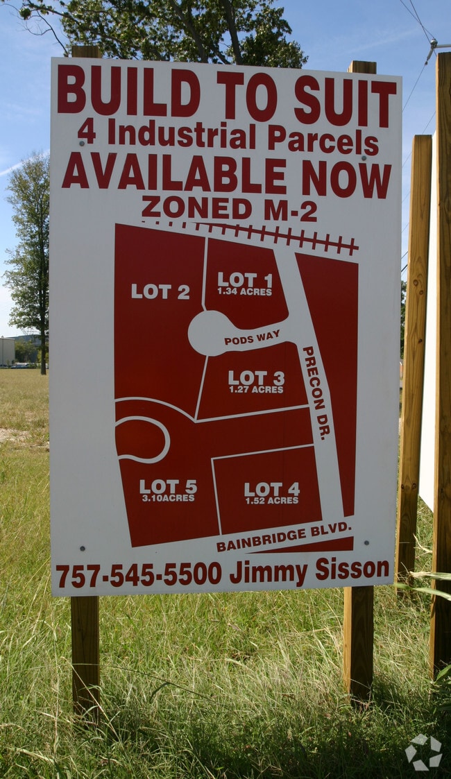
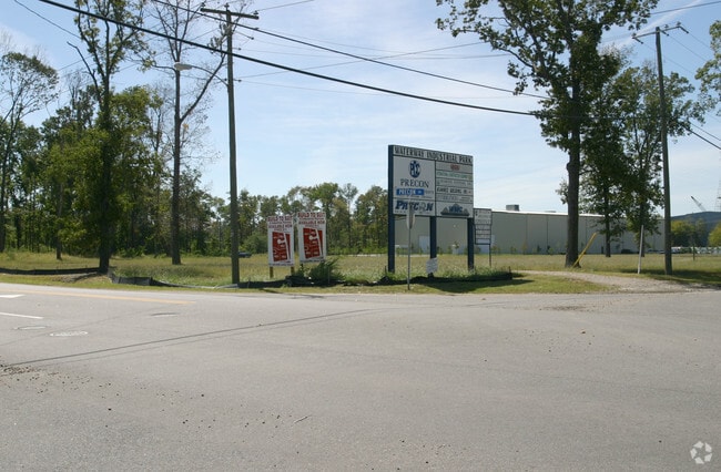
Distributionwarehouseregional
Chesapeake City
M1: LIGHT
Virginia
AE The base floodplain where base flood elevations are provided. AE Zones are now used on new format FIRMs instead of A1-A30 Zones.
1.80 AC
2024
Southern Chesapeake
2025
Hampton Roads
020903
Virginia Beach-Chesapeake-Norfolk, VA-NC
12,000 SF
NEARBY LISTINGS FOR SALE OR LEASE
-
-
-
-
-
-
No Photo
-
-
View all Chesapeake listings for sale on LoopNet.com
DEMOGRAPHICS near 1301 Precon Dr
1 mile
3 mile
5 mile
2025 Total Population
4,362
58,751
202,696
2030 Population
4,444
59,483
205,030
Pop Growth 2025-2030
+ 1.88%
+ 1.25%
+ 1.15%
Average Age
37
39
38
2025 Total Households
1,541
22,877
76,969
HH Growth 2025-2030
+ 2.01%
+ 1.33%
+ 1.17%
Median Household Inc
$67,751
$79,974
$76,048
Avg Household Size
2.80
2.50
2.60
2025 Avg HH Vehicles
2.00
2.00
2.00
Median Home Value
$281,994
$322,148
$326,213
Median Year Built
1991
1988
1985
Nearby Places
Map Layers
Map Styles
 Street
 Aerial
Transit
 Traffic
 Biking
Places
Listings with unknown addresses are not visible on the map
- Restaurants
- Banks
- Shops
- Fitness
- Groceries
PUBLIC TRANSPORTATION
COMMUTER RAIL
Drive
Walk
Distance
12 min
6.8 mi
AIRPORT
Norfolk International
Drive
Walk
Distance
Norfolk International
24 min
13.2 mi
Newport News/Williamsburg International
Drive
Walk
Distance
Newport News/Williamsburg International
53 min
34.9 mi
Nearby Properties
Address
Land Use
TOTAL SIZE
Lot Size
Zoning
Address
Land Use
TOTAL SIZE
Lot Size
Zoning
470,098 SF
14.10 AC
O-I: OFFIC
Address
Land Use
TOTAL SIZE
Lot Size
Zoning
405,992 SF
40.22 AC
PUD: PLANN
Address
Land Use
TOTAL SIZE
Lot Size
Zoning
6,820 SF
89.90 AC
R15S: RESI
Address
Land Use
TOTAL SIZE
Lot Size
Zoning
482.38 AC
MULTI: MUL
Address
Land Use
TOTAL SIZE
Lot Size
Zoning
358,908 SF
22.21 AC
MULTI: MUL
Address
Land Use
TOTAL SIZE
Lot Size
Zoning
299,727 SF
170.79 AC
C1: CONSER
Address
Land Use
TOTAL SIZE
Lot Size
Zoning
209,403 SF
2.81 AC
PUD: PLANN
Address
Land Use
TOTAL SIZE
Lot Size
Zoning
252,524 SF
20 AC
R8S: RESID
Address
Land Use
TOTAL SIZE
Lot Size
Zoning
286,936 SF
15 AC
RMF1: MULT
Address
Land Use
TOTAL SIZE
Lot Size
Zoning
32,163 SF
17.59 AC
MULTI: MUL
Address
Land Use
TOTAL SIZE
Lot Size
Zoning
26.63 AC
Address
Land Use
TOTAL SIZE
Lot Size
Zoning
92,723 SF
28.83 AC
R6: RESIDE
Address
Land Use
TOTAL SIZE
Lot Size
Zoning
142,656 SF
22.17 AC
RMF1: MULT
Address
Land Use
TOTAL SIZE
Lot Size
Zoning
277,846 SF
12.50 AC
RMF1: MULT
Address
Land Use
TOTAL SIZE
Lot Size
Zoning
178,068 SF
14.72 AC
M1: LIGHT
Address
Land Use
TOTAL SIZE
Lot Size
Zoning
75,936 SF
11.13 AC
MULTI: MUL
Address
Land Use
TOTAL SIZE
Lot Size
Zoning
127,755 SF
14.68 AC
PUD: PLANN
Address
Land Use
TOTAL SIZE
Lot Size
Zoning
162,291 SF
2.98 AC
PUD: PLANN
Address
Land Use
TOTAL SIZE
Lot Size
Zoning
166,753 SF
1.46 AC
PUD: PLANN
Address
Land Use
TOTAL SIZE
Lot Size
Zoning
63,050 SF
27.71 AC
O-I: OFFIC
Address
Land Use
TOTAL SIZE
Lot Size
Zoning
12,240 SF
20.98 AC
MULTI: MUL
Address
Land Use
TOTAL SIZE
Lot Size
Zoning
28,253 SF
32.34 AC
M3: WATERF
Address
Land Use
TOTAL SIZE
Lot Size
Zoning
119,946 SF
9.76 AC
M2: GENERA
Address
Land Use
TOTAL SIZE
Lot Size
Zoning
175,028 SF
12.41 AC
RMF1: MULT
Address
Land Use
TOTAL SIZE
Lot Size
Zoning
88,000 SF
37.05 AC
M2: GENERA
Address
Land Use
TOTAL SIZE
Lot Size
Zoning
144,984 SF
6.34 AC
O-I: OFFIC
Address
Land Use
TOTAL SIZE
Lot Size
Zoning
121,111 SF
16.68 AC
B3: HIGHWA
Address
Land Use
TOTAL SIZE
Lot Size
Zoning
119,870 SF
12.21 AC
B3: HIGHWA
Address
Land Use
TOTAL SIZE
Lot Size
Zoning
1,921 SF
9.46 AC
RMF1: MULT
Address
Land Use
TOTAL SIZE
Lot Size
Zoning
201,130 SF
5.44 AC
RMF1: MULT
The World's #1 Commercial Real Estate Marketplace
Connect with us
© 2026 CoStar Group
The information above has been obtained from sources believed reliable. While we do not doubt its accuracy we have not verified it and make no guarantee, warranty or representation about it. It is your responsibility to independently confirm its accuracy and completeness. Any projections, opinions, assumptions, or estimates used are for example only and do not represent the current or future performance of the property. The value of this transaction to you depends on tax and other factors which should be evaluated by your tax, financial, and legal advisors. You and your advisors should conduct a careful, independent investigation of the property to determine to your satisfaction the suitability of the property for your needs.