Property Record
1301 Stuart Ave, Albany, GA 31707


Save to a Folder
{{folder.Name}}
{{folder.ListingIds.length}} Properties
{{folder.ListingIds.length}} Property
Create a New Folder
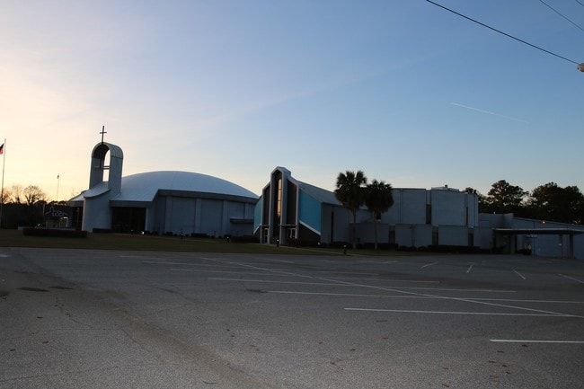
Property Detail
1301 Stuart Ave
000MM-00015-028
ALL OF LOT 20, LOT 4,5,6
Governmentalpublicusegeneral
DOUGHERTY
R-2
Georgia
B and X Area of moderate flood hazard, usually the area between the limits of the 100-year and 500-year floods.
20
0
4.68 AC
2025
Albany/Southwest
000502
Other Market Areas
42,448 SF
Albany, GA
NEARBY LISTINGS FOR SALE OR LEASE
DEMOGRAPHICS near 1301 Stuart Ave
1 mile
3 mile
5 mile
2025 Total Population
4,293
32,709
73,736
2030 Population
4,125
32,214
72,723
Pop Growth 2025-2030
(3.91%)
(1.51%)
(1.37%)
Average Age
39
39
39
2025 Total Households
1,980
14,319
30,183
HH Growth 2025-2030
(3.84%)
(1.67%)
(1.48%)
Median Household Inc
$53,868
$53,675
$52,279
Avg Household Size
2.10
2.20
2.30
2025 Avg HH Vehicles
1.00
2.00
2.00
Median Home Value
$148,595
$191,095
$190,824
Median Year Built
1969
1976
1977
Nearby Places
Map Layers
Map Styles
 Street
 Aerial
Layers
 Traffic
 Biking
Places
Listings with unknown addresses are not visible on the map
- Restaurants
- Banks
- Shops
- Fitness
- Groceries
PUBLIC TRANSPORTATION
AIRPORT
Southwest Georgia Regional
Drive
Walk
Distance
Southwest Georgia Regional
14 min
6.5 mi
Freight Ports
Port of Panama City
Drive
Walk
Distance
Port of Panama City
234 min
160.8 mi
SALE & LEASE HISTORY
LISTING DATE
SALE/LEASE

Oct 23, 2019
For Sale
May 12, 2017
For Sale
Mar 16, 2021
For Sale
Jun 21, 2021
For Sale
Feb 15, 2017
For Sale
Nearby Properties
Address
Land Use
TOTAL SIZE
Lot Size
Zoning
Address
Land Use
TOTAL SIZE
Lot Size
Zoning
Address
Land Use
TOTAL SIZE
Lot Size
Zoning
126,650 SF
19.41 AC
C-2
Address
Land Use
TOTAL SIZE
Lot Size
Zoning
51,008 SF
19.48 AC
C-5
Address
Land Use
TOTAL SIZE
Lot Size
Zoning
274,484 SF
16.31 AC
C-5
Address
Land Use
TOTAL SIZE
Lot Size
Zoning
1.77 AC
C-2
Address
Land Use
TOTAL SIZE
Lot Size
Zoning
42,880 SF
31.25 AC
C-R
Address
Land Use
TOTAL SIZE
Lot Size
Zoning
1.75 AC
C-2
Address
Land Use
TOTAL SIZE
Lot Size
Zoning
186,956 SF
29.23 AC
C-R
Address
Land Use
TOTAL SIZE
Lot Size
Zoning
147,258 SF
36.94 AC
C-7
Address
Land Use
TOTAL SIZE
Lot Size
Zoning
0.83 AC
C-2
Address
Land Use
TOTAL SIZE
Lot Size
Zoning
224,080 SF
21.72 AC
R2
Address
Land Use
TOTAL SIZE
Lot Size
Zoning
1,752 SF
13.25 AC
R2
Address
Land Use
TOTAL SIZE
Lot Size
Zoning
131,385 SF
21.89 AC
C-3
Address
Land Use
TOTAL SIZE
Lot Size
Zoning
125,299 SF
14.05 AC
C-7
Address
Land Use
TOTAL SIZE
Lot Size
Zoning
88,144 SF
12.47 AC
C-3
Address
Land Use
TOTAL SIZE
Lot Size
Zoning
87,288 SF
1.22 AC
C-5
Address
Land Use
TOTAL SIZE
Lot Size
Zoning
95,923 SF
8.53 AC
C-2
Address
Land Use
TOTAL SIZE
Lot Size
Zoning
0.54 AC
C-2
Address
Land Use
TOTAL SIZE
Lot Size
Zoning
107,500 SF
11.27 AC
C-2
Address
Land Use
TOTAL SIZE
Lot Size
Zoning
9,676 SF
10.73 AC
C-R
Address
Land Use
TOTAL SIZE
Lot Size
Zoning
129,973 SF
21.89 AC
C-3
Address
Land Use
TOTAL SIZE
Lot Size
Zoning
21,760 SF
10.76 AC
C-R
Address
Land Use
TOTAL SIZE
Lot Size
Zoning
21,144 SF
11.79 AC
C-R
Address
Land Use
TOTAL SIZE
Lot Size
Zoning
35,650 SF
3.73 AC
C-5
Address
Land Use
TOTAL SIZE
Lot Size
Zoning
44,671 SF
4 AC
C-2
Address
Land Use
TOTAL SIZE
Lot Size
Zoning
9,216 SF
14.31 AC
R2
Address
Land Use
TOTAL SIZE
Lot Size
Zoning
3,002 SF
9.64 AC
R2
Address
Land Use
TOTAL SIZE
Lot Size
Zoning
5,768 SF
16.40 AC
C-R
Address
Land Use
TOTAL SIZE
Lot Size
Zoning
32,000 SF
14.19 AC
R-1
Address
Land Use
TOTAL SIZE
Lot Size
Zoning
19,104 SF
10.81 AC
C-R
The World's #1 Commercial Real Estate Marketplace
Connect with us
© 2026 CoStar Group
The information above has been obtained from sources believed reliable. While we do not doubt its accuracy we have not verified it and make no guarantee, warranty or representation about it. It is your responsibility to independently confirm its accuracy and completeness. Any projections, opinions, assumptions, or estimates used are for example only and do not represent the current or future performance of the property. The value of this transaction to you depends on tax and other factors which should be evaluated by your tax, financial, and legal advisors. You and your advisors should conduct a careful, independent investigation of the property to determine to your satisfaction the suitability of the property for your needs.