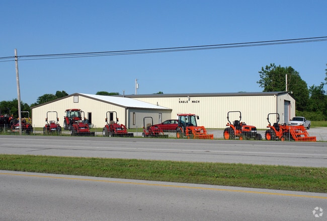
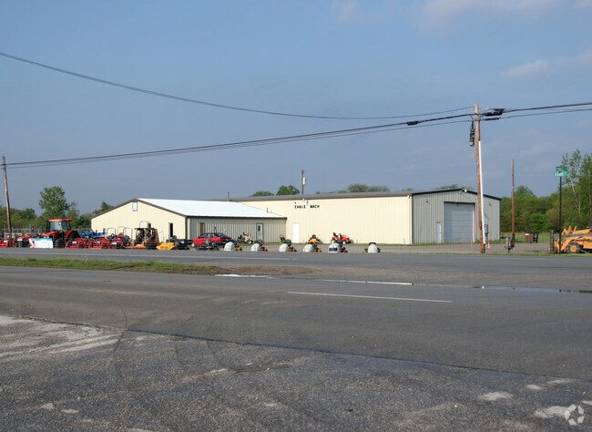
Property Record
13019 Powell Rd, Portage, OH 43451

NEARBY LISTINGS FOR SALE OR LEASE
Property Detail
13019 Powell Rd
I33-410-010000009001
S265.95 E245.24 NE
Commercialnec
Wood
X
Ohio
39173C0259D
1.50 AC
2023
Perrysburg/Northwood
2024
Toledo
021500
Toledo, OH
26,425 SF
DEMOGRAPHICS near 13019 Powell Rd
1 Mile
3 Mile
5 Mile
2024 Total Population
519
17,109
33,501
2029 Population
503
17,357
33,881
Pop Growth 2024-2029
(3.08%)
+ 1.45%
+ 1.13%
Average Age
36
36
34
2024 Total Households
177
8,271
13,442
HH Growth 2024-2029
(2.82%)
+ 1.63%
+ 1.31%
Median Household Inc
$67,500
$37,757
$42,384
Avg Household Size
2.70
2.00
2.10
2024 Avg HH Vehicles
2.00
2.00
2.00
Median Home Value
$225,000
$196,102
$198,370
Median Year Built
1978
1976
1979
Nearby Places
Map Layers
Map Styles
 Street
 Aerial
- Restaurants
- Banks
- Shops
- Fitness
- Groceries
PUBLIC TRANSPORTATION
AIRPORT
Eugene F Kranz Toledo Express
DRIVE
WALK
Distance
Eugene F Kranz Toledo Express
47 min
30.1 mi
Freight Ports
DRIVE
WALK
Distance
42 min
29.5 mi
Nearby Properties
Address
Land Use
TOTAL SIZE
Lot Size
Zoning
Address
Land Use
TOTAL SIZE
Lot Size
Zoning
302,240 SF
7.21 AC
Address
Land Use
TOTAL SIZE
Lot Size
Zoning
122,962 SF
19.30 AC
Address
Land Use
TOTAL SIZE
Lot Size
Zoning
14,124 SF
13.26 AC
Address
Land Use
TOTAL SIZE
Lot Size
Zoning
148,952 SF
2.39 AC
Address
Land Use
TOTAL SIZE
Lot Size
Zoning
94,350 SF
57.70 AC
Address
Land Use
TOTAL SIZE
Lot Size
Zoning
28,901 SF
11.36 AC
Address
Land Use
TOTAL SIZE
Lot Size
Zoning
104,233 SF
19.35 AC
Address
Land Use
TOTAL SIZE
Lot Size
Zoning
136,154 SF
11.47 AC
Address
Land Use
TOTAL SIZE
Lot Size
Zoning
217,995 SF
24.23 AC
Address
Land Use
TOTAL SIZE
Lot Size
Zoning
21,445 SF
12 AC
Address
Land Use
TOTAL SIZE
Lot Size
Zoning
32,105 SF
0.39 AC
Address
Land Use
TOTAL SIZE
Lot Size
Zoning
10,560 SF
6.74 AC
Address
Land Use
TOTAL SIZE
Lot Size
Zoning
177,236 SF
15 AC
Address
Land Use
TOTAL SIZE
Lot Size
Zoning
26,032 SF
2.37 AC
Address
Land Use
TOTAL SIZE
Lot Size
Zoning
14,740 SF
12.29 AC
Address
Land Use
TOTAL SIZE
Lot Size
Zoning
56,055 SF
3.99 AC
Address
Land Use
TOTAL SIZE
Lot Size
Zoning
80,290 SF
1.95 AC
Address
Land Use
TOTAL SIZE
Lot Size
Zoning
184,745 SF
10.99 AC
Address
Land Use
TOTAL SIZE
Lot Size
Zoning
95,300 SF
9.90 AC
Address
Land Use
TOTAL SIZE
Lot Size
Zoning
64,400 SF
3.94 AC
Address
Land Use
TOTAL SIZE
Lot Size
Zoning
40,988 SF
7.74 AC
Address
Land Use
TOTAL SIZE
Lot Size
Zoning
51,268 SF
5.65 AC
Address
Land Use
TOTAL SIZE
Lot Size
Zoning
30,960 SF
5.50 AC
Address
Land Use
TOTAL SIZE
Lot Size
Zoning
13,156 SF
5.11 AC
Address
Land Use
TOTAL SIZE
Lot Size
Zoning
122,427 SF
8.86 AC
Address
Land Use
TOTAL SIZE
Lot Size
Zoning
40,156 SF
7.58 AC
Address
Land Use
TOTAL SIZE
Lot Size
Zoning
98,548 SF
10 AC
Address
Land Use
TOTAL SIZE
Lot Size
Zoning
43,776 SF
4.92 AC
Address
Land Use
TOTAL SIZE
Lot Size
Zoning
58,736 SF
3.28 AC
Address
Land Use
TOTAL SIZE
Lot Size
Zoning
24,909 SF
7.51 AC
The World's #1 Commercial Real Estate Marketplace
Connect with us
© 2025 CoStar Group
The information above has been obtained from sources believed reliable. While we do not doubt its accuracy we have not verified it and make no guarantee, warranty or representation about it. It is your responsibility to independently confirm its accuracy and completeness. Any projections, opinions, assumptions, or estimates used are for example only and do not represent the current or future performance of the property. The value of this transaction to you depends on tax and other factors which should be evaluated by your tax, financial, and legal advisors. You and your advisors should conduct a careful, independent investigation of the property to determine to your satisfaction the suitability of the property for your needs.