Property Record
1302 Lexington Ave, Thomasville, NC 27360
NEARBY LISTINGS FOR SALE OR LEASE
Property Detail
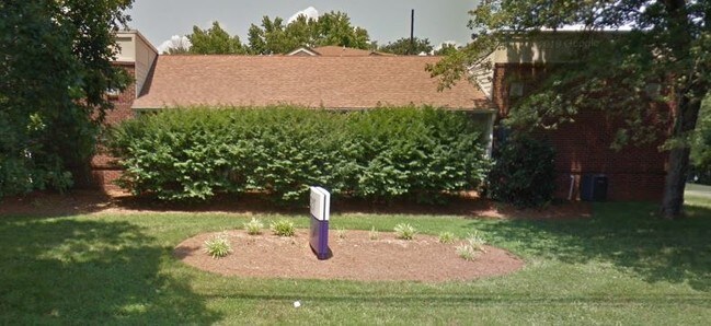
1302 Lexington Ave
16-325-0-000-0042-0-0-0
L43 BK2377-1380 MT CALVARY RD
Medicalbuilding
Davidson
X
North Carolina
3710676700J
0.87 AC
2025
North Davidson County
2025
Greensboro/Winston-Salem
060900
Winston-Salem, NC
10,959 SF
DEMOGRAPHICS near 1302 Lexington Ave
1 Mile
3 Mile
5 Mile
2024 Total Population
3,110
24,146
45,406
2029 Population
3,297
25,561
47,859
Pop Growth 2024-2029
+ 6.01%
+ 5.86%
+ 5.40%
Average Age
40
40
41
2024 Total Households
1,297
9,716
18,152
HH Growth 2024-2029
+ 6.01%
+ 5.77%
+ 5.32%
Median Household Inc
$44,843
$41,683
$52,066
Avg Household Size
2.40
2.40
2.40
2024 Avg HH Vehicles
2.00
2.00
2.00
Median Home Value
$144,904
$142,814
$159,632
Median Year Built
1975
1970
1979
Nearby Places
Map Layers
Map Styles
 Street
 Aerial
- Restaurants
- Banks
- Shops
- Fitness
- Groceries
PUBLIC TRANSPORTATION
AIRPORT
Piedmont Triad International
DRIVE
WALK
Distance
Piedmont Triad International
37 min
22.5 mi
Freight Ports
Port of Wilmington
DRIVE
WALK
Distance
Port of Wilmington
257 min
218.8 mi
Nearby Properties
Address
Land Use
TOTAL SIZE
Lot Size
Zoning
Address
Land Use
TOTAL SIZE
Lot Size
Zoning
103,482 SF
49.98 AC
OI
Address
Land Use
TOTAL SIZE
Lot Size
Zoning
66,674 SF
59.96 AC
OI
Address
Land Use
TOTAL SIZE
Lot Size
Zoning
3,638 SF
41.44 AC
OI
Address
Land Use
TOTAL SIZE
Lot Size
Zoning
134,369 SF
20.67 AC
R15
Address
Land Use
TOTAL SIZE
Lot Size
Zoning
13,770 SF
34.64 AC
R10
Address
Land Use
TOTAL SIZE
Lot Size
Zoning
122,865 SF
30.57 AC
R15
Address
Land Use
TOTAL SIZE
Lot Size
Zoning
9,020 SF
135.18 AC
M1CZ
Address
Land Use
TOTAL SIZE
Lot Size
Zoning
63,936 SF
19.05 AC
R10
Address
Land Use
TOTAL SIZE
Lot Size
Zoning
51,230 SF
7.52 AC
C2
Address
Land Use
TOTAL SIZE
Lot Size
Zoning
56,305 SF
5.39 AC
OI
Address
Land Use
TOTAL SIZE
Lot Size
Zoning
12,536 SF
300.20 AC
M1CZ
Address
Land Use
TOTAL SIZE
Lot Size
Zoning
4,224 SF
50.07 AC
M2
Address
Land Use
TOTAL SIZE
Lot Size
Zoning
72,642 SF
10.53 AC
R10
Address
Land Use
TOTAL SIZE
Lot Size
Zoning
124,326 SF
13.45 AC
C3
Address
Land Use
TOTAL SIZE
Lot Size
Zoning
4,560 SF
187.84 AC
R10
Address
Land Use
TOTAL SIZE
Lot Size
Zoning
149,129 SF
15.65 AC
R10
Address
Land Use
TOTAL SIZE
Lot Size
Zoning
12,040 SF
17.95 AC
RA3
Address
Land Use
TOTAL SIZE
Lot Size
Zoning
6,960 SF
9.61 AC
R8
Address
Land Use
TOTAL SIZE
Lot Size
Zoning
38,896 SF
6.64 AC
C2
Address
Land Use
TOTAL SIZE
Lot Size
Zoning
39,842 SF
12.49 AC
M2
Address
Land Use
TOTAL SIZE
Lot Size
Zoning
35,582 SF
4.95 AC
R8
Address
Land Use
TOTAL SIZE
Lot Size
Zoning
63,730 SF
19.47 AC
R10
Address
Land Use
TOTAL SIZE
Lot Size
Zoning
2,460 SF
26.64 AC
R8
Address
Land Use
TOTAL SIZE
Lot Size
Zoning
1,551 SF
16.15 AC
R8
Address
Land Use
TOTAL SIZE
Lot Size
Zoning
13,891 SF
63.54 AC
RA3
Address
Land Use
TOTAL SIZE
Lot Size
Zoning
31,332 SF
7.89 AC
C2
Address
Land Use
TOTAL SIZE
Lot Size
Zoning
8,400 SF
5.31 AC
C2
Address
Land Use
TOTAL SIZE
Lot Size
Zoning
34,506 SF
12.70 AC
R10
Address
Land Use
TOTAL SIZE
Lot Size
Zoning
16,132 SF
1.48 AC
M1
Address
Land Use
TOTAL SIZE
Lot Size
Zoning
17,443 SF
2.38 AC
OI
The World's #1 Commercial Real Estate Marketplace
Connect with us
© 2025 CoStar Group
The information above has been obtained from sources believed reliable. While we do not doubt its accuracy we have not verified it and make no guarantee, warranty or representation about it. It is your responsibility to independently confirm its accuracy and completeness. Any projections, opinions, assumptions, or estimates used are for example only and do not represent the current or future performance of the property. The value of this transaction to you depends on tax and other factors which should be evaluated by your tax, financial, and legal advisors. You and your advisors should conduct a careful, independent investigation of the property to determine to your satisfaction the suitability of the property for your needs.