Property Record
1302 Raymond Dr, Mendota, IL 61342


Save to a Folder
{{folder.Name}}
{{folder.ListingIds.length}} Properties
{{folder.ListingIds.length}} Property
Create a New Folder
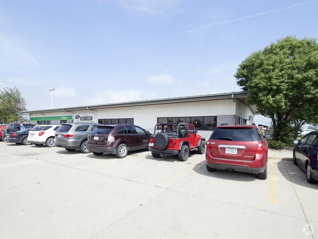
Property Detail
1302 Raymond Dr
Ottawa, IL
FULL SUB, LT 1 SEC 25-36-1
01-25-300001
La Salle
Commercialnec
Illinois
B and X Area of moderate flood hazard, usually the area between the limits of the 100-year and 500-year floods.
1
2025
5.07 AC
2025
I-39 Corr/LaSalle County
961800
Chicago
12,073 SF
NEARBY LISTINGS FOR SALE OR LEASE
DEMOGRAPHICS near 1302 Raymond Dr
1 mile
3 mile
5 mile
2025 Total Population
33
4,914
7,968
2030 Population
33
4,857
7,856
Pop Growth 2025-2030
0.00%
(1.16%)
(1.41%)
Average Age
43
40
41
2025 Total Households
12
1,860
3,163
HH Growth 2025-2030
0.00%
(1.29%)
(1.52%)
Median Household Inc
$55,000
$66,059
$66,611
Avg Household Size
2.50
2.50
2.40
2025 Avg HH Vehicles
2.00
2.00
2.00
Median Home Value
$150,000
$141,314
$148,665
Median Year Built
1954
1955
1958
Nearby Places
Map Layers
Map Styles
 Street
 Aerial
Layers
 Traffic
 Biking
Places
Listings with unknown addresses are not visible on the map
- Restaurants
- Banks
- Shops
- Fitness
- Groceries
PUBLIC TRANSPORTATION
COMMUTER RAIL
Drive
Walk
Distance
5 min
3.0 mi
Nearby Properties
Address
Land Use
TOTAL SIZE
Lot Size
Zoning
Address
Land Use
TOTAL SIZE
Lot Size
Zoning
6,765 SF
131.49 AC
Address
Land Use
TOTAL SIZE
Lot Size
Zoning
1,155 SF
30 AC
Address
Land Use
TOTAL SIZE
Lot Size
Zoning
37.10 AC
Address
Land Use
TOTAL SIZE
Lot Size
Zoning
245,030 SF
14.36 AC
Address
Land Use
TOTAL SIZE
Lot Size
Zoning
202,418 SF
15.50 AC
Address
Land Use
TOTAL SIZE
Lot Size
Zoning
62,128 SF
27.06 AC
Address
Land Use
TOTAL SIZE
Lot Size
Zoning
149,296 SF
19.53 AC
Address
Land Use
TOTAL SIZE
Lot Size
Zoning
90,000 SF
19.30 AC
Address
Land Use
TOTAL SIZE
Lot Size
Zoning
9,000 SF
12.82 AC
Address
Land Use
TOTAL SIZE
Lot Size
Zoning
60,473 SF
16.58 AC
Address
Land Use
TOTAL SIZE
Lot Size
Zoning
25,637 SF
9.09 AC
Address
Land Use
TOTAL SIZE
Lot Size
Zoning
35,100 SF
1.79 AC
Address
Land Use
TOTAL SIZE
Lot Size
Zoning
6,400 SF
5.05 AC
Address
Land Use
TOTAL SIZE
Lot Size
Zoning
11,628 SF
0.32 AC
Address
Land Use
TOTAL SIZE
Lot Size
Zoning
12,784 SF
2.36 AC
Address
Land Use
TOTAL SIZE
Lot Size
Zoning
16,872 SF
2.92 AC
Address
Land Use
TOTAL SIZE
Lot Size
Zoning
32,000 SF
1.83 AC
Address
Land Use
TOTAL SIZE
Lot Size
Zoning
29,400 SF
1.71 AC
Address
Land Use
TOTAL SIZE
Lot Size
Zoning
4,770 SF
1.98 AC
Address
Land Use
TOTAL SIZE
Lot Size
Zoning
41,613 SF
207.86 AC
Address
Land Use
TOTAL SIZE
Lot Size
Zoning
20,946 SF
5.63 AC
Address
Land Use
TOTAL SIZE
Lot Size
Zoning
8,000 SF
0.98 AC
Address
Land Use
TOTAL SIZE
Lot Size
Zoning
73,699 SF
3.50 AC
Address
Land Use
TOTAL SIZE
Lot Size
Zoning
3,565 SF
0.85 AC
Address
Land Use
TOTAL SIZE
Lot Size
Zoning
20,400 SF
4.57 AC
Address
Land Use
TOTAL SIZE
Lot Size
Zoning
2,112 SF
55.10 AC
Address
Land Use
TOTAL SIZE
Lot Size
Zoning
27,000 SF
3 AC
Address
Land Use
TOTAL SIZE
Lot Size
Zoning
115,765 SF
37.10 AC
Address
Land Use
TOTAL SIZE
Lot Size
Zoning
7,800 SF
1.05 AC
The World's #1 Commercial Real Estate Marketplace
Connect with us
© 2026 CoStar Group
The information above has been obtained from sources believed reliable. While we do not doubt its accuracy we have not verified it and make no guarantee, warranty or representation about it. It is your responsibility to independently confirm its accuracy and completeness. Any projections, opinions, assumptions, or estimates used are for example only and do not represent the current or future performance of the property. The value of this transaction to you depends on tax and other factors which should be evaluated by your tax, financial, and legal advisors. You and your advisors should conduct a careful, independent investigation of the property to determine to your satisfaction the suitability of the property for your needs.