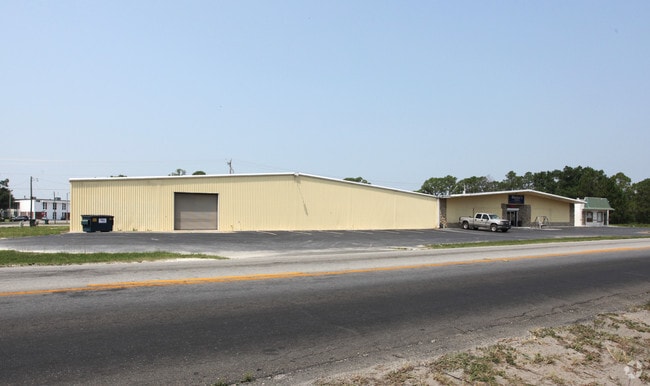
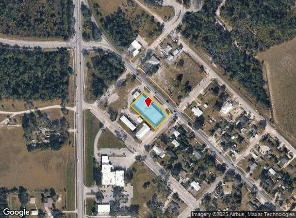
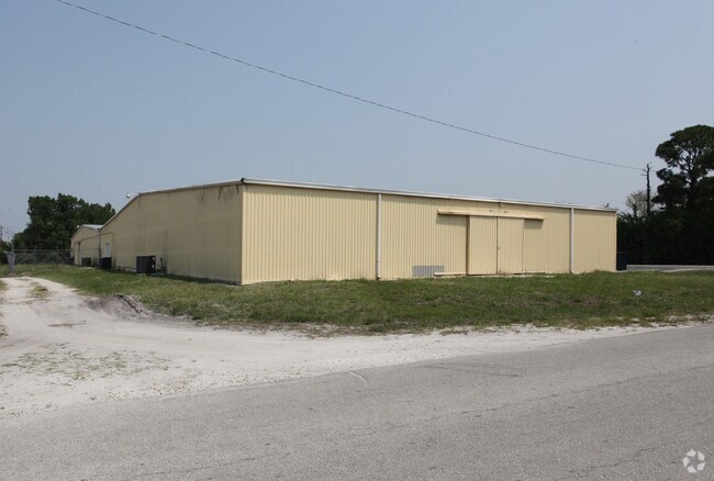
Property Record
1303 New Market Rd W, Immokalee, FL 34142
NEARBY LISTINGS FOR SALE OR LEASE
Property Detail
1303 New Market Rd W
Naples-Immokalee-Marco Island, FL
Newmarket Subd
63850920005
NEWMARKET SUBD BLK 4 LTS 4 THRU 6
Storemultistory
Collier
AH
Florida
12021C0135H
4
2024
0.80 AC
2025
Outlying Collier County
011400
Southwest Florida
16,901 SF
DEMOGRAPHICS near 1303 New Market Rd W
1 Mile
3 Mile
5 Mile
2024 Total Population
4,879
17,803
19,627
2029 Population
5,195
19,144
21,144
Pop Growth 2024-2029
+ 6.48%
+ 7.53%
+ 7.73%
Average Age
30
31
31
2024 Total Households
1,216
4,525
5,055
HH Growth 2024-2029
+ 5.51%
+ 6.52%
+ 6.77%
Median Household Inc
$41,366
$42,086
$40,985
Avg Household Size
3.70
3.60
3.50
2024 Avg HH Vehicles
2.00
2.00
2.00
Median Home Value
$145,982
$165,254
$166,373
Median Year Built
1991
1993
1992
Nearby Places
Map Layers
Map Styles
 Street
 Aerial
- Restaurants
- Banks
- Shops
- Fitness
- Groceries
PUBLIC TRANSPORTATION
AIRPORT
Southwest Florida International
DRIVE
WALK
Distance
Southwest Florida International
38 min
26.7 mi
Nearby Properties
Address
Land Use
TOTAL SIZE
Lot Size
Zoning
Address
Land Use
TOTAL SIZE
Lot Size
Zoning
217,887 SF
564.45 AC
A-MHO
Address
Land Use
TOTAL SIZE
Lot Size
Zoning
243,268 SF
43.41 AC
RSF-3
Address
Land Use
TOTAL SIZE
Lot Size
Zoning
150,228 SF
172.69 AC
I
Address
Land Use
TOTAL SIZE
Lot Size
Zoning
118,281 SF
24.62 AC
A
Address
Land Use
TOTAL SIZE
Lot Size
Zoning
139,063 SF
22.83 AC
RSF-3
Address
Land Use
TOTAL SIZE
Lot Size
Zoning
182,696 SF
12.78 AC
MPUD
Address
Land Use
TOTAL SIZE
Lot Size
Zoning
39,880 SF
6.52 AC
RMF-6
Address
Land Use
TOTAL SIZE
Lot Size
Zoning
152,819 SF
17.50 AC
I-FMOSD
Address
Land Use
TOTAL SIZE
Lot Size
Zoning
336.06 AC
AOPUD
Address
Land Use
TOTAL SIZE
Lot Size
Zoning
39,087 SF
3.47 AC
C-4-MSOSD
Address
Land Use
TOTAL SIZE
Lot Size
Zoning
74,473 SF
10.29 AC
VR
Address
Land Use
TOTAL SIZE
Lot Size
Zoning
38,837 SF
9.41 AC
PUD
Address
Land Use
TOTAL SIZE
Lot Size
Zoning
40,862 SF
6.57 AC
PUD
Address
Land Use
TOTAL SIZE
Lot Size
Zoning
90,082 SF
9.37 AC
MPUD
Address
Land Use
TOTAL SIZE
Lot Size
Zoning
25,308 SF
5.96 AC
PUD
Address
Land Use
TOTAL SIZE
Lot Size
Zoning
33,530 SF
3.83 AC
PUD
Address
Land Use
TOTAL SIZE
Lot Size
Zoning
45,799 SF
8.70 AC
RMF-6
Address
Land Use
TOTAL SIZE
Lot Size
Zoning
20,484 SF
3.03 AC
C-5-AOSD
Address
Land Use
TOTAL SIZE
Lot Size
Zoning
4,719 SF
2.95 AC
C-4-MSOSD
Address
Land Use
TOTAL SIZE
Lot Size
Zoning
46,520 SF
160 AC
A
Address
Land Use
TOTAL SIZE
Lot Size
Zoning
78,445 SF
6.40 AC
RMF-16
Address
Land Use
TOTAL SIZE
Lot Size
Zoning
20,566 SF
7.42 AC
C-4-MSOSD
Address
Land Use
TOTAL SIZE
Lot Size
Zoning
48,224 SF
4 AC
I
Address
Land Use
TOTAL SIZE
Lot Size
Zoning
27,951 SF
7.95 AC
RSF3
Address
Land Use
TOTAL SIZE
Lot Size
Zoning
91,633 SF
45.30 AC
I
Address
Land Use
TOTAL SIZE
Lot Size
Zoning
93,715 SF
8.97 AC
PUD
Address
Land Use
TOTAL SIZE
Lot Size
Zoning
22,386 SF
5.66 AC
Address
Land Use
TOTAL SIZE
Lot Size
Zoning
20,525 SF
4.91 AC
C1
Address
Land Use
TOTAL SIZE
Lot Size
Zoning
28,582 SF
3.83 AC
E
Address
Land Use
TOTAL SIZE
Lot Size
Zoning
40,653 SF
5 AC
PUD
The World's #1 Commercial Real Estate Marketplace
Connect with us
© 2025 CoStar Group
The information above has been obtained from sources believed reliable. While we do not doubt its accuracy we have not verified it and make no guarantee, warranty or representation about it. It is your responsibility to independently confirm its accuracy and completeness. Any projections, opinions, assumptions, or estimates used are for example only and do not represent the current or future performance of the property. The value of this transaction to you depends on tax and other factors which should be evaluated by your tax, financial, and legal advisors. You and your advisors should conduct a careful, independent investigation of the property to determine to your satisfaction the suitability of the property for your needs.