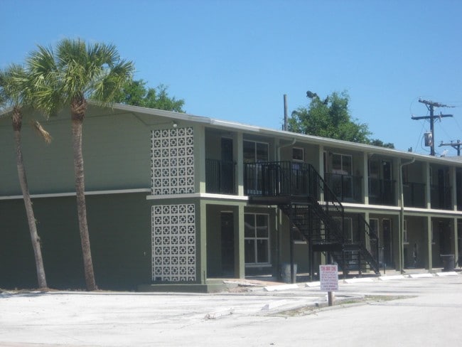
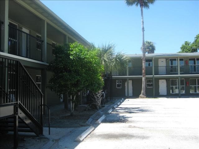
Property Record
1304 N Fiske Blvd, Cocoa, FL 32922
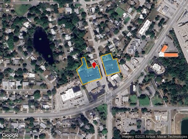

NEARBY LISTINGS FOR SALE OR LEASE
Property Detail
1304 N Fiske Blvd
Palm Bay-Melbourne-Titusville, FL
Cocoa Hills Subd
24-36-29-BV-00000.0-000A.04
COCOA HILLS SUBD PART OF LOT A, ALL OF LOTS 82, 228, 229 AND PART OF LOT 230 & TRACT D OF PB 13 PG 88 ALL AS DESC IN ORB 3549 PG 729
Apartment
Brevard
X
Florida
12009C0426H
a
2024
1.55 AC
2025
Cocoa
062302
Orlando
33,618 SF
DEMOGRAPHICS near 1304 N Fiske Blvd
1 Mile
3 Mile
5 Mile
2024 Total Population
8,681
45,363
93,852
2029 Population
9,463
49,661
102,621
Pop Growth 2024-2029
+ 9.01%
+ 9.47%
+ 9.34%
Average Age
39
42
44
2024 Total Households
3,568
19,044
39,543
HH Growth 2024-2029
+ 8.69%
+ 9.18%
+ 9.19%
Median Household Inc
$34,216
$48,033
$61,308
Avg Household Size
2.30
2.30
2.30
2024 Avg HH Vehicles
1.00
2.00
2.00
Median Home Value
$151,244
$228,634
$268,550
Median Year Built
1964
1972
1979
Nearby Places
Map Layers
Map Styles
 Street
 Aerial
- Restaurants
- Banks
- Shops
- Fitness
- Groceries
PUBLIC TRANSPORTATION
AIRPORT
Melbourne Orlando International
DRIVE
WALK
Distance
Melbourne Orlando International
39 min
24.7 mi
Freight Ports
Port Canaveral
DRIVE
WALK
Distance
Port Canaveral
16 min
10.8 mi
Nearby Properties
Address
Land Use
TOTAL SIZE
Lot Size
Zoning
Address
Land Use
TOTAL SIZE
Lot Size
Zoning
825,903 SF
94.80 AC
RU17
Address
Land Use
TOTAL SIZE
Lot Size
Zoning
411,148 SF
8.13 AC
HC
Address
Land Use
TOTAL SIZE
Lot Size
Zoning
497,135 SF
34.13 AC
CW
Address
Land Use
TOTAL SIZE
Lot Size
Zoning
68,677 SF
13.88 AC
RMU
Address
Land Use
TOTAL SIZE
Lot Size
Zoning
256,094 SF
37.37 AC
BU1
Address
Land Use
TOTAL SIZE
Lot Size
Zoning
307,934 SF
13.66 AC
RU215
Address
Land Use
TOTAL SIZE
Lot Size
Zoning
176,670 SF
13.49 AC
CG
Address
Land Use
TOTAL SIZE
Lot Size
Zoning
264,679 SF
59.90 AC
RU17
Address
Land Use
TOTAL SIZE
Lot Size
Zoning
211,483 SF
14.46 AC
BU2
Address
Land Use
TOTAL SIZE
Lot Size
Zoning
276,665 SF
38.95 AC
R2
Address
Land Use
TOTAL SIZE
Lot Size
Zoning
313,612 SF
11.91 AC
BU1
Address
Land Use
TOTAL SIZE
Lot Size
Zoning
212,232 SF
20.80 AC
RU215
Address
Land Use
TOTAL SIZE
Lot Size
Zoning
153,136 SF
8.65 AC
RU215
Address
Land Use
TOTAL SIZE
Lot Size
Zoning
105,278 SF
14.75 AC
AU
Address
Land Use
TOTAL SIZE
Lot Size
Zoning
8.30 AC
CW
Address
Land Use
TOTAL SIZE
Lot Size
Zoning
211,753 SF
25.16 AC
CG
Address
Land Use
TOTAL SIZE
Lot Size
Zoning
140,113 SF
25 AC
GU
Address
Land Use
TOTAL SIZE
Lot Size
Zoning
67,595 SF
6.62 AC
Address
Land Use
TOTAL SIZE
Lot Size
Zoning
120,495 SF
3.86 AC
PUD
Address
Land Use
TOTAL SIZE
Lot Size
Zoning
174,500 SF
13.34 AC
RU-2-10
Address
Land Use
TOTAL SIZE
Lot Size
Zoning
96,878 SF
17.47 AC
CN
Address
Land Use
TOTAL SIZE
Lot Size
Zoning
117,078 SF
6.13 AC
R2A 8/1
Address
Land Use
TOTAL SIZE
Lot Size
Zoning
75,552 SF
9.95 AC
PUD
Address
Land Use
TOTAL SIZE
Lot Size
Zoning
101,494 SF
5.81 AC
CC
Address
Land Use
TOTAL SIZE
Lot Size
Zoning
96,814 SF
8.89 AC
RU215
Address
Land Use
TOTAL SIZE
Lot Size
Zoning
101,294 SF
20.14 AC
M2
Address
Land Use
TOTAL SIZE
Lot Size
Zoning
70,834 SF
15.33 AC
INL
Address
Land Use
TOTAL SIZE
Lot Size
Zoning
130,361 SF
12.77 AC
BU1
Address
Land Use
TOTAL SIZE
Lot Size
Zoning
83,650 SF
25.65 AC
AU
Address
Land Use
TOTAL SIZE
Lot Size
Zoning
97,920 SF
6.08 AC
RU215
The World's #1 Commercial Real Estate Marketplace
Connect with us
© 2025 CoStar Group
The information above has been obtained from sources believed reliable. While we do not doubt its accuracy we have not verified it and make no guarantee, warranty or representation about it. It is your responsibility to independently confirm its accuracy and completeness. Any projections, opinions, assumptions, or estimates used are for example only and do not represent the current or future performance of the property. The value of this transaction to you depends on tax and other factors which should be evaluated by your tax, financial, and legal advisors. You and your advisors should conduct a careful, independent investigation of the property to determine to your satisfaction the suitability of the property for your needs.