Property Record
13040 Us Highway 31, Grand Haven, MI 49417

NEARBY LISTINGS FOR SALE OR LEASE
-
-
View all Grand Haven listings for lease on LoopNet.com
Property Detail
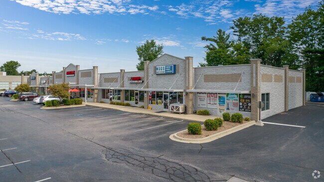
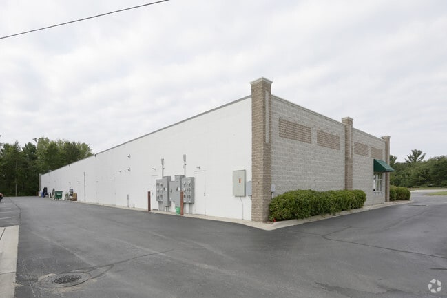
13040 Us Highway 31
70-07-10-300-036
PART OF SW 1/4 COM W 1/4 COR, TH S 89D 17M 28S E 112937 FT ALG E&W 1/4 LI, TH S 0D 11M 59S W 330 FT, N 89D 17M 28S W 202 FT,
Regionalshoppingcenterormallwithanchorstore
Ottawa
X
Michigan
26121C0425E
2.25 AC
2025
Grand Haven/Ferrysburg
2025
West Michigan
021304
Grand Rapids-Wyoming, MI
15,378 SF
DEMOGRAPHICS near 13040 Us Highway 31
1 Mile
3 Mile
5 Mile
2024 Total Population
1,446
18,257
39,428
2029 Population
1,513
19,255
41,808
Pop Growth 2024-2029
+ 4.63%
+ 5.47%
+ 6.04%
Average Age
46
42
42
2024 Total Households
563
7,386
16,157
HH Growth 2024-2029
+ 4.97%
+ 5.58%
+ 6.18%
Median Household Inc
$100,294
$80,396
$77,885
Avg Household Size
2.60
2.40
2.40
2024 Avg HH Vehicles
2.00
2.00
2.00
Median Home Value
$349,202
$295,193
$299,407
Median Year Built
1989
1991
1980
Nearby Places
Map Layers
Map Styles
 Street
 Aerial
- Restaurants
- Banks
- Shops
- Fitness
- Groceries
PUBLIC TRANSPORTATION
AIRPORT
Gerald R Ford International
DRIVE
WALK
Distance
Gerald R Ford International
65 min
43.7 mi
SALE & LEASE HISTORY
LISTING DATE
SALE/LEASE

Sep 25, 2016
For Lease
Mar 16, 2021
For Lease
Nearby Properties
Address
Land Use
TOTAL SIZE
Lot Size
Zoning
Address
Land Use
TOTAL SIZE
Lot Size
Zoning
199,740 SF
15 AC
PUD
Address
Land Use
TOTAL SIZE
Lot Size
Zoning
355,785 SF
24.60 AC
I-1
Address
Land Use
TOTAL SIZE
Lot Size
Zoning
220,630 SF
10.34 AC
PUD
Address
Land Use
TOTAL SIZE
Lot Size
Zoning
184,312 SF
11.47 AC
PUD
Address
Land Use
TOTAL SIZE
Lot Size
Zoning
60,299 SF
19 AC
OVERLAY
Address
Land Use
TOTAL SIZE
Lot Size
Zoning
191,144 SF
16.60 AC
Address
Land Use
TOTAL SIZE
Lot Size
Zoning
249,728 SF
15.06 AC
Address
Land Use
TOTAL SIZE
Lot Size
Zoning
121,189 SF
8.73 AC
PUD
Address
Land Use
TOTAL SIZE
Lot Size
Zoning
113,566 SF
6.70 AC
PUD
Address
Land Use
TOTAL SIZE
Lot Size
Zoning
202,338 SF
8.95 AC
Address
Land Use
TOTAL SIZE
Lot Size
Zoning
191,989 SF
10.44 AC
Address
Land Use
TOTAL SIZE
Lot Size
Zoning
112,745 SF
10.56 AC
PUD
Address
Land Use
TOTAL SIZE
Lot Size
Zoning
184,100 SF
9.74 AC
Address
Land Use
TOTAL SIZE
Lot Size
Zoning
90,701 SF
5.65 AC
Address
Land Use
TOTAL SIZE
Lot Size
Zoning
217,995 SF
40.96 AC
PUD
Address
Land Use
TOTAL SIZE
Lot Size
Zoning
188,852 SF
20.66 AC
OVERLAY
Address
Land Use
TOTAL SIZE
Lot Size
Zoning
146,163 SF
13.23 AC
Address
Land Use
TOTAL SIZE
Lot Size
Zoning
1,400 SF
80.03 AC
R-4
Address
Land Use
TOTAL SIZE
Lot Size
Zoning
130,268 SF
17.21 AC
OVERLAY
Address
Land Use
TOTAL SIZE
Lot Size
Zoning
143,083 SF
12.25 AC
Address
Land Use
TOTAL SIZE
Lot Size
Zoning
71.84 AC
R-4
Address
Land Use
TOTAL SIZE
Lot Size
Zoning
146,285 SF
7.77 AC
Address
Land Use
TOTAL SIZE
Lot Size
Zoning
127,125 SF
11.63 AC
Address
Land Use
TOTAL SIZE
Lot Size
Zoning
98,248 SF
17.79 AC
I-1
Address
Land Use
TOTAL SIZE
Lot Size
Zoning
50,969 SF
1.67 AC
Address
Land Use
TOTAL SIZE
Lot Size
Zoning
16,762 SF
143.08 AC
R-1
Address
Land Use
TOTAL SIZE
Lot Size
Zoning
61,612 SF
2.12 AC
PUD
Address
Land Use
TOTAL SIZE
Lot Size
Zoning
198,000 SF
22.91 AC
OVERLAY
Address
Land Use
TOTAL SIZE
Lot Size
Zoning
29.80 AC
Address
Land Use
TOTAL SIZE
Lot Size
Zoning
121,688 SF
8.26 AC
OVERLAY
The World's #1 Commercial Real Estate Marketplace
Connect with us
© 2026 CoStar Group
The information above has been obtained from sources believed reliable. While we do not doubt its accuracy we have not verified it and make no guarantee, warranty or representation about it. It is your responsibility to independently confirm its accuracy and completeness. Any projections, opinions, assumptions, or estimates used are for example only and do not represent the current or future performance of the property. The value of this transaction to you depends on tax and other factors which should be evaluated by your tax, financial, and legal advisors. You and your advisors should conduct a careful, independent investigation of the property to determine to your satisfaction the suitability of the property for your needs.