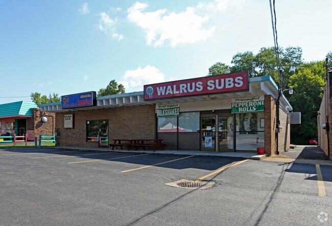
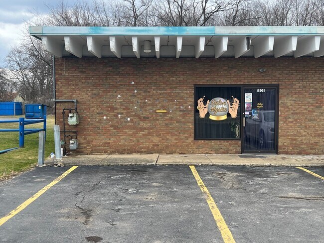
Property Record
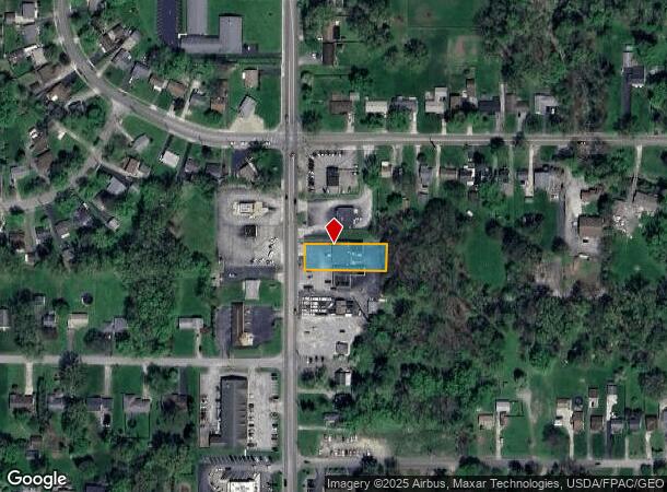
1305 S Raccoon Rd, Youngstown, OH 44515
NEARBY LISTINGS FOR SALE OR LEASE
Property Detail
1305 S Raccoon Rd
Youngstown/Warren/Boardman
Pembrook Rep 1
Youngstown-Warren-Boardman, OH-PA
LOT 10 69.5 X 225 PEMBROOK REP 1
48-080-0-031.00-0
Mahoning
Storebuilding
Ohio
2024
10
2024
0.36 AC
812302
Austintown
3,612 SF
DEMOGRAPHICS near 1305 S Raccoon Rd
1 Mile
3 Mile
5 Mile
2024 Total Population
12,548
51,107
115,188
2029 Population
12,296
49,892
113,332
Pop Growth 2024-2029
(2.01%)
(2.38%)
(1.61%)
Average Age
41
43
42
2024 Total Households
6,014
23,172
49,713
HH Growth 2024-2029
(2.28%)
(2.52%)
(1.74%)
Median Household Inc
$44,219
$48,003
$47,890
Avg Household Size
2.00
2.10
2.20
2024 Avg HH Vehicles
2.00
2.00
2.00
Median Home Value
$111,277
$113,369
$123,767
Median Year Built
1964
1961
1960
Nearby Places
- Restaurants
- Banks
- Shops
- Fitness
- Groceries
SALE & LEASE HISTORY
LISTING DATE
SALE/LEASE

Mar 09, 2018
For Sale
Mar 03, 2023
For Lease
Mar 03, 2021
For Lease
Nearby Properties
Address
Land Use
TOTAL SIZE
Lot Size
Zoning
Address
Land Use
TOTAL SIZE
Lot Size
Zoning
178,531 SF
189.16 AC
Address
Land Use
TOTAL SIZE
Lot Size
Zoning
188,134 SF
12.60 AC
R1
Address
Land Use
TOTAL SIZE
Lot Size
Zoning
127,210 SF
12.43 AC
R1
Address
Land Use
TOTAL SIZE
Lot Size
Zoning
227,713 SF
15.07 AC
Address
Land Use
TOTAL SIZE
Lot Size
Zoning
122,806 SF
9.46 AC
R1
Address
Land Use
TOTAL SIZE
Lot Size
Zoning
324,442 SF
54 AC
R1
Address
Land Use
TOTAL SIZE
Lot Size
Zoning
101,687 SF
9.93 AC
Address
Land Use
TOTAL SIZE
Lot Size
Zoning
78,660 SF
22.36 AC
R3
Address
Land Use
TOTAL SIZE
Lot Size
Zoning
54,767 SF
16 AC
B2
Address
Land Use
TOTAL SIZE
Lot Size
Zoning
470,857 SF
18.81 AC
I2
Address
Land Use
TOTAL SIZE
Lot Size
Zoning
103,976 SF
16.14 AC
PUD
Address
Land Use
TOTAL SIZE
Lot Size
Zoning
123,472 SF
28.58 AC
R3
Address
Land Use
TOTAL SIZE
Lot Size
Zoning
70,544 SF
7.62 AC
B2
Address
Land Use
TOTAL SIZE
Lot Size
Zoning
63,713 SF
7.38 AC
Address
Land Use
TOTAL SIZE
Lot Size
Zoning
110,387 SF
20 AC
R3
Address
Land Use
TOTAL SIZE
Lot Size
Zoning
89,623 SF
20.45 AC
ASER
Address
Land Use
TOTAL SIZE
Lot Size
Zoning
106,276 SF
10.86 AC
Address
Land Use
TOTAL SIZE
Lot Size
Zoning
81,954 SF
15 AC
R3
Address
Land Use
TOTAL SIZE
Lot Size
Zoning
49,659 SF
19.52 AC
R3
Address
Land Use
TOTAL SIZE
Lot Size
Zoning
23,603 SF
8.87 AC
B2
Address
Land Use
TOTAL SIZE
Lot Size
Zoning
114,617 SF
18.07 AC
B2
Address
Land Use
TOTAL SIZE
Lot Size
Zoning
70,713 SF
7.73 AC
B2
Address
Land Use
TOTAL SIZE
Lot Size
Zoning
60,742 SF
10 AC
R1
Address
Land Use
TOTAL SIZE
Lot Size
Zoning
315,482 SF
33.17 AC
I2
Address
Land Use
TOTAL SIZE
Lot Size
Zoning
43,927 SF
13.92 AC
R3
Address
Land Use
TOTAL SIZE
Lot Size
Zoning
57,266 SF
5.84 AC
Address
Land Use
TOTAL SIZE
Lot Size
Zoning
13,667 SF
7.29 AC
B1
Address
Land Use
TOTAL SIZE
Lot Size
Zoning
11,472 SF
11 AC
R3
Address
Land Use
TOTAL SIZE
Lot Size
Zoning
94,096 SF
4.46 AC
I2
Address
Land Use
TOTAL SIZE
Lot Size
Zoning
133,122 SF
39.19 AC
R1
The World's #1 Commercial Real Estate Marketplace
Connect with us
© 2025 CoStar Group
The information above has been obtained from sources believed reliable. While we do not doubt its accuracy we have not verified it and make no guarantee, warranty or representation about it. It is your responsibility to independently confirm its accuracy and completeness. Any projections, opinions, assumptions, or estimates used are for example only and do not represent the current or future performance of the property. The value of this transaction to you depends on tax and other factors which should be evaluated by your tax, financial, and legal advisors. You and your advisors should conduct a careful, independent investigation of the property to determine to your satisfaction the suitability of the property for your needs.