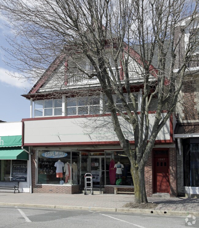
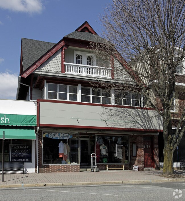
Property Record
1305 3Rd Ave, Spring Lake, NJ 07762


Property Detail
1305 3Rd Ave
47-00081-0000-00019
MONMOUTH
Storemultistory
New Jersey
C0
19
B and X Area of moderate flood hazard, usually the area between the limits of the 100-year and 500-year floods.
0.10 AC
2024
Southern Monmouth
2025
Northern New Jersey
809100
Lakewood-New Brunswick, NJ
5,734 SF
NEARBY LISTINGS FOR SALE OR LEASE
DEMOGRAPHICS near 1305 3Rd Ave
1 mile
3 mile
5 mile
2025 Total Population
8,326
50,233
117,309
2030 Population
8,764
51,802
120,275
Pop Growth 2025-2030
+ 5.26%
+ 3.12%
+ 2.53%
Average Age
49
46
45
2025 Total Households
3,837
21,847
49,929
HH Growth 2025-2030
+ 4.98%
+ 3.18%
+ 2.71%
Median Household Inc
$118,749
$120,145
$110,096
Avg Household Size
2.10
2.20
2.30
2025 Avg HH Vehicles
2.00
2.00
2.00
Median Home Value
$1,038,025
$835,919
$749,889
Median Year Built
1967
1965
1964
Nearby Places
Map Layers
Map Styles
 Street
 Aerial
Transit
 Traffic
 Biking
Places
Listings with unknown addresses are not visible on the map
- Restaurants
- Banks
- Shops
- Fitness
- Groceries
PUBLIC TRANSPORTATION
COMMUTER RAIL
Spring Lake (North Jersey Coast Line - NJ Transit Commuter Rail (NJ Transit))
Drive
Walk
Distance
Spring Lake (North Jersey Coast Line - NJ Transit Commuter Rail (NJ Transit))
4 min
13 min
0.6 mi
Belmar (North Jersey Coast Line - NJ Transit Commuter Rail (NJ Transit))
Drive
Walk
Distance
Belmar (North Jersey Coast Line - NJ Transit Commuter Rail (NJ Transit))
9 min
2.5 mi
Nearby Properties
Address
Land Use
TOTAL SIZE
Lot Size
Zoning
Address
Land Use
TOTAL SIZE
Lot Size
Zoning
22,660 SF
164.35 AC
4
Address
Land Use
TOTAL SIZE
Lot Size
Zoning
2,596 SF
54.13 AC
SF10
Address
Land Use
TOTAL SIZE
Lot Size
Zoning
5,776 SF
25.50 AC
PB
Address
Land Use
TOTAL SIZE
Lot Size
Zoning
1,846 SF
23.23 AC
SF10
Address
Land Use
TOTAL SIZE
Lot Size
Zoning
23,868 SF
137.35 AC
SF40
Address
Land Use
TOTAL SIZE
Lot Size
Zoning
4,078 SF
11.84 AC
SF05
Address
Land Use
TOTAL SIZE
Lot Size
Zoning
3.46 AC
SF05
Address
Land Use
TOTAL SIZE
Lot Size
Zoning
190,893 SF
36.69 AC
POS
Address
Land Use
TOTAL SIZE
Lot Size
Zoning
17.66 AC
1E
Address
Land Use
TOTAL SIZE
Lot Size
Zoning
49,657 SF
11.22 AC
HB80
Address
Land Use
TOTAL SIZE
Lot Size
Zoning
20,959 SF
3.10 AC
SF10
Address
Land Use
TOTAL SIZE
Lot Size
Zoning
61,432 SF
3.44 AC
SF05
Address
Land Use
TOTAL SIZE
Lot Size
Zoning
254,714 SF
3.40 AC
WPRA
Address
Land Use
TOTAL SIZE
Lot Size
Zoning
9.30 AC
SF05
Address
Land Use
TOTAL SIZE
Lot Size
Zoning
61,536 SF
3.44 AC
SF05
Address
Land Use
TOTAL SIZE
Lot Size
Zoning
84,297 SF
42.37 AC
CR40
Address
Land Use
TOTAL SIZE
Lot Size
Zoning
49,170 SF
8.38 AC
HB80
Address
Land Use
TOTAL SIZE
Lot Size
Zoning
45,236 SF
48.30 AC
POS
Address
Land Use
TOTAL SIZE
Lot Size
Zoning
27,328 SF
6.79 AC
HB12
Address
Land Use
TOTAL SIZE
Lot Size
Zoning
26.05 AC
SF10
Address
Land Use
TOTAL SIZE
Lot Size
Zoning
43,217 SF
0.86 AC
SF10
Address
Land Use
TOTAL SIZE
Lot Size
Zoning
86,051 SF
9.41 AC
HB12
Address
Land Use
TOTAL SIZE
Lot Size
Zoning
6.43 AC
SF05
Address
Land Use
TOTAL SIZE
Lot Size
Zoning
111,580 SF
25 AC
POS
Address
Land Use
TOTAL SIZE
Lot Size
Zoning
8.83 AC
R-2
Address
Land Use
TOTAL SIZE
Lot Size
Zoning
2,568 SF
6.97 AC
SF05
Address
Land Use
TOTAL SIZE
Lot Size
Zoning
13,094 SF
1.43 AC
HB80
Address
Land Use
TOTAL SIZE
Lot Size
Zoning
192 SF
12.50 AC
HD12
Address
Land Use
TOTAL SIZE
Lot Size
Zoning
81,656 SF
8.15 AC
HB80
Address
Land Use
TOTAL SIZE
Lot Size
Zoning
15.94 AC
R-2
The World's #1 Commercial Real Estate Marketplace
Connect with us
© 2026 CoStar Group
The information above has been obtained from sources believed reliable. While we do not doubt its accuracy we have not verified it and make no guarantee, warranty or representation about it. It is your responsibility to independently confirm its accuracy and completeness. Any projections, opinions, assumptions, or estimates used are for example only and do not represent the current or future performance of the property. The value of this transaction to you depends on tax and other factors which should be evaluated by your tax, financial, and legal advisors. You and your advisors should conduct a careful, independent investigation of the property to determine to your satisfaction the suitability of the property for your needs.