Property Record
1305 Atlantic Ave, Chesapeake, VA 23324

Property Detail
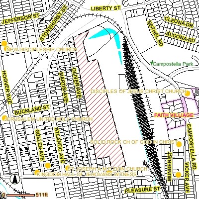
1305 Atlantic Ave
1350000004970
PARCEL A SUBD NORFOLK SOUTHERN RAILWAY CO 20.7098A
Officebuilding
CHESAPEAKE
M2: GENERA
Virginia
B and X Area of moderate flood hazard, usually the area between the limits of the 100-year and 500-year floods.
20.71 AC
2024
South Norfolk
2025
Hampton Roads
020200
Virginia Beach-Chesapeake-Norfolk, VA-NC
384 SF
NEARBY LISTINGS FOR SALE OR LEASE
-
-
-
-
-
-
-
No Photo
-
View all Chesapeake listings for sale on LoopNet.com
DEMOGRAPHICS near 1305 Atlantic Ave
1 mile
3 mile
5 mile
2025 Total Population
17,557
91,597
268,149
2030 Population
17,847
92,208
267,788
Pop Growth 2025-2030
+ 1.65%
+ 0.67%
(0.13%)
Average Age
37
38
38
2025 Total Households
6,682
35,657
108,126
HH Growth 2025-2030
+ 1.71%
+ 0.62%
(0.21%)
Median Household Inc
$59,209
$58,550
$66,352
Avg Household Size
2.60
2.40
2.40
2025 Avg HH Vehicles
2.00
2.00
2.00
Median Home Value
$263,299
$266,018
$293,958
Median Year Built
1971
1976
1976
Nearby Places
Map Layers
Map Styles
 Street
 Aerial
Transit
 Traffic
 Biking
Places
Listings with unknown addresses are not visible on the map
- Restaurants
- Banks
- Shops
- Fitness
- Groceries
PUBLIC TRANSPORTATION
COMMUTER RAIL
Norfolk (Northeast Regional - Amtrak)
Drive
Walk
Distance
Norfolk (Northeast Regional - Amtrak)
6 min
3.1 mi
AIRPORT
Norfolk International
Drive
Walk
Distance
Norfolk International
17 min
8.3 mi
Newport News/Williamsburg International
Drive
Walk
Distance
Newport News/Williamsburg International
49 min
31.8 mi
Freight Ports
Virginia Port Authority - Portsmouth
Drive
Walk
Distance
Virginia Port Authority - Portsmouth
17 min
7.5 mi
Nearby Properties
Address
Land Use
TOTAL SIZE
Lot Size
Zoning
Address
Land Use
TOTAL SIZE
Lot Size
Zoning
5,704 SF
4.67 AC
D2
Address
Land Use
TOTAL SIZE
Lot Size
Zoning
439,870 SF
24.90 AC
PUD: PLANN
Address
Land Use
TOTAL SIZE
Lot Size
Zoning
55.11 AC
IN2
Address
Land Use
TOTAL SIZE
Lot Size
Zoning
743,121 SF
57.42 AC
RMF1: MULT
Address
Land Use
TOTAL SIZE
Lot Size
Zoning
421,856 SF
2.64 AC
D1
Address
Land Use
TOTAL SIZE
Lot Size
Zoning
971,654 SF
6.01 AC
D2
Address
Land Use
TOTAL SIZE
Lot Size
Zoning
689,954 SF
63.25 AC
Address
Land Use
TOTAL SIZE
Lot Size
Zoning
473,072 SF
9.72 AC
SD
Address
Land Use
TOTAL SIZE
Lot Size
Zoning
358,908 SF
22.21 AC
MULTI: MUL
Address
Land Use
TOTAL SIZE
Lot Size
Zoning
258,000 SF
1.38 AC
M2: GENERA
Address
Land Use
TOTAL SIZE
Lot Size
Zoning
192,270 SF
1.99 AC
D2
Address
Land Use
TOTAL SIZE
Lot Size
Zoning
17.04 AC
A24
Address
Land Use
TOTAL SIZE
Lot Size
Zoning
363,974 SF
1.49 AC
Address
Land Use
TOTAL SIZE
Lot Size
Zoning
264,213 SF
17.59 AC
PUD: PLANN
Address
Land Use
TOTAL SIZE
Lot Size
Zoning
356,598 SF
1.84 AC
D2
Address
Land Use
TOTAL SIZE
Lot Size
Zoning
50,384 SF
0.74 AC
Address
Land Use
TOTAL SIZE
Lot Size
Zoning
252,524 SF
20 AC
R8S: RESID
Address
Land Use
TOTAL SIZE
Lot Size
Zoning
35,091 SF
0.71 AC
Address
Land Use
TOTAL SIZE
Lot Size
Zoning
197,074 SF
6.69 AC
Address
Land Use
TOTAL SIZE
Lot Size
Zoning
640,920 SF
3.67 AC
HCEF
Address
Land Use
TOTAL SIZE
Lot Size
Zoning
188,152 SF
16.93 AC
Address
Land Use
TOTAL SIZE
Lot Size
Zoning
32,163 SF
17.59 AC
MULTI: MUL
Address
Land Use
TOTAL SIZE
Lot Size
Zoning
608,074 SF
0.60 AC
Address
Land Use
TOTAL SIZE
Lot Size
Zoning
254,194 SF
1.93 AC
D3
Address
Land Use
TOTAL SIZE
Lot Size
Zoning
262,920 SF
20.94 AC
PUD: PLANN
Address
Land Use
TOTAL SIZE
Lot Size
Zoning
366,720 SF
23 AC
RMF1: MULT
Address
Land Use
TOTAL SIZE
Lot Size
Zoning
56,217 SF
1.31 AC
Address
Land Use
TOTAL SIZE
Lot Size
Zoning
251,984 SF
0.40 AC
D2
Address
Land Use
TOTAL SIZE
Lot Size
Zoning
401,302 SF
18.74 AC
M2: GENERA
Address
Land Use
TOTAL SIZE
Lot Size
Zoning
128,596 SF
16.91 AC
M2: GENERA
The World's #1 Commercial Real Estate Marketplace
Connect with us
© 2026 CoStar Group
The information above has been obtained from sources believed reliable. While we do not doubt its accuracy we have not verified it and make no guarantee, warranty or representation about it. It is your responsibility to independently confirm its accuracy and completeness. Any projections, opinions, assumptions, or estimates used are for example only and do not represent the current or future performance of the property. The value of this transaction to you depends on tax and other factors which should be evaluated by your tax, financial, and legal advisors. You and your advisors should conduct a careful, independent investigation of the property to determine to your satisfaction the suitability of the property for your needs.