Property Record
1305 Fallston Rd, Shelby, NC 28150

Property Detail
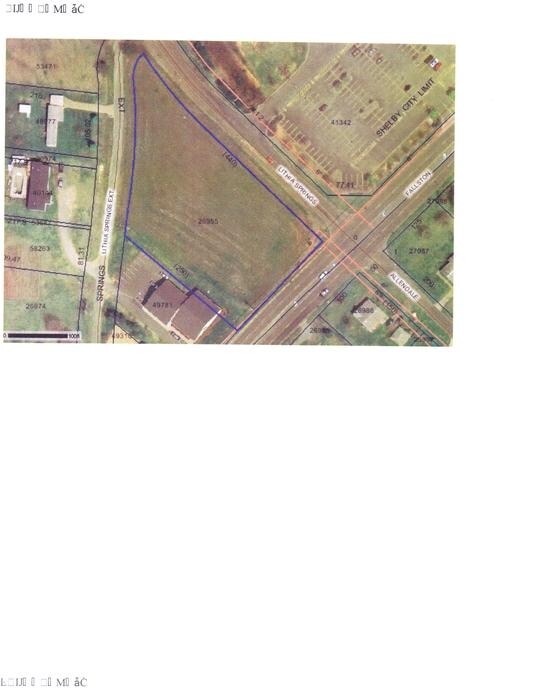
1305 Fallston Rd
41342
7.608 AC HWY 18 N
Supermarket
Cleveland
CPD
North Carolina
B and X Area of moderate flood hazard, usually the area between the limits of the 100-year and 500-year floods.
39
2025
7.61 AC
2025
Cleveland County
950800
Charlotte
43,128 SF
Shelby-Kings Mountain, NC
NEARBY LISTINGS FOR SALE OR LEASE
DEMOGRAPHICS near 1305 Fallston Rd
1 mile
3 mile
5 mile
2025 Total Population
2,316
18,107
35,595
2030 Population
2,364
18,631
36,419
Pop Growth 2025-2030
+ 2.07%
+ 2.89%
+ 2.31%
Average Age
43
43
42
2025 Total Households
1,041
7,580
14,839
HH Growth 2025-2030
+ 1.92%
+ 2.85%
+ 2.28%
Median Household Inc
$43,499
$58,641
$59,887
Avg Household Size
2.20
2.20
2.30
2025 Avg HH Vehicles
2.00
2.00
2.00
Median Home Value
$205,714
$258,518
$249,807
Median Year Built
1973
1973
1976
Nearby Places
Map Layers
Map Styles
 Street
 Aerial
Layers
 Traffic
 Biking
Places
Listings with unknown addresses are not visible on the map
- Restaurants
- Banks
- Shops
- Fitness
- Groceries
Nearby Properties
Address
Land Use
TOTAL SIZE
Lot Size
Zoning
Address
Land Use
TOTAL SIZE
Lot Size
Zoning
15.70 AC
RO
Address
Land Use
TOTAL SIZE
Lot Size
Zoning
6,250 SF
18.80 AC
HI
Address
Land Use
TOTAL SIZE
Lot Size
Zoning
18,864 SF
10.65 AC
ROCU
Address
Land Use
TOTAL SIZE
Lot Size
Zoning
1,436 SF
8.02 AC
RO
Address
Land Use
TOTAL SIZE
Lot Size
Zoning
24,652 SF
3.72 AC
R10
Address
Land Use
TOTAL SIZE
Lot Size
Zoning
44,684 SF
4.44 AC
RO
Address
Land Use
TOTAL SIZE
Lot Size
Zoning
63,543 SF
24.07 AC
R20
Address
Land Use
TOTAL SIZE
Lot Size
Zoning
134,978 SF
14.50 AC
GB2CU
Address
Land Use
TOTAL SIZE
Lot Size
Zoning
43,540 SF
2.96 AC
GI
Address
Land Use
TOTAL SIZE
Lot Size
Zoning
93.55 AC
R10
Address
Land Use
TOTAL SIZE
Lot Size
Zoning
40,074 SF
16 AC
R20
Address
Land Use
TOTAL SIZE
Lot Size
Zoning
24,255 SF
8.28 AC
GB2
Address
Land Use
TOTAL SIZE
Lot Size
Zoning
130 SF
6.14 AC
CB
Address
Land Use
TOTAL SIZE
Lot Size
Zoning
50,776 SF
15.10 AC
R20
Address
Land Use
TOTAL SIZE
Lot Size
Zoning
33,067 SF
3.10 AC
R6CU
Address
Land Use
TOTAL SIZE
Lot Size
Zoning
19,069 SF
12.69 AC
ROCU
Address
Land Use
TOTAL SIZE
Lot Size
Zoning
29,969 SF
9.28 AC
CPD
Address
Land Use
TOTAL SIZE
Lot Size
Zoning
49,947 SF
1 AC
GB
Address
Land Use
TOTAL SIZE
Lot Size
Zoning
19,665 SF
68.06 AC
GI
Address
Land Use
TOTAL SIZE
Lot Size
Zoning
2,585 SF
5.62 AC
RO
Address
Land Use
TOTAL SIZE
Lot Size
Zoning
23,500 SF
0.81 AC
RO
Address
Land Use
TOTAL SIZE
Lot Size
Zoning
27,800 SF
2.16 AC
RO
Address
Land Use
TOTAL SIZE
Lot Size
Zoning
7,500 SF
108.07 AC
AA1
Address
Land Use
TOTAL SIZE
Lot Size
Zoning
10,302 SF
42.70 AC
LI
Address
Land Use
TOTAL SIZE
Lot Size
Zoning
21,627 SF
10 AC
CPD
Address
Land Use
TOTAL SIZE
Lot Size
Zoning
12.70 AC
R10
Address
Land Use
TOTAL SIZE
Lot Size
Zoning
15,913 SF
1.14 AC
RO
Address
Land Use
TOTAL SIZE
Lot Size
Zoning
2,170 SF
6.86 AC
GB
Address
Land Use
TOTAL SIZE
Lot Size
Zoning
74,824 SF
6.78 AC
LI
The World's #1 Commercial Real Estate Marketplace
Connect with us
© 2026 CoStar Group
The information above has been obtained from sources believed reliable. While we do not doubt its accuracy we have not verified it and make no guarantee, warranty or representation about it. It is your responsibility to independently confirm its accuracy and completeness. Any projections, opinions, assumptions, or estimates used are for example only and do not represent the current or future performance of the property. The value of this transaction to you depends on tax and other factors which should be evaluated by your tax, financial, and legal advisors. You and your advisors should conduct a careful, independent investigation of the property to determine to your satisfaction the suitability of the property for your needs.