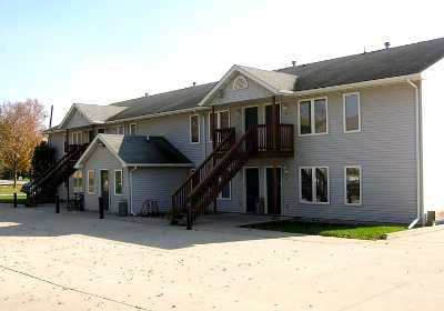
Property Record
1305 Georgia Ave, Ames, IA 50014


NEARBY LISTINGS FOR SALE OR LEASE
Property Detail
1305 Georgia Ave
Ames, IA
Ontario West 1St Add
05-31-475-175
ONTARIO OT LOTS 1 & 2 & 10' ADJ ON E BLK 4
Apartment
Story
X
Iowa
19015C0250D
1,2
2024
0.47 AC
2025
West Ames
000600
Other Market Areas
7,464 SF
DEMOGRAPHICS near 1305 Georgia Ave
1 Mile
3 Mile
5 Mile
2024 Total Population
6,777
45,963
67,289
2029 Population
7,045
47,316
69,316
Pop Growth 2024-2029
+ 3.95%
+ 2.94%
+ 3.01%
Average Age
35
31
33
2024 Total Households
2,888
16,841
27,049
HH Growth 2024-2029
+ 3.95%
+ 3.46%
+ 3.41%
Median Household Inc
$73,503
$56,655
$57,826
Avg Household Size
2.30
2.20
2.10
2024 Avg HH Vehicles
2.00
2.00
2.00
Median Home Value
$261,022
$273,600
$251,942
Median Year Built
1988
1995
1990
Nearby Places
Map Layers
Map Styles
 Street
 Aerial
- Restaurants
- Banks
- Shops
- Fitness
- Groceries
PUBLIC TRANSPORTATION
AIRPORT
Des Moines International
DRIVE
WALK
Distance
Des Moines International
61 min
44.0 mi
SALE & LEASE HISTORY
LISTING DATE
SALE/LEASE

Mar 16, 2021
For Sale
Apr 24, 2018
For Sale
Nearby Properties
Address
Land Use
TOTAL SIZE
Lot Size
Zoning
Address
Land Use
TOTAL SIZE
Lot Size
Zoning
289,606 SF
1.77 AC
CSC
Address
Land Use
TOTAL SIZE
Lot Size
Zoning
45,250 SF
12.69 AC
Address
Land Use
TOTAL SIZE
Lot Size
Zoning
45,627 SF
8.91 AC
RH
Address
Land Use
TOTAL SIZE
Lot Size
Zoning
117,797 SF
7.88 AC
Address
Land Use
TOTAL SIZE
Lot Size
Zoning
82,734 SF
1.42 AC
CSC
Address
Land Use
TOTAL SIZE
Lot Size
Zoning
16,222 SF
10.44 AC
Address
Land Use
TOTAL SIZE
Lot Size
Zoning
6,090 SF
20.72 AC
F-PRD
Address
Land Use
TOTAL SIZE
Lot Size
Zoning
133,668 SF
3.71 AC
RH
Address
Land Use
TOTAL SIZE
Lot Size
Zoning
20,619 SF
2.44 AC
RH
Address
Land Use
TOTAL SIZE
Lot Size
Zoning
105,550 SF
0.62 AC
CSC
Address
Land Use
TOTAL SIZE
Lot Size
Zoning
97,767 SF
0.05 AC
CSC
Address
Land Use
TOTAL SIZE
Lot Size
Zoning
88,584 SF
0.57 AC
Address
Land Use
TOTAL SIZE
Lot Size
Zoning
100,588 SF
7.65 AC
HOC
Address
Land Use
TOTAL SIZE
Lot Size
Zoning
22,864 SF
2.13 AC
RH
Address
Land Use
TOTAL SIZE
Lot Size
Zoning
30,207 SF
4.81 AC
Address
Land Use
TOTAL SIZE
Lot Size
Zoning
41,000 SF
1.73 AC
Address
Land Use
TOTAL SIZE
Lot Size
Zoning
63,021 SF
3.43 AC
Address
Land Use
TOTAL SIZE
Lot Size
Zoning
20,340 SF
5.66 AC
RH
Address
Land Use
TOTAL SIZE
Lot Size
Zoning
13,200 SF
8.28 AC
Address
Land Use
TOTAL SIZE
Lot Size
Zoning
72,459 SF
3.06 AC
CCR
Address
Land Use
TOTAL SIZE
Lot Size
Zoning
43,805 SF
4.65 AC
HOC
Address
Land Use
TOTAL SIZE
Lot Size
Zoning
31,254 SF
3.51 AC
F-PRD
Address
Land Use
TOTAL SIZE
Lot Size
Zoning
93,977 SF
0.48 AC
Address
Land Use
TOTAL SIZE
Lot Size
Zoning
41,412 SF
3.31 AC
Address
Land Use
TOTAL SIZE
Lot Size
Zoning
35,356 SF
3.16 AC
CCN
Address
Land Use
TOTAL SIZE
Lot Size
Zoning
19,656 SF
4.86 AC
RH
Address
Land Use
TOTAL SIZE
Lot Size
Zoning
12,960 SF
15.64 AC
C-1
Address
Land Use
TOTAL SIZE
Lot Size
Zoning
588 SF
3.04 AC
HOC
Address
Land Use
TOTAL SIZE
Lot Size
Zoning
16,018 SF
3.19 AC
Address
Land Use
TOTAL SIZE
Lot Size
Zoning
7,938 SF
3.86 AC
CCN
The World's #1 Commercial Real Estate Marketplace
Connect with us
© 2026 CoStar Group
The information above has been obtained from sources believed reliable. While we do not doubt its accuracy we have not verified it and make no guarantee, warranty or representation about it. It is your responsibility to independently confirm its accuracy and completeness. Any projections, opinions, assumptions, or estimates used are for example only and do not represent the current or future performance of the property. The value of this transaction to you depends on tax and other factors which should be evaluated by your tax, financial, and legal advisors. You and your advisors should conduct a careful, independent investigation of the property to determine to your satisfaction the suitability of the property for your needs.