No Photo
Property Record
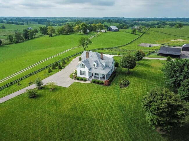
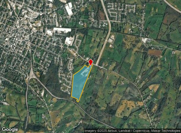
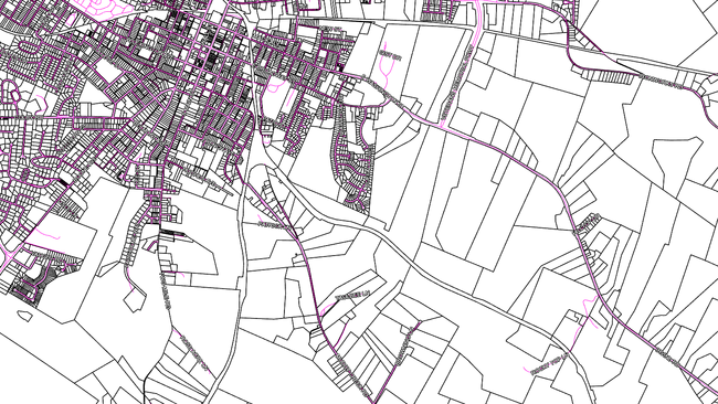
1305 Irvine Rd, Winchester, KY 40391
NEARBY LISTINGS FOR SALE OR LEASE
-
-
-
No Photo
-
View all Winchester listings for sale on LoopNet.com
Property Detail
1305 Irvine Rd
065-2005-01100
TWO TRACTS OF LAND IN DEED 487-895 LESS TRACT 2 PLAT 659 LESS PARCEL 1 PLAT 2483
Farms
Clark
X
Kentucky
21049C0110D
53.56 AC
2024
Clark County
2024
Lexington/Fayette
020106
Lexington-Fayette, KY
2,253 SF
DEMOGRAPHICS near 1305 Irvine Rd
1 Mile
3 Mile
5 Mile
2024 Total Population
3,409
19,272
29,225
2029 Population
3,462
19,493
29,521
Pop Growth 2024-2029
+ 1.55%
+ 1.15%
+ 1.01%
Average Age
39
40
40
2024 Total Households
1,413
7,925
11,935
HH Growth 2024-2029
+ 1.70%
+ 1.14%
+ 1.01%
Median Household Inc
$47,818
$50,424
$57,471
Avg Household Size
2.40
2.40
2.40
2024 Avg HH Vehicles
2.00
2.00
2.00
Median Home Value
$116,578
$158,011
$174,771
Median Year Built
1968
1972
1979
Nearby Places
Map Layers
Map Styles
 Street
 Aerial
- Restaurants
- Banks
- Shops
- Fitness
- Groceries
PUBLIC TRANSPORTATION
AIRPORT
Blue Grass
DRIVE
WALK
Distance
Blue Grass
45 min
30.9 mi
Freight Ports
Port of Toledo
DRIVE
WALK
Distance
Port of Toledo
353 min
304.2 mi
SALE & LEASE HISTORY
LISTING DATE
SALE/LEASE

Aug 15, 2021
For Sale
Nearby Properties
Address
Land Use
TOTAL SIZE
Lot Size
Zoning
Address
Land Use
TOTAL SIZE
Lot Size
Zoning
792 SF
5.71 AC
SINGLE FAM
Address
Land Use
TOTAL SIZE
Lot Size
Zoning
Address
Land Use
TOTAL SIZE
Lot Size
Zoning
Address
Land Use
TOTAL SIZE
Lot Size
Zoning
Address
Land Use
TOTAL SIZE
Lot Size
Zoning
136,116 SF
12.58 AC
LIGHT INDU
Address
Land Use
TOTAL SIZE
Lot Size
Zoning
6.65 AC
I1
Address
Land Use
TOTAL SIZE
Lot Size
Zoning
0.98 AC
DOWNTOWN B
Address
Land Use
TOTAL SIZE
Lot Size
Zoning
24.23 AC
I1
Address
Land Use
TOTAL SIZE
Lot Size
Zoning
121,809 SF
19.44 AC
LIGHT INDU
Address
Land Use
TOTAL SIZE
Lot Size
Zoning
Address
Land Use
TOTAL SIZE
Lot Size
Zoning
4.53 AC
Address
Land Use
TOTAL SIZE
Lot Size
Zoning
64,000 SF
8.45 AC
HIGHWAY BU
Address
Land Use
TOTAL SIZE
Lot Size
Zoning
3.15 AC
Address
Land Use
TOTAL SIZE
Lot Size
Zoning
15.06 AC
I1
Address
Land Use
TOTAL SIZE
Lot Size
Zoning
5.88 AC
PLANNED DE
Address
Land Use
TOTAL SIZE
Lot Size
Zoning
1.07 AC
PD
Address
Land Use
TOTAL SIZE
Lot Size
Zoning
112,148 SF
13.81 AC
LIGHT INDU
Address
Land Use
TOTAL SIZE
Lot Size
Zoning
1.90 AC
B3
Address
Land Use
TOTAL SIZE
Lot Size
Zoning
20 AC
MH
Address
Land Use
TOTAL SIZE
Lot Size
Zoning
14,878 SF
1.86 AC
NEIGHBORHO
Address
Land Use
TOTAL SIZE
Lot Size
Zoning
19.91 AC
LIGHT INDU
Address
Land Use
TOTAL SIZE
Lot Size
Zoning
63,296 SF
1.10 AC
DOWNTOWN B
Address
Land Use
TOTAL SIZE
Lot Size
Zoning
102,345 SF
7.80 AC
LIGHT INDU
Address
Land Use
TOTAL SIZE
Lot Size
Zoning
31.50 AC
I1
Address
Land Use
TOTAL SIZE
Lot Size
Zoning
100,531 SF
10.01 AC
LIGHT INDU
Address
Land Use
TOTAL SIZE
Lot Size
Zoning
62,800 SF
8.97 AC
LIGHT INDU
Address
Land Use
TOTAL SIZE
Lot Size
Zoning
17,282 SF
0.59 AC
DOWNTOWN B
Address
Land Use
TOTAL SIZE
Lot Size
Zoning
6.66 AC
B3
Address
Land Use
TOTAL SIZE
Lot Size
Zoning
2.46 AC
B3
Address
Land Use
TOTAL SIZE
Lot Size
Zoning
3.85 AC
R5
The World's #1 Commercial Real Estate Marketplace
Connect with us
© 2025 CoStar Group
The information above has been obtained from sources believed reliable. While we do not doubt its accuracy we have not verified it and make no guarantee, warranty or representation about it. It is your responsibility to independently confirm its accuracy and completeness. Any projections, opinions, assumptions, or estimates used are for example only and do not represent the current or future performance of the property. The value of this transaction to you depends on tax and other factors which should be evaluated by your tax, financial, and legal advisors. You and your advisors should conduct a careful, independent investigation of the property to determine to your satisfaction the suitability of the property for your needs.