Property Record
1305 Morgan Stanley Ave, Winter Park, FL 32789


NEARBY LISTINGS FOR SALE OR LEASE
Property Detail
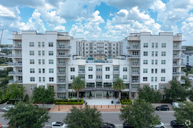
1305 Morgan Stanley Ave
Orlando-Kissimmee-Sanford, FL
Home Acres
01-2229-3712-07-031
HOME ACRES M/97 LOTS 3 THROUGH 10 & LOTS 11 THROUGH 18 AND T HE NORTH 15 FT+/- OF LOTS 2 & 19 BLK G & VACATED R/W PER OR B 210/254 & 219/631 ON W OF LOTS 6 THROUGH 10 & VAC R/W PER
Apartment
Orange
X
Florida
12095C0255F
10,11
2024
2.42 AC
2025
Eatonville
015901
Orlando
448,026 SF
DEMOGRAPHICS near 1305 Morgan Stanley Ave
1 Mile
3 Mile
5 Mile
2024 Total Population
12,633
89,016
284,331
2029 Population
13,452
92,880
295,863
Pop Growth 2024-2029
+ 6.48%
+ 4.34%
+ 4.06%
Average Age
43
42
40
2024 Total Households
6,012
39,355
127,386
HH Growth 2024-2029
+ 6.64%
+ 4.62%
+ 4.25%
Median Household Inc
$59,959
$78,340
$64,233
Avg Household Size
2.10
2.20
2.20
2024 Avg HH Vehicles
2.00
2.00
2.00
Median Home Value
$445,192
$450,834
$345,284
Median Year Built
1980
1975
1980
Nearby Places
Map Layers
Map Styles
 Street
 Aerial
- Restaurants
- Banks
- Shops
- Fitness
- Groceries
Nearby Properties
Address
Land Use
TOTAL SIZE
Lot Size
Zoning
Address
Land Use
TOTAL SIZE
Lot Size
Zoning
2,093,075 SF
57.25 AC
PD/T
Address
Land Use
TOTAL SIZE
Lot Size
Zoning
1,283,799 SF
51.47 AC
PQP
Address
Land Use
TOTAL SIZE
Lot Size
Zoning
712,535 SF
16.90 AC
O-1
Address
Land Use
TOTAL SIZE
Lot Size
Zoning
502,971 SF
30.54 AC
C-1
Address
Land Use
TOTAL SIZE
Lot Size
Zoning
689,476 SF
2.54 AC
PD/T
Address
Land Use
TOTAL SIZE
Lot Size
Zoning
855,665 SF
75.29 AC
P/T/W
Address
Land Use
TOTAL SIZE
Lot Size
Zoning
1,009,074 SF
37.77 AC
PD
Address
Land Use
TOTAL SIZE
Lot Size
Zoning
597,657 SF
2.17 AC
MU-2/T/SP
Address
Land Use
TOTAL SIZE
Lot Size
Zoning
324,200 SF
1.02 AC
PD/T
Address
Land Use
TOTAL SIZE
Lot Size
Zoning
676,774 SF
46.39 AC
R-4
Address
Land Use
TOTAL SIZE
Lot Size
Zoning
507,541 SF
49.48 AC
I-1
Address
Land Use
TOTAL SIZE
Lot Size
Zoning
467,832 SF
20.10 AC
PD
Address
Land Use
TOTAL SIZE
Lot Size
Zoning
538,389 SF
3.25 AC
OC-PD
Address
Land Use
TOTAL SIZE
Lot Size
Zoning
153,319 SF
0.99 AC
PD/T
Address
Land Use
TOTAL SIZE
Lot Size
Zoning
464,785 SF
2.19 AC
R-MF
Address
Land Use
TOTAL SIZE
Lot Size
Zoning
468,073 SF
PD/T
Address
Land Use
TOTAL SIZE
Lot Size
Zoning
468,719 SF
45.46 AC
PD
Address
Land Use
TOTAL SIZE
Lot Size
Zoning
656,009 SF
5.59 AC
DM
Address
Land Use
TOTAL SIZE
Lot Size
Zoning
561,228 SF
5.70 AC
PD/T
Address
Land Use
TOTAL SIZE
Lot Size
Zoning
580,396 SF
4.23 AC
PD/T/SP
Address
Land Use
TOTAL SIZE
Lot Size
Zoning
508,038 SF
5.98 AC
PD
Address
Land Use
TOTAL SIZE
Lot Size
Zoning
563,546 SF
0.61 AC
DM
Address
Land Use
TOTAL SIZE
Lot Size
Zoning
122,491 SF
3.35 AC
R-4
Address
Land Use
TOTAL SIZE
Lot Size
Zoning
555,833 SF
3.65 AC
DM
Address
Land Use
TOTAL SIZE
Lot Size
Zoning
505,902 SF
4.69 AC
DM
Address
Land Use
TOTAL SIZE
Lot Size
Zoning
277,160 SF
2.38 AC
R-MF
Address
Land Use
TOTAL SIZE
Lot Size
Zoning
396,016 SF
4.45 AC
R-4
Address
Land Use
TOTAL SIZE
Lot Size
Zoning
631,978 SF
7 AC
PD
Address
Land Use
TOTAL SIZE
Lot Size
Zoning
135,028 SF
27.59 AC
PR
The World's #1 Commercial Real Estate Marketplace
Connect with us
© 2025 CoStar Group
The information above has been obtained from sources believed reliable. While we do not doubt its accuracy we have not verified it and make no guarantee, warranty or representation about it. It is your responsibility to independently confirm its accuracy and completeness. Any projections, opinions, assumptions, or estimates used are for example only and do not represent the current or future performance of the property. The value of this transaction to you depends on tax and other factors which should be evaluated by your tax, financial, and legal advisors. You and your advisors should conduct a careful, independent investigation of the property to determine to your satisfaction the suitability of the property for your needs.