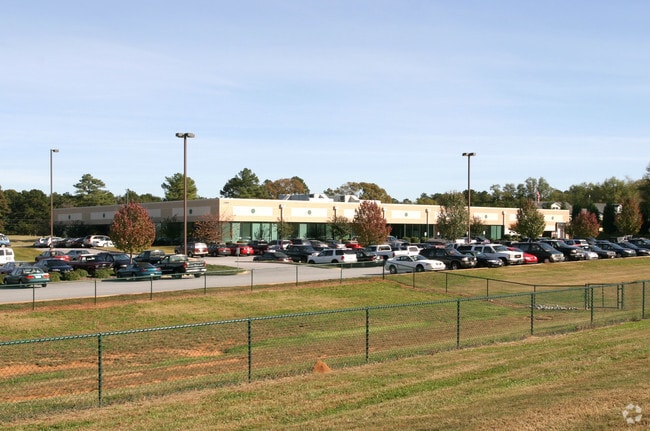
Property Record
1305 Perimeter Rd, Greenville, SC 29605


NEARBY LISTINGS FOR SALE OR LEASE
Property Detail
1305 Perimeter Rd
Greenville-Anderson-Greer, SC
MAP 0411.00
0411.00-01-001.11
Greenville
Officebuilding
South Carolina
X
001.11
45045C0413E
8.14 AC
2025
Western Greenville County
2024
Greenville/Spartanburg
003401
DEMOGRAPHICS near 1305 Perimeter Rd
1 Mile
3 Mile
5 Mile
2024 Total Population
2,310
28,747
88,559
2029 Population
2,544
31,971
98,414
Pop Growth 2024-2029
+ 10.13%
+ 11.22%
+ 11.13%
Average Age
39
38
39
2024 Total Households
870
11,064
35,217
HH Growth 2024-2029
+ 10.23%
+ 11.31%
+ 11.19%
Median Household Inc
$73,852
$62,994
$66,302
Avg Household Size
2.60
2.50
2.50
2024 Avg HH Vehicles
2.00
2.00
2.00
Median Home Value
$172,506
$178,791
$214,469
Median Year Built
2003
1994
1994
Nearby Places
Map Layers
Map Styles
 Street
 Aerial
- Restaurants
- Banks
- Shops
- Fitness
- Groceries
PUBLIC TRANSPORTATION
COMMUTER RAIL
DRIVE
WALK
Distance
22 min
9.3 mi
AIRPORT
Greenville Spartanburg International
DRIVE
WALK
Distance
Greenville Spartanburg International
27 min
16.5 mi
Nearby Properties
Address
Land Use
TOTAL SIZE
Lot Size
Zoning
Address
Land Use
TOTAL SIZE
Lot Size
Zoning
78.04 AC
C2
Address
Land Use
TOTAL SIZE
Lot Size
Zoning
977.33 AC
I1
Address
Land Use
TOTAL SIZE
Lot Size
Zoning
12.95 AC
RM3
Address
Land Use
TOTAL SIZE
Lot Size
Zoning
29.91 AC
Address
Land Use
TOTAL SIZE
Lot Size
Zoning
32.34 AC
Address
Land Use
TOTAL SIZE
Lot Size
Zoning
41.48 AC
I2
Address
Land Use
TOTAL SIZE
Lot Size
Zoning
12.87 AC
I2
Address
Land Use
TOTAL SIZE
Lot Size
Zoning
14.13 AC
Address
Land Use
TOTAL SIZE
Lot Size
Zoning
387.84 AC
S1
Address
Land Use
TOTAL SIZE
Lot Size
Zoning
31.52 AC
I2
Address
Land Use
TOTAL SIZE
Lot Size
Zoning
8.97 AC
Address
Land Use
TOTAL SIZE
Lot Size
Zoning
13.90 AC
I1
Address
Land Use
TOTAL SIZE
Lot Size
Zoning
33.60 AC
I1
Address
Land Use
TOTAL SIZE
Lot Size
Zoning
13.52 AC
I2
Address
Land Use
TOTAL SIZE
Lot Size
Zoning
28.29 AC
I2
Address
Land Use
TOTAL SIZE
Lot Size
Zoning
12.41 AC
RS
Address
Land Use
TOTAL SIZE
Lot Size
Zoning
Address
Land Use
TOTAL SIZE
Lot Size
Zoning
12.85 AC
I1
Address
Land Use
TOTAL SIZE
Lot Size
Zoning
13.36 AC
I1
Address
Land Use
TOTAL SIZE
Lot Size
Zoning
11 AC
I1
Address
Land Use
TOTAL SIZE
Lot Size
Zoning
128.50 AC
I1
Address
Land Use
TOTAL SIZE
Lot Size
Zoning
108.12 AC
I1
Address
Land Use
TOTAL SIZE
Lot Size
Zoning
45.10 AC
I1
Address
Land Use
TOTAL SIZE
Lot Size
Zoning
40.92 AC
S1
Address
Land Use
TOTAL SIZE
Lot Size
Zoning
23.10 AC
S1
Address
Land Use
TOTAL SIZE
Lot Size
Zoning
12.84 AC
S1
Address
Land Use
TOTAL SIZE
Lot Size
Zoning
91.92 AC
I1
Address
Land Use
TOTAL SIZE
Lot Size
Zoning
75.52 AC
I1
Address
Land Use
TOTAL SIZE
Lot Size
Zoning
55.53 AC
S1
The World's #1 Commercial Real Estate Marketplace
Connect with us
© 2026 CoStar Group
The information above has been obtained from sources believed reliable. While we do not doubt its accuracy we have not verified it and make no guarantee, warranty or representation about it. It is your responsibility to independently confirm its accuracy and completeness. Any projections, opinions, assumptions, or estimates used are for example only and do not represent the current or future performance of the property. The value of this transaction to you depends on tax and other factors which should be evaluated by your tax, financial, and legal advisors. You and your advisors should conduct a careful, independent investigation of the property to determine to your satisfaction the suitability of the property for your needs.