Property Record
13050 Se 162Nd Ave, Clackamas, OR 97015
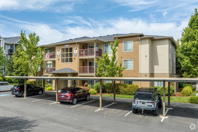

Property Detail
13050 Se 162Nd Ave
Portland-Vancouver-Hillsboro, OR-WA
SUBDIVISION TARALON COMMONS 4012 LT 6
05013455
CLACKAMAS
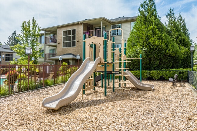
Multifamilydwelling
Oregon
MURM1
6
AE The base floodplain where base flood elevations are provided. AE Zones are now used on new format FIRMs instead of A1-A30 Zones.
8 AC
2025
Rock Creek
2025
Portland
022110
NEARBY LISTINGS FOR SALE OR LEASE
-
-
View all Clackamas listings for sale on LoopNet.com
DEMOGRAPHICS near 13050 Se 162Nd Ave
1 mile
3 mile
5 mile
2025 Total Population
14,127
54,421
150,039
2030 Population
14,553
55,201
150,320
Pop Growth 2025-2030
+ 3.02%
+ 1.43%
+ 0.19%
Average Age
38
40
41
2025 Total Households
4,684
18,172
52,670
HH Growth 2025-2030
+ 2.99%
+ 1.39%
+ 0.05%
Median Household Inc
$107,764
$111,151
$93,851
Avg Household Size
3.00
2.90
2.70
2025 Avg HH Vehicles
2.00
2.00
2.00
Median Home Value
$690,590
$690,054
$595,637
Median Year Built
2008
1997
1989
Nearby Places
Map Layers
Map Styles
 Street
 Aerial
Layers
 Traffic
 Biking
Places
Listings with unknown addresses are not visible on the map
- Restaurants
- Banks
- Shops
- Fitness
- Groceries
PUBLIC TRANSPORTATION
COMMUTER RAIL
Oregon City Amtrak (Amtrak Cascades - Amtrak)
Drive
Walk
Distance
Oregon City Amtrak (Amtrak Cascades - Amtrak)
16 min
9.0 mi
AIRPORT
Portland International
Drive
Walk
Distance
Portland International
27 min
16.2 mi
Freight Ports
Port of Portland
Drive
Walk
Distance
Port of Portland
31 min
19.5 mi
Nearby Properties
Address
Land Use
TOTAL SIZE
Lot Size
Zoning
Address
Land Use
TOTAL SIZE
Lot Size
Zoning
4,654 SF
73.99 AC
LI
Address
Land Use
TOTAL SIZE
Lot Size
Zoning
6.92 AC
MCC
Address
Land Use
TOTAL SIZE
Lot Size
Zoning
2,232 SF
15.74 AC
MUC
Address
Land Use
TOTAL SIZE
Lot Size
Zoning
12.06 AC
MCC
Address
Land Use
TOTAL SIZE
Lot Size
Zoning
9 AC
MUE
Address
Land Use
TOTAL SIZE
Lot Size
Zoning
22.99 AC
LI
Address
Land Use
TOTAL SIZE
Lot Size
Zoning
2,089 SF
4.30 AC
MURM2
Address
Land Use
TOTAL SIZE
Lot Size
Zoning
6 AC
GI
Address
Land Use
TOTAL SIZE
Lot Size
Zoning
12 AC
LI
Address
Land Use
TOTAL SIZE
Lot Size
Zoning
1,032 SF
5.50 AC
MR2
Address
Land Use
TOTAL SIZE
Lot Size
Zoning
7.25 AC
LI
Address
Land Use
TOTAL SIZE
Lot Size
Zoning
3,342 SF
9.34 AC
MUE
Address
Land Use
TOTAL SIZE
Lot Size
Zoning
17.04 AC
GI
Address
Land Use
TOTAL SIZE
Lot Size
Zoning
10.11 AC
MR2
Address
Land Use
TOTAL SIZE
Lot Size
Zoning
2,510 SF
16.02 AC
GI
Address
Land Use
TOTAL SIZE
Lot Size
Zoning
4.83 AC
MCC
Address
Land Use
TOTAL SIZE
Lot Size
Zoning
5.66 AC
MCC
Address
Land Use
TOTAL SIZE
Lot Size
Zoning
1 AC
MURX
Address
Land Use
TOTAL SIZE
Lot Size
Zoning
5.52 AC
MURM1
Address
Land Use
TOTAL SIZE
Lot Size
Zoning
Address
Land Use
TOTAL SIZE
Lot Size
Zoning
14.44 AC
MR2
Address
Land Use
TOTAL SIZE
Lot Size
Zoning
1,386 SF
12.64 AC
GI
Address
Land Use
TOTAL SIZE
Lot Size
Zoning
3.15 AC
MURM2
Address
Land Use
TOTAL SIZE
Lot Size
Zoning
1,896 SF
1.96 AC
VO
Address
Land Use
TOTAL SIZE
Lot Size
Zoning
4.76 AC
MUC
Address
Land Use
TOTAL SIZE
Lot Size
Zoning
5.31 AC
C2
Address
Land Use
TOTAL SIZE
Lot Size
Zoning
Address
Land Use
TOTAL SIZE
Lot Size
Zoning
The World's #1 Commercial Real Estate Marketplace
Connect with us
© 2026 CoStar Group
The information above has been obtained from sources believed reliable. While we do not doubt its accuracy we have not verified it and make no guarantee, warranty or representation about it. It is your responsibility to independently confirm its accuracy and completeness. Any projections, opinions, assumptions, or estimates used are for example only and do not represent the current or future performance of the property. The value of this transaction to you depends on tax and other factors which should be evaluated by your tax, financial, and legal advisors. You and your advisors should conduct a careful, independent investigation of the property to determine to your satisfaction the suitability of the property for your needs.