Property Record
1306 Boy Scout Rd, Ashland, KY 41102


NEARBY LISTINGS FOR SALE OR LEASE
-
-
View all Ashland listings for sale on LoopNet.com
Property Detail
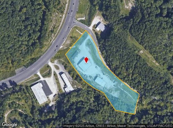
1306 Boy Scout Rd
024-05-00-041.01
TRACT TWO 5.52 ACRES +
Warehouse
Boyd
X
Kentucky
21019C0058D
5.52 AC
2025
Outlying Boyd County
2025
Huntington/Ashland
031003
Huntington-Ashland, WV-KY-OH
5,400 SF
DEMOGRAPHICS near 1306 Boy Scout Rd
1 mile
3 mile
5 mile
2024 Total Population
933
25,097
47,223
2029 Population
926
24,815
46,621
Pop Growth 2024-2029
(0.75%)
(1.12%)
(1.27%)
Average Age
42
42
42
2024 Total Households
341
10,281
19,394
HH Growth 2024-2029
(0.59%)
(1.12%)
(1.21%)
Median Household Inc
$74,210
$55,204
$52,322
Avg Household Size
2.40
2.40
2.30
2024 Avg HH Vehicles
2.00
2.00
2.00
Median Home Value
$167,226
$127,427
$125,913
Median Year Built
1975
1970
1969
Nearby Places
Map Layers
Map Styles
 Street
 Aerial
Transit
 Traffic
 Biking
Places
Listings with unknown addresses are not visible on the map
- Restaurants
- Banks
- Shops
- Fitness
- Groceries
PUBLIC TRANSPORTATION
COMMUTER RAIL
Ashland Amtrak Station (Cardinal - Amtrak)
Drive
Walk
Distance
Ashland Amtrak Station (Cardinal - Amtrak)
6 min
4.0 mi
AIRPORT
Tri-State/Milton J Ferguson Field
Drive
Walk
Distance
Tri-State/Milton J Ferguson Field
25 min
13.8 mi
Freight Ports
Port of Toledo
Drive
Walk
Distance
Port of Toledo
338 min
261.0 mi
Nearby Properties
Address
Land Use
TOTAL SIZE
Lot Size
Zoning
Address
Land Use
TOTAL SIZE
Lot Size
Zoning
36.49 AC
OTHER
Address
Land Use
TOTAL SIZE
Lot Size
Zoning
2,318 SF
190 AC
Address
Land Use
TOTAL SIZE
Lot Size
Zoning
91,786 SF
2.93 AC
Address
Land Use
TOTAL SIZE
Lot Size
Zoning
11 AC
COMMERCIAL
Address
Land Use
TOTAL SIZE
Lot Size
Zoning
22 AC
OTHER
Address
Land Use
TOTAL SIZE
Lot Size
Zoning
16.10 AC
Address
Land Use
TOTAL SIZE
Lot Size
Zoning
22,592 SF
43.50 AC
OTHER
Address
Land Use
TOTAL SIZE
Lot Size
Zoning
33,980 SF
2.03 AC
COMMERCIAL
Address
Land Use
TOTAL SIZE
Lot Size
Zoning
Address
Land Use
TOTAL SIZE
Lot Size
Zoning
4 AC
Z01
Address
Land Use
TOTAL SIZE
Lot Size
Zoning
7.76 AC
Z03
Address
Land Use
TOTAL SIZE
Lot Size
Zoning
35,506 SF
6 AC
OTHER
Address
Land Use
TOTAL SIZE
Lot Size
Zoning
8,379 SF
7.76 AC
COMMERCIAL
Address
Land Use
TOTAL SIZE
Lot Size
Zoning
36,866 SF
4.70 AC
OTHER
Address
Land Use
TOTAL SIZE
Lot Size
Zoning
9,576 SF
12.29 AC
COMMERCIAL
Address
Land Use
TOTAL SIZE
Lot Size
Zoning
Address
Land Use
TOTAL SIZE
Lot Size
Zoning
20,018 SF
0.36 AC
OTHER
Address
Land Use
TOTAL SIZE
Lot Size
Zoning
22,236 SF
3.96 AC
RESIDENTIA
Address
Land Use
TOTAL SIZE
Lot Size
Zoning
44,650 SF
7.81 AC
Z02
Address
Land Use
TOTAL SIZE
Lot Size
Zoning
0.57 AC
RESIDENTIA
Address
Land Use
TOTAL SIZE
Lot Size
Zoning
6,840 SF
24 AC
COMMERCIAL
Address
Land Use
TOTAL SIZE
Lot Size
Zoning
1.02 AC
COMMERCIAL
Address
Land Use
TOTAL SIZE
Lot Size
Zoning
9.03 AC
Z02
Address
Land Use
TOTAL SIZE
Lot Size
Zoning
Address
Land Use
TOTAL SIZE
Lot Size
Zoning
Address
Land Use
TOTAL SIZE
Lot Size
Zoning
2.44 AC
COMMERCIAL
Address
Land Use
TOTAL SIZE
Lot Size
Zoning
1.09 AC
COMMERCIAL
Address
Land Use
TOTAL SIZE
Lot Size
Zoning
6 AC
COMMERCIAL
Address
Land Use
TOTAL SIZE
Lot Size
Zoning
3,520 SF
0.19 AC
COMMERCIAL
Address
Land Use
TOTAL SIZE
Lot Size
Zoning
1.11 AC
COMMERCIAL
The World's #1 Commercial Real Estate Marketplace
Connect with us
© 2026 CoStar Group
The information above has been obtained from sources believed reliable. While we do not doubt its accuracy we have not verified it and make no guarantee, warranty or representation about it. It is your responsibility to independently confirm its accuracy and completeness. Any projections, opinions, assumptions, or estimates used are for example only and do not represent the current or future performance of the property. The value of this transaction to you depends on tax and other factors which should be evaluated by your tax, financial, and legal advisors. You and your advisors should conduct a careful, independent investigation of the property to determine to your satisfaction the suitability of the property for your needs.