Property Record
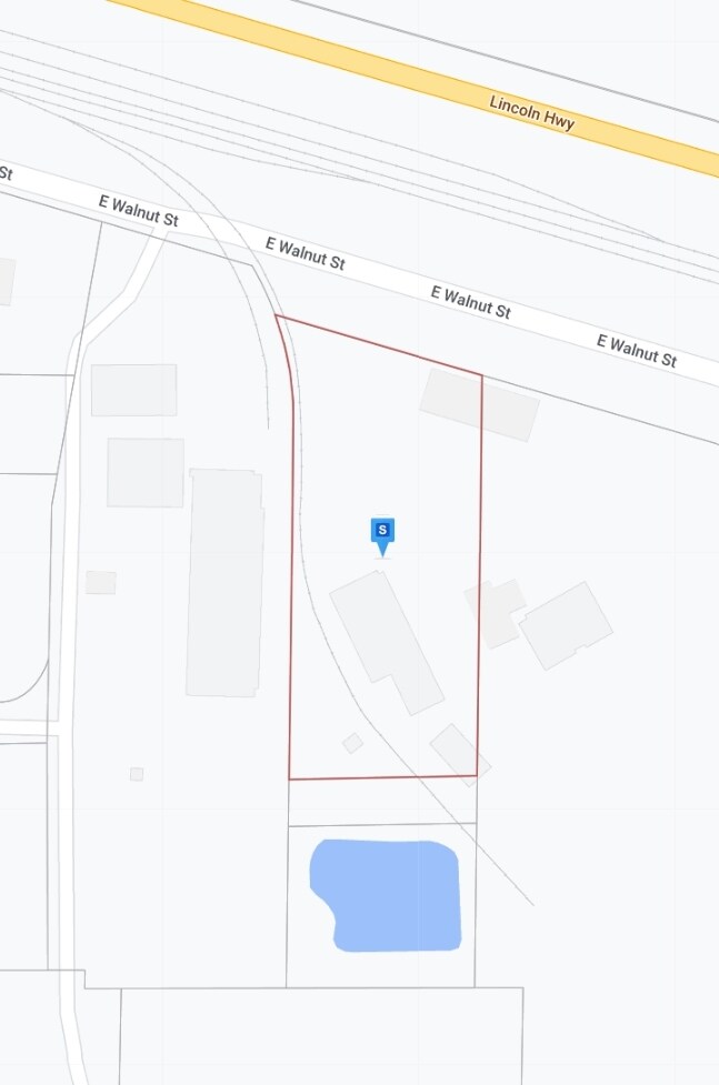
1306 E Walnut St, Lexington, NE 68850

Property Detail
1306 E Walnut St
24-0008979
00001673 TRACT IN NE1/4 S OF RR ROW (17.26A) (09-09-21)
Gasolinefuelbulkstorage
DAWSON
03-COMMERC
Nebraska
B and X Area of moderate flood hazard, usually the area between the limits of the 100-year and 500-year floods.
20.93 AC
2025
I-80 Corridor
2025
Other Market Areas
968500
Lexington, NE
12,074 SF
NEARBY LISTINGS FOR SALE OR LEASE
-
-
View all Lexington listings for sale on LoopNet.com
DEMOGRAPHICS near 1306 E Walnut St
1 mile
3 mile
5 mile
2025 Total Population
840
11,891
12,335
2030 Population
861
12,335
12,784
Pop Growth 2025-2030
+ 2.50%
+ 3.73%
+ 3.64%
Average Age
36
35
35
2025 Total Households
276
3,790
3,949
HH Growth 2025-2030
+ 2.54%
+ 3.72%
+ 3.65%
Median Household Inc
$70,672
$65,087
$65,600
Avg Household Size
2.90
3.10
3.00
2025 Avg HH Vehicles
2.00
2.00
2.00
Median Home Value
$174,137
$163,294
$165,644
Median Year Built
1962
1974
1974
Nearby Places
Map Layers
Map Styles
 Street
 Aerial
Layers
 Traffic
 Biking
Places
Listings with unknown addresses are not visible on the map
- Restaurants
- Banks
- Shops
- Fitness
- Groceries
Nearby Properties
Address
Land Use
TOTAL SIZE
Lot Size
Zoning
Address
Land Use
TOTAL SIZE
Lot Size
Zoning
1,344 SF
128.24 AC
04-INDUSTR
Address
Land Use
TOTAL SIZE
Lot Size
Zoning
20,460 SF
1 AC
04-INDUSTR
Address
Land Use
TOTAL SIZE
Lot Size
Zoning
38,994 SF
4.86 AC
03-COMMERC
Address
Land Use
TOTAL SIZE
Lot Size
Zoning
112,374 SF
27.73 AC
03-COMMERC
Address
Land Use
TOTAL SIZE
Lot Size
Zoning
144,333 SF
35.44 AC
03-COMMERC
Address
Land Use
TOTAL SIZE
Lot Size
Zoning
7,143 SF
4.88 AC
02-MULTI-F
Address
Land Use
TOTAL SIZE
Lot Size
Zoning
284 AC
00
Address
Land Use
TOTAL SIZE
Lot Size
Zoning
69,010 SF
5.18 AC
00
Address
Land Use
TOTAL SIZE
Lot Size
Zoning
38,256 SF
10.07 AC
03-COMMERC
Address
Land Use
TOTAL SIZE
Lot Size
Zoning
7,804 SF
8.63 AC
03-COMMERC
Address
Land Use
TOTAL SIZE
Lot Size
Zoning
31,173 SF
2.24 AC
03-COMMERC
Address
Land Use
TOTAL SIZE
Lot Size
Zoning
11,074 SF
1.64 AC
02-MULTI-F
Address
Land Use
TOTAL SIZE
Lot Size
Zoning
7,344 SF
1.08 AC
03-COMMERC
Address
Land Use
TOTAL SIZE
Lot Size
Zoning
12,944 SF
0.76 AC
02-MULTI-F
Address
Land Use
TOTAL SIZE
Lot Size
Zoning
17,359 SF
1 AC
03-COMMERC
Address
Land Use
TOTAL SIZE
Lot Size
Zoning
18,700 SF
1.23 AC
03-COMMERC
Address
Land Use
TOTAL SIZE
Lot Size
Zoning
25,071 SF
6.93 AC
04-INDUSTR
Address
Land Use
TOTAL SIZE
Lot Size
Zoning
24,481 SF
0.52 AC
03-COMMERC
Address
Land Use
TOTAL SIZE
Lot Size
Zoning
10,000 SF
17.42 AC
03-COMMERC
Address
Land Use
TOTAL SIZE
Lot Size
Zoning
4,788 SF
2.11 AC
03-COMMERC
Address
Land Use
TOTAL SIZE
Lot Size
Zoning
17,920 SF
10.34 AC
03-COMMERC
Address
Land Use
TOTAL SIZE
Lot Size
Zoning
14,940 SF
16.85 AC
03-COMMERC
Address
Land Use
TOTAL SIZE
Lot Size
Zoning
11,550 SF
6.53 AC
03-COMMERC
Address
Land Use
TOTAL SIZE
Lot Size
Zoning
3,869 SF
266.90 AC
05-AGRICUL
Address
Land Use
TOTAL SIZE
Lot Size
Zoning
9,259 SF
2.89 AC
03-COMMERC
Address
Land Use
TOTAL SIZE
Lot Size
Zoning
5.50 AC
03-COMMERC
Address
Land Use
TOTAL SIZE
Lot Size
Zoning
6,599 SF
1.18 AC
03-COMMERC
Address
Land Use
TOTAL SIZE
Lot Size
Zoning
34,562 SF
2.11 AC
03-COMMERC
The World's #1 Commercial Real Estate Marketplace
Connect with us
© 2026 CoStar Group
The information above has been obtained from sources believed reliable. While we do not doubt its accuracy we have not verified it and make no guarantee, warranty or representation about it. It is your responsibility to independently confirm its accuracy and completeness. Any projections, opinions, assumptions, or estimates used are for example only and do not represent the current or future performance of the property. The value of this transaction to you depends on tax and other factors which should be evaluated by your tax, financial, and legal advisors. You and your advisors should conduct a careful, independent investigation of the property to determine to your satisfaction the suitability of the property for your needs.