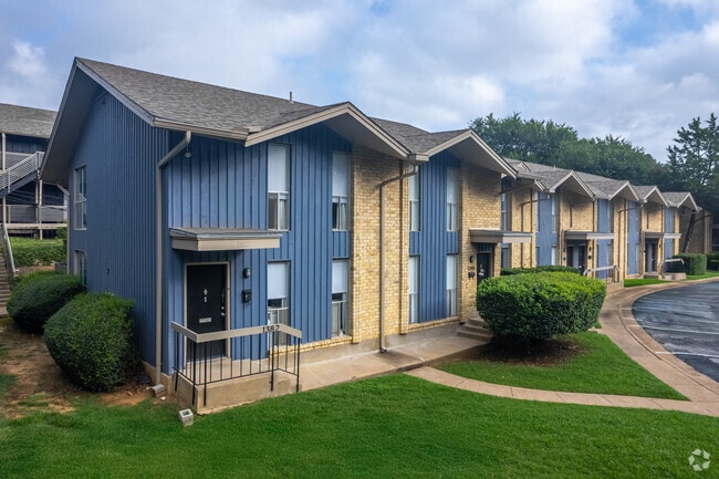
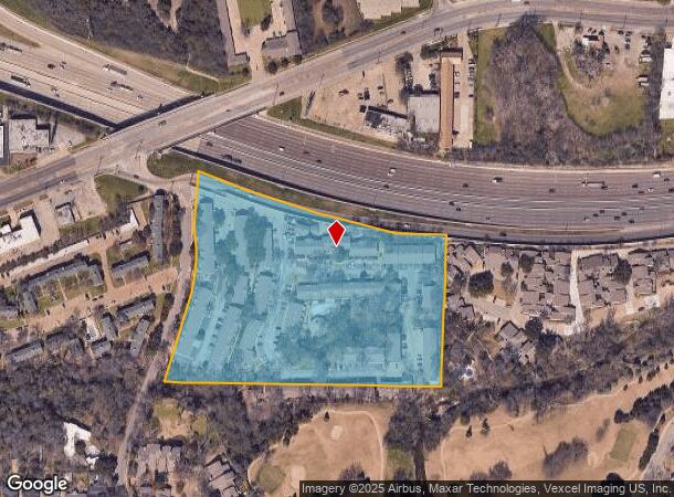
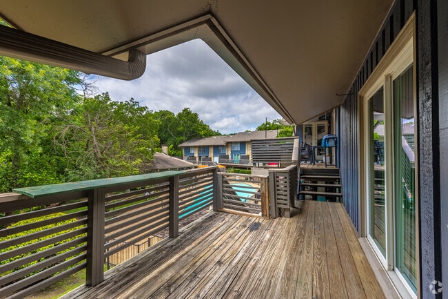
Property Record
1306 N Plymouth Rd, Dallas, TX 75208
NEARBY LISTINGS FOR SALE OR LEASE
Property Detail
1306 N Plymouth Rd
Dallas-Fort Worth-Arlington, TX
William Myers Abs 880
00000459607000000
BLK 5929 TR 3 ACS 9.697 @ I 30 INT201000327524 DD12202010 CO-DC 5929 000 00300 2005929 000
Apartment
Dallas
AE
Texas
48113C0340J
3
2024
9.70 AC
2025
Kessler
004400
Dallas/Ft Worth
202,908 SF
DEMOGRAPHICS near 1306 N Plymouth Rd
1 Mile
3 Mile
5 Mile
2024 Total Population
10,910
119,911
350,290
2029 Population
11,002
120,395
351,914
Pop Growth 2024-2029
+ 0.84%
+ 0.40%
+ 0.46%
Average Age
39
36
36
2024 Total Households
5,224
43,529
148,586
HH Growth 2024-2029
+ 1.11%
+ 0.55%
+ 0.75%
Median Household Inc
$72,051
$56,614
$62,005
Avg Household Size
2.10
2.60
2.20
2024 Avg HH Vehicles
2.00
2.00
2.00
Median Home Value
$476,820
$264,847
$248,423
Median Year Built
1969
1970
1989
Nearby Places
Map Layers
Map Styles
 Street
 Aerial
- Restaurants
- Banks
- Shops
- Fitness
- Groceries
PUBLIC TRANSPORTATION
COMMUTER RAIL
Victory Station (DART LIGHT RAIL - GREEN LINE - Dallas Area Rapid Transit (DART), DART LIGHT RAIL - ORANGE LINE - Dallas Area Rapid Transit (DART), TRINITY RAILWAY - Dallas Area Rapid Transit (DART))
DRIVE
WALK
Distance
Victory Station (DART LIGHT RAIL - GREEN LINE - Dallas Area Rapid Transit (DART), DART LIGHT RAIL - ORANGE LINE - Dallas Area Rapid Transit (DART), TRINITY RAILWAY - Dallas Area Rapid Transit (DART))
5 min
3.6 mi
Medical/Market Ctr Station (TRINITY RAILWAY - Dallas Area Rapid Transit (DART))
DRIVE
WALK
Distance
Medical/Market Ctr Station (TRINITY RAILWAY - Dallas Area Rapid Transit (DART))
9 min
6.1 mi
AIRPORT
Dallas Love Field
DRIVE
WALK
Distance
Dallas Love Field
15 min
8.5 mi
Dallas-Fort Worth International
DRIVE
WALK
Distance
Dallas-Fort Worth International
29 min
22.7 mi
Freight Ports
Port of Shreveport
DRIVE
WALK
Distance
Port of Shreveport
214 min
199.5 mi
Nearby Properties
Address
Land Use
TOTAL SIZE
Lot Size
Zoning
Address
Land Use
TOTAL SIZE
Lot Size
Zoning
1,298,826 SF
33.16 AC
Z163
Address
Land Use
TOTAL SIZE
Lot Size
Zoning
815,000 SF
7.20 AC
Z239
Address
Land Use
TOTAL SIZE
Lot Size
Zoning
1,308,710 SF
8.42 AC
Z21
Address
Land Use
TOTAL SIZE
Lot Size
Zoning
857,292 SF
1.47 AC
Z239
Address
Land Use
TOTAL SIZE
Lot Size
Zoning
784,725 SF
2.33 AC
Z239
Address
Land Use
TOTAL SIZE
Lot Size
Zoning
180,000 SF
4.66 AC
Z116
Address
Land Use
TOTAL SIZE
Lot Size
Zoning
818,188 SF
2.89 AC
Z239
Address
Land Use
TOTAL SIZE
Lot Size
Zoning
858,120 SF
2.21 AC
Z21
Address
Land Use
TOTAL SIZE
Lot Size
Zoning
806,107 SF
0.40 AC
Z239
Address
Land Use
TOTAL SIZE
Lot Size
Zoning
1,912,762 SF
1.54 AC
Z21
Address
Land Use
TOTAL SIZE
Lot Size
Zoning
352,834 SF
Address
Land Use
TOTAL SIZE
Lot Size
Zoning
723,546 SF
16.98 AC
Z46
Address
Land Use
TOTAL SIZE
Lot Size
Zoning
307,597 SF
15.21 AC
Z116
Address
Land Use
TOTAL SIZE
Lot Size
Zoning
226,948 SF
20.73 AC
Z239
Address
Land Use
TOTAL SIZE
Lot Size
Zoning
568,384 SF
1.04 AC
Z115
Address
Land Use
TOTAL SIZE
Lot Size
Zoning
616,463 SF
4.74 AC
Z239
Address
Land Use
TOTAL SIZE
Lot Size
Zoning
1,259,199 SF
29.32 AC
Z116
Address
Land Use
TOTAL SIZE
Lot Size
Zoning
584,943 SF
Address
Land Use
TOTAL SIZE
Lot Size
Zoning
732,117 SF
5 AC
Z239
Address
Land Use
TOTAL SIZE
Lot Size
Zoning
339,811 SF
2.58 AC
Z151
Address
Land Use
TOTAL SIZE
Lot Size
Zoning
600,907 SF
3.88 AC
Z239
Address
Land Use
TOTAL SIZE
Lot Size
Zoning
1,085,000 SF
88.02 AC
Address
Land Use
TOTAL SIZE
Lot Size
Zoning
724,888 SF
2.59 AC
Address
Land Use
TOTAL SIZE
Lot Size
Zoning
26,896 SF
3.56 AC
Z239
Address
Land Use
TOTAL SIZE
Lot Size
Zoning
466,620 SF
1.52 AC
Z239
Address
Land Use
TOTAL SIZE
Lot Size
Zoning
316,447 SF
12.61 AC
Z164
Address
Land Use
TOTAL SIZE
Lot Size
Zoning
1,974,033 SF
1.67 AC
Z21
Address
Land Use
TOTAL SIZE
Lot Size
Zoning
510,277 SF
1.67 AC
Z239
Address
Land Use
TOTAL SIZE
Lot Size
Zoning
1,083,196 SF
6.13 AC
Z21
Address
Land Use
TOTAL SIZE
Lot Size
Zoning
615,204 SF
5.92 AC
Z116
The World's #1 Commercial Real Estate Marketplace
Connect with us
© 2025 CoStar Group
The information above has been obtained from sources believed reliable. While we do not doubt its accuracy we have not verified it and make no guarantee, warranty or representation about it. It is your responsibility to independently confirm its accuracy and completeness. Any projections, opinions, assumptions, or estimates used are for example only and do not represent the current or future performance of the property. The value of this transaction to you depends on tax and other factors which should be evaluated by your tax, financial, and legal advisors. You and your advisors should conduct a careful, independent investigation of the property to determine to your satisfaction the suitability of the property for your needs.