Property Record
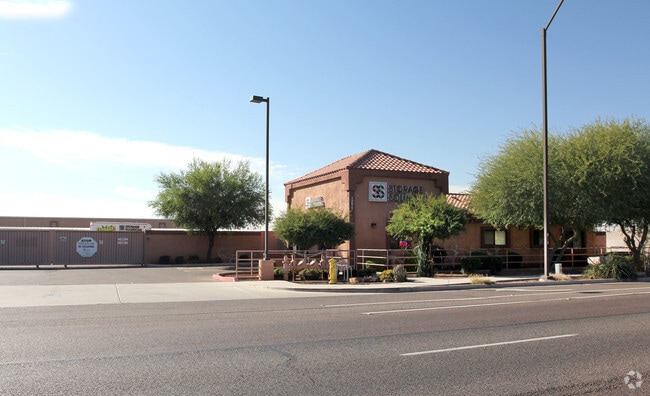
13075 W Indian School Rd, Avondale, AZ 85392


Property Detail
13075 W Indian School Rd
501-72-025L
TH PT NW4 SEC 26 DAF BEG NW COR SD SEC TH E 450F S 55F TO TPOB TH E 342.61F S 445F W 342.61F N 445F TO TPOB EX RD DAF BEG NW COR TH E 450F TH S 55F TPOB TH E 342.61F TH S 10F TH W 342.61F TH N 10F TPOB P/F 04-628630
Publicstorage
MARICOPA
PAD
Arizona
C and X Area of minimal flood hazard, usually depicted on FIRMs as above the 500-year flood level.
3.42 AC
2025
West I-10
2025
Phoenix
061014
Phoenix-Mesa-Chandler, AZ
93,620 SF
NEARBY LISTINGS FOR SALE OR LEASE
DEMOGRAPHICS near 13075 W Indian School Rd
1 mile
3 mile
5 mile
2025 Total Population
17,679
94,542
211,242
2030 Population
18,882
98,993
222,578
Pop Growth 2025-2030
+ 6.80%
+ 4.71%
+ 5.37%
Average Age
37
38
37
2025 Total Households
5,988
31,547
69,785
HH Growth 2025-2030
+ 6.81%
+ 4.78%
+ 5.60%
Median Household Inc
$95,196
$99,457
$90,409
Avg Household Size
2.90
2.90
2.90
2025 Avg HH Vehicles
2.00
2.00
2.00
Median Home Value
$465,654
$469,068
$449,478
Median Year Built
2005
2002
2004
Nearby Places
Map Layers
Map Styles
 Street
 Aerial
Layers
 Traffic
 Biking
Places
Listings with unknown addresses are not visible on the map
- Restaurants
- Banks
- Shops
- Fitness
- Groceries
PUBLIC TRANSPORTATION
AIRPORT
Phoenix Sky Harbor International
Drive
Walk
Distance
Phoenix Sky Harbor International
34 min
24.3 mi
Nearby Properties
Address
Land Use
TOTAL SIZE
Lot Size
Zoning
Address
Land Use
TOTAL SIZE
Lot Size
Zoning
12.04 AC
Address
Land Use
TOTAL SIZE
Lot Size
Zoning
49,475 SF
5.70 AC
PAD
Address
Land Use
TOTAL SIZE
Lot Size
Zoning
324,374 SF
18.26 AC
PAD
Address
Land Use
TOTAL SIZE
Lot Size
Zoning
401,714 SF
100.01 AC
PAD
Address
Land Use
TOTAL SIZE
Lot Size
Zoning
287,294 SF
67.46 AC
PAD
Address
Land Use
TOTAL SIZE
Lot Size
Zoning
296,791 SF
35 AC
PAD
Address
Land Use
TOTAL SIZE
Lot Size
Zoning
185,870 SF
125.41 AC
S1
Address
Land Use
TOTAL SIZE
Lot Size
Zoning
295,014 SF
37.63 AC
PAD
Address
Land Use
TOTAL SIZE
Lot Size
Zoning
380,477 SF
40 AC
RT
Address
Land Use
TOTAL SIZE
Lot Size
Zoning
282,993 SF
14.16 AC
PF
Address
Land Use
TOTAL SIZE
Lot Size
Zoning
353,155 SF
16.80 AC
M-H
Address
Land Use
TOTAL SIZE
Lot Size
Zoning
340,061 SF
15.50 AC
M-H
Address
Land Use
TOTAL SIZE
Lot Size
Zoning
328,244 SF
18.44 AC
PAD
Address
Land Use
TOTAL SIZE
Lot Size
Zoning
106,351 SF
20 AC
PAD
Address
Land Use
TOTAL SIZE
Lot Size
Zoning
189,996 SF
8.80 AC
PAD
Address
Land Use
TOTAL SIZE
Lot Size
Zoning
6,472 SF
1.14 AC
PAD
Address
Land Use
TOTAL SIZE
Lot Size
Zoning
116,236 SF
12.68 AC
PAD
Address
Land Use
TOTAL SIZE
Lot Size
Zoning
109,856 SF
25.18 AC
R-43
Address
Land Use
TOTAL SIZE
Lot Size
Zoning
232,797 SF
25.43 AC
PAD
Address
Land Use
TOTAL SIZE
Lot Size
Zoning
102,431 SF
17.63 AC
R-10
Address
Land Use
TOTAL SIZE
Lot Size
Zoning
181,897 SF
16.71 AC
R-43AG
Address
Land Use
TOTAL SIZE
Lot Size
Zoning
120,289 SF
13.69 AC
C-S
Address
Land Use
TOTAL SIZE
Lot Size
Zoning
291,119 SF
15.38 AC
PAD
Address
Land Use
TOTAL SIZE
Lot Size
Zoning
450,240 SF
25.56 AC
Address
Land Use
TOTAL SIZE
Lot Size
Zoning
389,952 SF
22.15 AC
Address
Land Use
TOTAL SIZE
Lot Size
Zoning
241,536 SF
7.62 AC
C2
Address
Land Use
TOTAL SIZE
Lot Size
Zoning
132,435 SF
17.43 AC
PAD
Address
Land Use
TOTAL SIZE
Lot Size
Zoning
3,237 SF
1.09 AC
I-1
Address
Land Use
TOTAL SIZE
Lot Size
Zoning
104,974 SF
13.35 AC
PF
The World's #1 Commercial Real Estate Marketplace
Connect with us
© 2026 CoStar Group
The information above has been obtained from sources believed reliable. While we do not doubt its accuracy we have not verified it and make no guarantee, warranty or representation about it. It is your responsibility to independently confirm its accuracy and completeness. Any projections, opinions, assumptions, or estimates used are for example only and do not represent the current or future performance of the property. The value of this transaction to you depends on tax and other factors which should be evaluated by your tax, financial, and legal advisors. You and your advisors should conduct a careful, independent investigation of the property to determine to your satisfaction the suitability of the property for your needs.