Property Record
1308 S Hampton Rd, Desoto, TX 75115

NEARBY LISTINGS FOR SALE OR LEASE
Property Detail
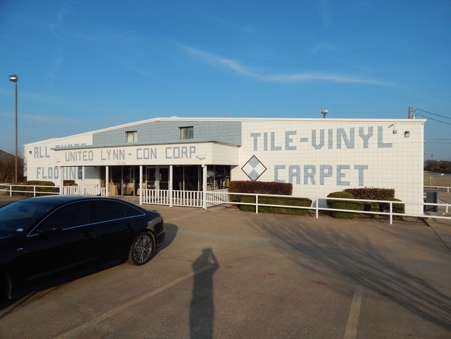
1308 S Hampton Rd
65077447510620000
John Lewis
Warehouse
JOHN LEWIS ABST 774 PG 475 TR 62 ACS 4.85 INT201700167265 DD06122017 CO-DC 0774475106200 5CS07744751
X
Dallas
48139C0055G
Texas
2024
4.85 AC
2025
C Hill/Dunc'vlle/Deso
016621
Dallas/Ft Worth
13,600 SF
Dallas-Fort Worth-Arlington, TX
DEMOGRAPHICS near 1308 S Hampton Rd
1 Mile
3 Mile
5 Mile
2024 Total Population
13,365
63,312
141,268
2029 Population
13,273
66,545
148,462
Pop Growth 2024-2029
(0.69%)
+ 5.11%
+ 5.09%
Average Age
36
38
38
2024 Total Households
4,385
21,099
48,064
HH Growth 2024-2029
(0.96%)
+ 5.00%
+ 4.90%
Median Household Inc
$75,338
$88,018
$80,747
Avg Household Size
3.00
2.90
2.90
2024 Avg HH Vehicles
2.00
2.00
2.00
Median Home Value
$213,598
$241,886
$244,011
Median Year Built
1997
1998
1995
Nearby Places
Map Layers
Map Styles
 Street
 Aerial
- Restaurants
- Banks
- Shops
- Fitness
- Groceries
PUBLIC TRANSPORTATION
AIRPORT
Dallas Love Field
DRIVE
WALK
Distance
Dallas Love Field
35 min
23.3 mi
Dallas-Fort Worth International
DRIVE
WALK
Distance
Dallas-Fort Worth International
47 min
33.1 mi
SALE & LEASE HISTORY
LISTING DATE
SALE/LEASE

Feb 16, 2017
For Sale
Nearby Properties
Address
Land Use
TOTAL SIZE
Lot Size
Zoning
Address
Land Use
TOTAL SIZE
Lot Size
Zoning
332,510 SF
18.45 AC
Address
Land Use
TOTAL SIZE
Lot Size
Zoning
123,880 SF
16.80 AC
Z236
Address
Land Use
TOTAL SIZE
Lot Size
Zoning
227,423 SF
13.86 AC
Z236
Address
Land Use
TOTAL SIZE
Lot Size
Zoning
281,669 SF
16.02 AC
Z312
Address
Land Use
TOTAL SIZE
Lot Size
Zoning
330,541 SF
14.85 AC
Address
Land Use
TOTAL SIZE
Lot Size
Zoning
253,794 SF
10.23 AC
Z201
Address
Land Use
TOTAL SIZE
Lot Size
Zoning
140,590 SF
4.90 AC
Z236
Address
Land Use
TOTAL SIZE
Lot Size
Zoning
190,592 SF
101.54 AC
Z370
Address
Land Use
TOTAL SIZE
Lot Size
Zoning
55,213 SF
11.83 AC
Z197
Address
Land Use
TOTAL SIZE
Lot Size
Zoning
161,008 SF
10.62 AC
Z188
Address
Land Use
TOTAL SIZE
Lot Size
Zoning
383 SF
56.48 AC
Z07
Address
Land Use
TOTAL SIZE
Lot Size
Zoning
191,240 SF
13.73 AC
Z109
Address
Land Use
TOTAL SIZE
Lot Size
Zoning
109,500 SF
12.13 AC
Z370
Address
Land Use
TOTAL SIZE
Lot Size
Zoning
116,640 SF
6 AC
Z175
Address
Land Use
TOTAL SIZE
Lot Size
Zoning
276,880 SF
14.17 AC
Address
Land Use
TOTAL SIZE
Lot Size
Zoning
327,382 SF
15.68 AC
Address
Land Use
TOTAL SIZE
Lot Size
Zoning
232,072 SF
21.24 AC
Z39
Address
Land Use
TOTAL SIZE
Lot Size
Zoning
117,564 SF
25.59 AC
Address
Land Use
TOTAL SIZE
Lot Size
Zoning
77,722 SF
0.67 AC
Address
Land Use
TOTAL SIZE
Lot Size
Zoning
209,051 SF
37.20 AC
Z312
Address
Land Use
TOTAL SIZE
Lot Size
Zoning
49,620 SF
10.04 AC
Z373
Address
Land Use
TOTAL SIZE
Lot Size
Zoning
116,318 SF
14.92 AC
Address
Land Use
TOTAL SIZE
Lot Size
Zoning
158 SF
27.05 AC
RC
Address
Land Use
TOTAL SIZE
Lot Size
Zoning
141 SF
20.35 AC
AO
Address
Land Use
TOTAL SIZE
Lot Size
Zoning
54,140 SF
4.28 AC
Z236
Address
Land Use
TOTAL SIZE
Lot Size
Zoning
46,876 SF
3.01 AC
Z34
Address
Land Use
TOTAL SIZE
Lot Size
Zoning
47,924 SF
1.04 AC
Address
Land Use
TOTAL SIZE
Lot Size
Zoning
148 SF
20.14 AC
Z159
Address
Land Use
TOTAL SIZE
Lot Size
Zoning
119 SF
31.32 AC
Z155
Address
Land Use
TOTAL SIZE
Lot Size
Zoning
50,428 SF
14.25 AC
Z313
The World's #1 Commercial Real Estate Marketplace
Connect with us
© 2026 CoStar Group
The information above has been obtained from sources believed reliable. While we do not doubt its accuracy we have not verified it and make no guarantee, warranty or representation about it. It is your responsibility to independently confirm its accuracy and completeness. Any projections, opinions, assumptions, or estimates used are for example only and do not represent the current or future performance of the property. The value of this transaction to you depends on tax and other factors which should be evaluated by your tax, financial, and legal advisors. You and your advisors should conduct a careful, independent investigation of the property to determine to your satisfaction the suitability of the property for your needs.