Property Record
13090 Bell Rd, Lemont, IL 60439
NEARBY LISTINGS FOR SALE OR LEASE
Property Detail
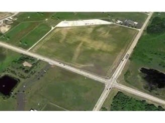
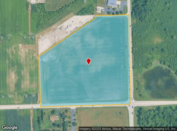
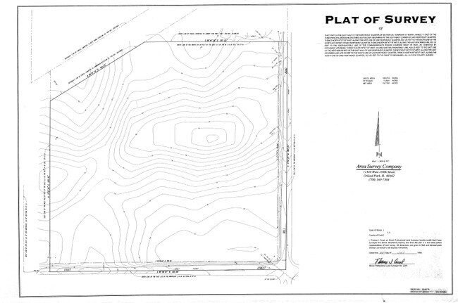
13090 Bell Rd
22-35-201-023-0000
Cook
Agriculturalland
Illinois
X
14.77 AC
17197C0095G
Joliet/Central Will
2023
Chicago
2025
Chicago-Naperville-Elgin, IL-IN
824003
DEMOGRAPHICS near 13090 Bell Rd
1 mile
3 mile
5 mile
2024 Total Population
2,339
34,667
81,008
2029 Population
2,308
34,080
79,322
Pop Growth 2024-2029
(1.33%)
(1.69%)
(2.08%)
Average Age
41
44
43
2024 Total Households
761
12,037
29,699
HH Growth 2024-2029
(1.31%)
(1.88%)
(2.36%)
Median Household Inc
$148,437
$113,904
$105,212
Avg Household Size
3.10
2.80
2.70
2024 Avg HH Vehicles
2.00
2.00
2.00
Median Home Value
$455,688
$378,218
$374,085
Median Year Built
1997
1990
1988
Nearby Places
Map Layers
Map Styles
 Street
 Aerial
Transit
 Traffic
 Biking
Places
Listings with unknown addresses are not visible on the map
- Restaurants
- Banks
- Shops
- Fitness
- Groceries
PUBLIC TRANSPORTATION
COMMUTER RAIL
Lemont Station (Heritage Corridor Line - Northeast Illinois Regional Commuter Railroad (Metra))
Drive
Walk
Distance
Lemont Station (Heritage Corridor Line - Northeast Illinois Regional Commuter Railroad (Metra))
9 min
5.0 mi
Orland Park 143Rd (Southwest Service - Metra)
Drive
Walk
Distance
Orland Park 143Rd (Southwest Service - Metra)
13 min
5.9 mi
AIRPORT
Chicago Midway International
Drive
Walk
Distance
Chicago Midway International
27 min
17.9 mi
Chicago O'Hare International
Drive
Walk
Distance
Chicago O'Hare International
44 min
29.4 mi
Freight Ports
Port Milwaukee
Drive
Walk
Distance
Port Milwaukee
125 min
101.1 mi
SALE & LEASE HISTORY
LISTING DATE
SALE/LEASE

Mar 14, 2025
For Sale
Nearby Properties
Address
Land Use
TOTAL SIZE
Lot Size
Zoning
Address
Land Use
TOTAL SIZE
Lot Size
Zoning
20.43 AC
Address
Land Use
TOTAL SIZE
Lot Size
Zoning
74,782 SF
5.15 AC
Address
Land Use
TOTAL SIZE
Lot Size
Zoning
8,577 SF
160 AC
Address
Land Use
TOTAL SIZE
Lot Size
Zoning
13.73 AC
Address
Land Use
TOTAL SIZE
Lot Size
Zoning
3,955 SF
1.82 AC
Address
Land Use
TOTAL SIZE
Lot Size
Zoning
166,107 SF
16.17 AC
Address
Land Use
TOTAL SIZE
Lot Size
Zoning
97,113 SF
44.53 AC
Address
Land Use
TOTAL SIZE
Lot Size
Zoning
15.21 AC
Address
Land Use
TOTAL SIZE
Lot Size
Zoning
103,164 SF
10.87 AC
Address
Land Use
TOTAL SIZE
Lot Size
Zoning
30,540 SF
5.34 AC
Address
Land Use
TOTAL SIZE
Lot Size
Zoning
6,768 SF
26.75 AC
Address
Land Use
TOTAL SIZE
Lot Size
Zoning
41,449 SF
3.26 AC
Address
Land Use
TOTAL SIZE
Lot Size
Zoning
20,068 SF
24.55 AC
Address
Land Use
TOTAL SIZE
Lot Size
Zoning
76,322 SF
4.36 AC
Address
Land Use
TOTAL SIZE
Lot Size
Zoning
2,066 SF
2.50 AC
Address
Land Use
TOTAL SIZE
Lot Size
Zoning
26,415 SF
3.46 AC
Address
Land Use
TOTAL SIZE
Lot Size
Zoning
15,150 SF
1.40 AC
Address
Land Use
TOTAL SIZE
Lot Size
Zoning
1.61 AC
Address
Land Use
TOTAL SIZE
Lot Size
Zoning
1,625 SF
0.82 AC
Address
Land Use
TOTAL SIZE
Lot Size
Zoning
4,718 SF
2.80 AC
Address
Land Use
TOTAL SIZE
Lot Size
Zoning
14,561 SF
6.71 AC
Address
Land Use
TOTAL SIZE
Lot Size
Zoning
18,329 SF
1.39 AC
Address
Land Use
TOTAL SIZE
Lot Size
Zoning
10,150 SF
1.13 AC
Address
Land Use
TOTAL SIZE
Lot Size
Zoning
5,044 SF
2 AC
Address
Land Use
TOTAL SIZE
Lot Size
Zoning
33.02 AC
Address
Land Use
TOTAL SIZE
Lot Size
Zoning
23,912 SF
2.01 AC
Address
Land Use
TOTAL SIZE
Lot Size
Zoning
8.97 AC
Address
Land Use
TOTAL SIZE
Lot Size
Zoning
4.15 AC
Address
Land Use
TOTAL SIZE
Lot Size
Zoning
16,330 SF
2.20 AC
Address
Land Use
TOTAL SIZE
Lot Size
Zoning
9,518 SF
1.03 AC
The World's #1 Commercial Real Estate Marketplace
Connect with us
© 2026 CoStar Group
The information above has been obtained from sources believed reliable. While we do not doubt its accuracy we have not verified it and make no guarantee, warranty or representation about it. It is your responsibility to independently confirm its accuracy and completeness. Any projections, opinions, assumptions, or estimates used are for example only and do not represent the current or future performance of the property. The value of this transaction to you depends on tax and other factors which should be evaluated by your tax, financial, and legal advisors. You and your advisors should conduct a careful, independent investigation of the property to determine to your satisfaction the suitability of the property for your needs.