Property Record
13090 Petigru Dr, Carmel, IN 46032

NEARBY LISTINGS FOR SALE OR LEASE
Property Detail
13090 Petigru Dr
29-09-29-020-003.001-018
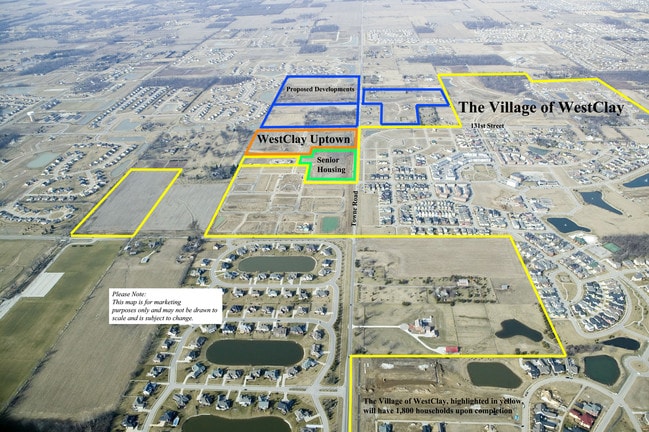
Village Of Westclay Section 6003B
Storebuilding
ACREAGE .48, SECTION 29, TOWNSHIP 18, RANGE 3, VILLAGE OF WESTCLAY, SECTION 6003B, BLOCK PT C
X
Hamilton
18057C0205G
Indiana
2023
0.48 AC
2024
Far North Hamilton Cnty
111010
Indianapolis
13,054 SF
Indianapolis-Carmel-Anderson, IN
DEMOGRAPHICS near 13090 Petigru Dr
1 Mile
3 Mile
5 Mile
2024 Total Population
8,967
51,412
137,294
2029 Population
10,025
58,163
152,634
Pop Growth 2024-2029
+ 11.80%
+ 13.13%
+ 11.17%
Average Age
38
38
39
2024 Total Households
2,951
17,683
54,245
HH Growth 2024-2029
+ 11.79%
+ 13.26%
+ 10.69%
Median Household Inc
$172,087
$160,354
$103,469
Avg Household Size
3.00
2.90
2.50
2024 Avg HH Vehicles
2.00
2.00
2.00
Median Home Value
$498,979
$464,970
$392,540
Median Year Built
2006
2005
1998
Nearby Places
Map Layers
Map Styles
 Street
 Aerial
- Restaurants
- Banks
- Shops
- Fitness
- Groceries
PUBLIC TRANSPORTATION
AIRPORT
Indianapolis International
DRIVE
WALK
Distance
Indianapolis International
49 min
27.9 mi
Nearby Properties
Address
Land Use
TOTAL SIZE
Lot Size
Zoning
Address
Land Use
TOTAL SIZE
Lot Size
Zoning
435,973 SF
Address
Land Use
TOTAL SIZE
Lot Size
Zoning
476,078 SF
8.08 AC
ZO01
Address
Land Use
TOTAL SIZE
Lot Size
Zoning
342,574 SF
5.64 AC
Address
Land Use
TOTAL SIZE
Lot Size
Zoning
504,699 SF
40 AC
Address
Land Use
TOTAL SIZE
Lot Size
Zoning
412,120 SF
12.16 AC
Address
Land Use
TOTAL SIZE
Lot Size
Zoning
280,428 SF
12.81 AC
Address
Land Use
TOTAL SIZE
Lot Size
Zoning
402,521 SF
153.38 AC
Address
Land Use
TOTAL SIZE
Lot Size
Zoning
83,446 SF
67.68 AC
Address
Land Use
TOTAL SIZE
Lot Size
Zoning
34,863 SF
14.77 AC
ZO01
Address
Land Use
TOTAL SIZE
Lot Size
Zoning
5,434 SF
11.35 AC
ZO01
Address
Land Use
TOTAL SIZE
Lot Size
Zoning
257,957 SF
9.06 AC
Address
Land Use
TOTAL SIZE
Lot Size
Zoning
117,664 SF
7.51 AC
Address
Land Use
TOTAL SIZE
Lot Size
Zoning
153,184 SF
1.17 AC
Address
Land Use
TOTAL SIZE
Lot Size
Zoning
210,424 SF
14.10 AC
Address
Land Use
TOTAL SIZE
Lot Size
Zoning
157,967 SF
Address
Land Use
TOTAL SIZE
Lot Size
Zoning
351,756 SF
8.38 AC
Address
Land Use
TOTAL SIZE
Lot Size
Zoning
212,140 SF
5.47 AC
Address
Land Use
TOTAL SIZE
Lot Size
Zoning
101,294 SF
1.44 AC
Address
Land Use
TOTAL SIZE
Lot Size
Zoning
189,622 SF
7.43 AC
Address
Land Use
TOTAL SIZE
Lot Size
Zoning
75,036 SF
22.39 AC
ZO01
Address
Land Use
TOTAL SIZE
Lot Size
Zoning
150,702 SF
4.76 AC
Address
Land Use
TOTAL SIZE
Lot Size
Zoning
143,254 SF
9.38 AC
Address
Land Use
TOTAL SIZE
Lot Size
Zoning
170,360 SF
3.67 AC
Address
Land Use
TOTAL SIZE
Lot Size
Zoning
85,564 SF
2.30 AC
ZO01
Address
Land Use
TOTAL SIZE
Lot Size
Zoning
141,279 SF
13.30 AC
Address
Land Use
TOTAL SIZE
Lot Size
Zoning
188,944 SF
5.68 AC
Address
Land Use
TOTAL SIZE
Lot Size
Zoning
188,082 SF
7.60 AC
Address
Land Use
TOTAL SIZE
Lot Size
Zoning
156,876 SF
6.65 AC
Address
Land Use
TOTAL SIZE
Lot Size
Zoning
220,885 SF
25.94 AC
Address
Land Use
TOTAL SIZE
Lot Size
Zoning
18,212 SF
5.69 AC
ZO01
The World's #1 Commercial Real Estate Marketplace
Connect with us
© 2026 CoStar Group
The information above has been obtained from sources believed reliable. While we do not doubt its accuracy we have not verified it and make no guarantee, warranty or representation about it. It is your responsibility to independently confirm its accuracy and completeness. Any projections, opinions, assumptions, or estimates used are for example only and do not represent the current or future performance of the property. The value of this transaction to you depends on tax and other factors which should be evaluated by your tax, financial, and legal advisors. You and your advisors should conduct a careful, independent investigation of the property to determine to your satisfaction the suitability of the property for your needs.