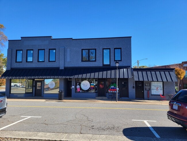
Property Record
131 Conover Sta Se, Conover, NC 28613
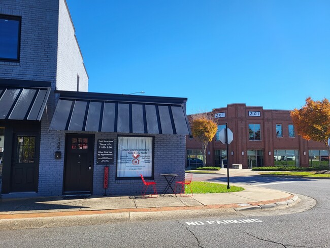
Current Lease Availabilities
NEARBY LISTINGS FOR SALE OR LEASE
Property Detail
131 Conover Sta Se
3741051804250000
331-335 4TH ST SW
Commercialnec
Catawba
X
North Carolina
3710374100J
0.10 AC
2024
Catawba County
2025
Charlotte
010102
Hickory-Lenoir-Morganton, NC
6,170 SF
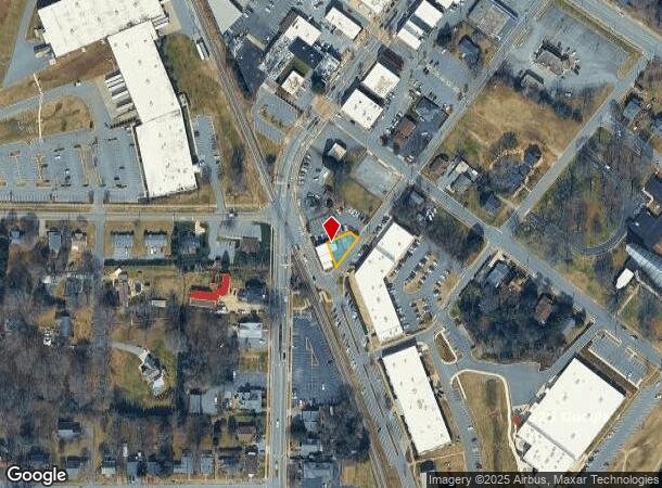
DEMOGRAPHICS near 131 Conover Sta Se
1 mile
3 mile
5 mile
2024 Total Population
4,469
19,667
47,213
2029 Population
4,654
20,560
49,318
Pop Growth 2024-2029
+ 4.14%
+ 4.54%
+ 4.46%
Average Age
43
41
40
2024 Total Households
1,835
7,902
18,646
HH Growth 2024-2029
+ 3.98%
+ 4.44%
+ 4.39%
Median Household Inc
$53,451
$52,933
$56,520
Avg Household Size
2.20
2.40
2.40
2024 Avg HH Vehicles
2.00
2.00
2.00
Median Home Value
$207,841
$175,539
$171,493
Median Year Built
1983
1984
1984
Nearby Places
Map Layers
Map Styles
 Street
 Aerial
Transit
 Traffic
 Biking
Places
Listings with unknown addresses are not visible on the map
- Restaurants
- Banks
- Shops
- Fitness
- Groceries
PUBLIC TRANSPORTATION
AIRPORT
Charlotte/Douglas International
Drive
Walk
Distance
Charlotte/Douglas International
68 min
44.1 mi
Concord-Padgett Regional
Drive
Walk
Distance
Concord-Padgett Regional
68 min
49.5 mi
Nearby Properties
Address
Land Use
TOTAL SIZE
Lot Size
Zoning
Address
Land Use
TOTAL SIZE
Lot Size
Zoning
83,982 SF
96.78 AC
OI
Address
Land Use
TOTAL SIZE
Lot Size
Zoning
125,462 SF
18.74 AC
PD-O&I
Address
Land Use
TOTAL SIZE
Lot Size
Zoning
502,665 SF
53.28 AC
EM-1-CD
Address
Land Use
TOTAL SIZE
Lot Size
Zoning
7,164 SF
45.82 AC
OI
Address
Land Use
TOTAL SIZE
Lot Size
Zoning
7,684 SF
11.85 AC
R-20-CD
Address
Land Use
TOTAL SIZE
Lot Size
Zoning
82,274 SF
19.77 AC
M-1-CD
Address
Land Use
TOTAL SIZE
Lot Size
Zoning
217,586 SF
28.33 AC
CC-CD
Address
Land Use
TOTAL SIZE
Lot Size
Zoning
248,173 SF
53.73 AC
B-4
Address
Land Use
TOTAL SIZE
Lot Size
Zoning
30.63 AC
R-20
Address
Land Use
TOTAL SIZE
Lot Size
Zoning
4,700 SF
34.87 AC
COI
Address
Land Use
TOTAL SIZE
Lot Size
Zoning
103,090 SF
36.13 AC
R-9
Address
Land Use
TOTAL SIZE
Lot Size
Zoning
3,751 SF
92.71 AC
PD-O&I
Address
Land Use
TOTAL SIZE
Lot Size
Zoning
150,498 SF
11.27 AC
M-1
Address
Land Use
TOTAL SIZE
Lot Size
Zoning
23,646 SF
79.60 AC
M-1
Address
Land Use
TOTAL SIZE
Lot Size
Zoning
9,064 SF
4.59 AC
B-2-CD
Address
Land Use
TOTAL SIZE
Lot Size
Zoning
283,942 SF
26.59 AC
M-1
Address
Land Use
TOTAL SIZE
Lot Size
Zoning
270,125 SF
19.98 AC
EM-1
Address
Land Use
TOTAL SIZE
Lot Size
Zoning
226,704 SF
24.60 AC
EM-1
Address
Land Use
TOTAL SIZE
Lot Size
Zoning
155,824 SF
27.77 AC
M-1
Address
Land Use
TOTAL SIZE
Lot Size
Zoning
67,085 SF
15.80 AC
PD-SC-M
Address
Land Use
TOTAL SIZE
Lot Size
Zoning
354,727 SF
28.03 AC
M-1
Address
Land Use
TOTAL SIZE
Lot Size
Zoning
213,422 SF
33.51 AC
M-1
Address
Land Use
TOTAL SIZE
Lot Size
Zoning
637,521 SF
87.22 AC
M-1
Address
Land Use
TOTAL SIZE
Lot Size
Zoning
7,680 SF
9.22 AC
PD-H
Address
Land Use
TOTAL SIZE
Lot Size
Zoning
20.90 AC
M-1
Address
Land Use
TOTAL SIZE
Lot Size
Zoning
318,757 SF
23.50 AC
M-1
Address
Land Use
TOTAL SIZE
Lot Size
Zoning
234,094 SF
15.22 AC
EM-1
Address
Land Use
TOTAL SIZE
Lot Size
Zoning
156,161 SF
17.22 AC
M-1
Address
Land Use
TOTAL SIZE
Lot Size
Zoning
249,849 SF
20.99 AC
M-1
Address
Land Use
TOTAL SIZE
Lot Size
Zoning
36,254 SF
13.18 AC
M-1
The World's #1 Commercial Real Estate Marketplace
Connect with us
© 2026 CoStar Group
The information above has been obtained from sources believed reliable. While we do not doubt its accuracy we have not verified it and make no guarantee, warranty or representation about it. It is your responsibility to independently confirm its accuracy and completeness. Any projections, opinions, assumptions, or estimates used are for example only and do not represent the current or future performance of the property. The value of this transaction to you depends on tax and other factors which should be evaluated by your tax, financial, and legal advisors. You and your advisors should conduct a careful, independent investigation of the property to determine to your satisfaction the suitability of the property for your needs.