Property Record
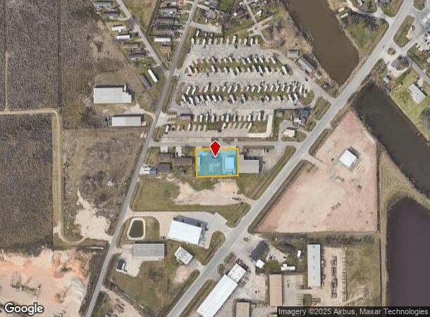
131 Cora St, Freeport, TX 77541


NEARBY LISTINGS FOR SALE OR LEASE
Property Detail
131 Cora St
Houston-The Woodlands-Sugar Land, TX
Jeffers (A0051 F J Calvit Div 10 (B C I
5400-0009-000
Brazoria
Sfr
Texas
X
0.39 AC
48039C0805K
South Hwy 35
1,877 SF
Houston
DEMOGRAPHICS near 131 Cora St
1 Mile
3 Mile
5 Mile
2024 Total Population
1,457
6,712
23,708
2029 Population
1,669
7,606
27,143
Pop Growth 2024-2029
+ 14.55%
+ 13.32%
+ 14.49%
Average Age
41
37
38
2024 Total Households
609
2,472
8,845
HH Growth 2024-2029
+ 14.78%
+ 13.67%
+ 15.15%
Median Household Inc
$42,500
$51,179
$51,713
Avg Household Size
2.40
2.70
2.70
2024 Avg HH Vehicles
2.00
2.00
2.00
Median Home Value
$203,371
$139,378
$136,245
Median Year Built
1985
1980
1977
Nearby Places
Map Layers
Map Styles
 Street
 Aerial
- Restaurants
- Banks
- Shops
- Fitness
- Groceries
SALE & LEASE HISTORY
LISTING DATE
SALE/LEASE

Aug 03, 2023
For Sale
Nearby Properties
Address
Land Use
TOTAL SIZE
Lot Size
Zoning
Address
Land Use
TOTAL SIZE
Lot Size
Zoning
Address
Land Use
TOTAL SIZE
Lot Size
Zoning
Address
Land Use
TOTAL SIZE
Lot Size
Zoning
Address
Land Use
TOTAL SIZE
Lot Size
Zoning
Address
Land Use
TOTAL SIZE
Lot Size
Zoning
Address
Land Use
TOTAL SIZE
Lot Size
Zoning
Address
Land Use
TOTAL SIZE
Lot Size
Zoning
Address
Land Use
TOTAL SIZE
Lot Size
Zoning
33.09 AC
0050
Address
Land Use
TOTAL SIZE
Lot Size
Zoning
61.70 AC
Address
Land Use
TOTAL SIZE
Lot Size
Zoning
Address
Land Use
TOTAL SIZE
Lot Size
Zoning
Address
Land Use
TOTAL SIZE
Lot Size
Zoning
Address
Land Use
TOTAL SIZE
Lot Size
Zoning
Address
Land Use
TOTAL SIZE
Lot Size
Zoning
242.03 AC
0275
Address
Land Use
TOTAL SIZE
Lot Size
Zoning
Address
Land Use
TOTAL SIZE
Lot Size
Zoning
4.27 AC
0170
Address
Land Use
TOTAL SIZE
Lot Size
Zoning
188,497 SF
14.79 AC
1135
Address
Land Use
TOTAL SIZE
Lot Size
Zoning
Address
Land Use
TOTAL SIZE
Lot Size
Zoning
75.99 AC
0410
Address
Land Use
TOTAL SIZE
Lot Size
Zoning
Address
Land Use
TOTAL SIZE
Lot Size
Zoning
Address
Land Use
TOTAL SIZE
Lot Size
Zoning
24.81 AC
0031
Address
Land Use
TOTAL SIZE
Lot Size
Zoning
48,773 SF
Address
Land Use
TOTAL SIZE
Lot Size
Zoning
1.75 AC
Address
Land Use
TOTAL SIZE
Lot Size
Zoning
Address
Land Use
TOTAL SIZE
Lot Size
Zoning
Address
Land Use
TOTAL SIZE
Lot Size
Zoning
15.78 AC
0130
Address
Land Use
TOTAL SIZE
Lot Size
Zoning
Address
Land Use
TOTAL SIZE
Lot Size
Zoning
56,600 SF
5 AC
0010
Address
Land Use
TOTAL SIZE
Lot Size
Zoning
129,934 SF
10.96 AC
0006
The World's #1 Commercial Real Estate Marketplace
Connect with us
© 2025 CoStar Group
The information above has been obtained from sources believed reliable. While we do not doubt its accuracy we have not verified it and make no guarantee, warranty or representation about it. It is your responsibility to independently confirm its accuracy and completeness. Any projections, opinions, assumptions, or estimates used are for example only and do not represent the current or future performance of the property. The value of this transaction to you depends on tax and other factors which should be evaluated by your tax, financial, and legal advisors. You and your advisors should conduct a careful, independent investigation of the property to determine to your satisfaction the suitability of the property for your needs.