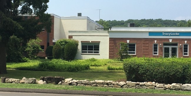
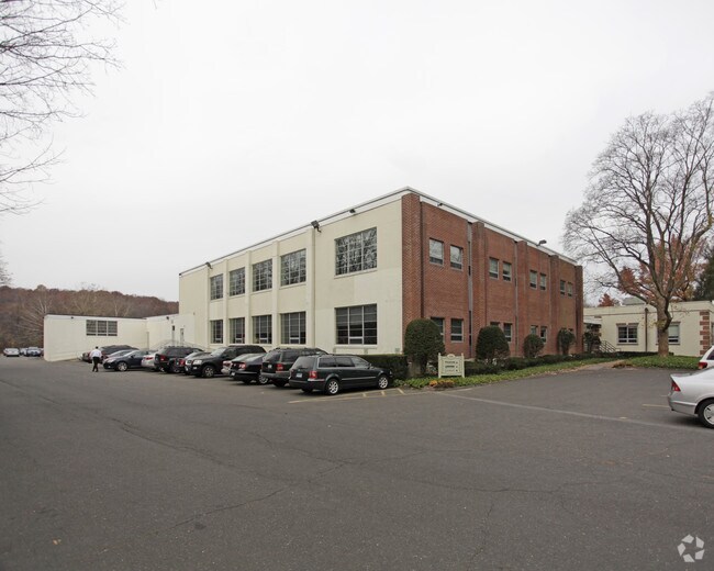
Property Record
131 Danbury Rd, Wilton, CT 06897

Property Detail
131 Danbury Rd
Commercialbuilding
Western Ct
DE-5
Connecticut
AE The base floodplain where base flood elevations are provided. AE Zones are now used on new format FIRMs instead of A1-A30 Zones.
4.74 AC
2025
Wilton
2025
Westchester/So Connecticut
045400
Bridgeport-Stamford-Danbury, CT
50,953 SF
WILT-000070-000001
NEARBY LISTINGS FOR SALE OR LEASE
DEMOGRAPHICS near 131 Danbury Rd
1 mile
3 mile
5 mile
2025 Total Population
4,231
29,264
111,929
2030 Population
4,379
30,113
114,710
Pop Growth 2025-2030
+ 3.50%
+ 2.90%
+ 2.48%
Average Age
42
43
42
2025 Total Households
1,615
10,766
41,472
HH Growth 2025-2030
+ 3.59%
+ 2.98%
+ 2.47%
Median Household Inc
$186,946
$181,563
$155,955
Avg Household Size
2.60
2.60
2.60
2025 Avg HH Vehicles
2.00
2.00
2.00
Median Home Value
$835,106
$841,998
$851,511
Median Year Built
1981
1971
1967
Nearby Places
Map Layers
Map Styles
 Street
 Aerial
Transit
 Traffic
 Biking
Places
Listings with unknown addresses are not visible on the map
- Restaurants
- Banks
- Shops
- Fitness
- Groceries
PUBLIC TRANSPORTATION
COMMUTER RAIL
Wilton Station (New Haven Line - Metro-North Commuter Railroad Company (Metro-North))
Drive
Walk
Distance
Wilton Station (New Haven Line - Metro-North Commuter Railroad Company (Metro-North))
3 min
1.7 mi
Merritt 7 Station (New Haven Line - Metro-North Commuter Railroad Company (Metro-North))
Drive
Walk
Distance
Merritt 7 Station (New Haven Line - Metro-North Commuter Railroad Company (Metro-North))
5 min
2.5 mi
AIRPORT
Westchester County
Drive
Walk
Distance
Westchester County
36 min
23.9 mi
Tweed/New Haven
Drive
Walk
Distance
Tweed/New Haven
55 min
35.9 mi
Freight Ports
Port of New Haven
Drive
Walk
Distance
Port of New Haven
50 min
33.1 mi
SALE & LEASE HISTORY
LISTING DATE
SALE/LEASE

Sep 24, 2016
For Lease
Jul 19, 2018
For Lease
Nearby Properties
Address
Land Use
TOTAL SIZE
Lot Size
Zoning
Address
Land Use
TOTAL SIZE
Lot Size
Zoning
339,272 SF
4.07 AC
EO
Address
Land Use
TOTAL SIZE
Lot Size
Zoning
28.64 AC
DE-10
Address
Land Use
TOTAL SIZE
Lot Size
Zoning
82.14 AC
R-2
Address
Land Use
TOTAL SIZE
Lot Size
Zoning
248,486 SF
6.57 AC
EO
Address
Land Use
TOTAL SIZE
Lot Size
Zoning
292,852 SF
3.38 AC
EO
Address
Land Use
TOTAL SIZE
Lot Size
Zoning
254,126 SF
3.33 AC
EO
Address
Land Use
TOTAL SIZE
Lot Size
Zoning
109.27 AC
R-2
Address
Land Use
TOTAL SIZE
Lot Size
Zoning
320,588 SF
3.22 AC
EO
Address
Land Use
TOTAL SIZE
Lot Size
Zoning
254,126 SF
3.06 AC
EO
Address
Land Use
TOTAL SIZE
Lot Size
Zoning
271,344 SF
2.36 AC
EO
Address
Land Use
TOTAL SIZE
Lot Size
Zoning
196,084 SF
4.34 AC
DE-5
Address
Land Use
TOTAL SIZE
Lot Size
Zoning
21.34 AC
B2
Address
Land Use
TOTAL SIZE
Lot Size
Zoning
24.67 AC
DE-10
Address
Land Use
TOTAL SIZE
Lot Size
Zoning
111,713 SF
C
Address
Land Use
TOTAL SIZE
Lot Size
Zoning
12.32 AC
CRA-1
Address
Land Use
TOTAL SIZE
Lot Size
Zoning
34.16 AC
R-2
Address
Land Use
TOTAL SIZE
Lot Size
Zoning
4.79 AC
EO
Address
Land Use
TOTAL SIZE
Lot Size
Zoning
248,782 SF
3.52 AC
EO
Address
Land Use
TOTAL SIZE
Lot Size
Zoning
10.64 AC
HODD
Address
Land Use
TOTAL SIZE
Lot Size
Zoning
249,779 SF
3.09 AC
EO
Address
Land Use
TOTAL SIZE
Lot Size
Zoning
214,890 SF
2.91 AC
EO
Address
Land Use
TOTAL SIZE
Lot Size
Zoning
20.91 AC
A1
Address
Land Use
TOTAL SIZE
Lot Size
Zoning
199,630 SF
1.94 AC
EO
Address
Land Use
TOTAL SIZE
Lot Size
Zoning
32.55 AC
DE-10
Address
Land Use
TOTAL SIZE
Lot Size
Zoning
133,120 SF
1.53 AC
EO
Address
Land Use
TOTAL SIZE
Lot Size
Zoning
33.70 AC
R-2
Address
Land Use
TOTAL SIZE
Lot Size
Zoning
219,944 SF
2 AC
EO
Address
Land Use
TOTAL SIZE
Lot Size
Zoning
238,879 SF
4.30 AC
B2
Address
Land Use
TOTAL SIZE
Lot Size
Zoning
206,490 SF
1 AC
DE-5
Address
Land Use
TOTAL SIZE
Lot Size
Zoning
11.14 AC
B2
The World's #1 Commercial Real Estate Marketplace
Connect with us
© 2026 CoStar Group
The information above has been obtained from sources believed reliable. While we do not doubt its accuracy we have not verified it and make no guarantee, warranty or representation about it. It is your responsibility to independently confirm its accuracy and completeness. Any projections, opinions, assumptions, or estimates used are for example only and do not represent the current or future performance of the property. The value of this transaction to you depends on tax and other factors which should be evaluated by your tax, financial, and legal advisors. You and your advisors should conduct a careful, independent investigation of the property to determine to your satisfaction the suitability of the property for your needs.