Property Record
131 N Central Entrance Ave, Duluth, MN 55811
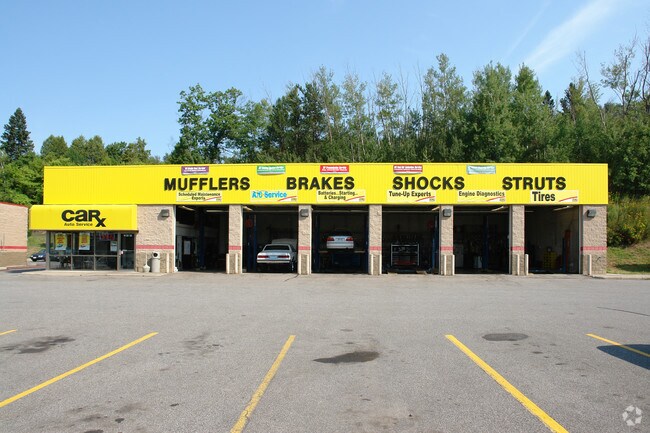

Property Detail
131 N Central Entrance Ave
Duluth, MN-WI
W 70.38 FT OF LOT 10 EX S 10 FT FOR HWYAND LOTS 11 12 AND 13 EX S 10 FT FOR HWY SERIAL #
010040000780
Saint Louis
Commercialnec
Minnesota
C and X Area of minimal flood hazard, usually depicted on FIRMs as above the 500-year flood level.
10-12
2026
1.34 AC
2024
Miller Hill/Airpark
003300
Duluth
NEARBY LISTINGS FOR SALE OR LEASE
-
-
-
-
-
-
-
No Photo
-
View all Duluth listings for sale on LoopNet.com
DEMOGRAPHICS near 131 N Central Entrance Ave
1 mile
3 mile
5 mile
2025 Total Population
4,527
47,825
73,405
2030 Population
4,447
47,292
72,477
Pop Growth 2025-2030
(1.77%)
(1.11%)
(1.26%)
Average Age
40
38
39
2025 Total Households
2,061
20,149
30,572
HH Growth 2025-2030
(2.91%)
(1.41%)
(1.46%)
Median Household Inc
$56,741
$53,075
$64,434
Avg Household Size
1.90
2.00
2.10
2025 Avg HH Vehicles
2.00
2.00
2.00
Median Home Value
$308,893
$266,616
$280,039
Median Year Built
1979
1954
1953
Nearby Places
Map Layers
Map Styles
 Street
 Aerial
Layers
 Traffic
 Biking
Places
Listings with unknown addresses are not visible on the map
- Restaurants
- Banks
- Shops
- Fitness
- Groceries
PUBLIC TRANSPORTATION
AIRPORT
Duluth International
Drive
Walk
Distance
Duluth International
17 min
6.4 mi
Nearby Properties
Address
Land Use
TOTAL SIZE
Lot Size
Zoning
Address
Land Use
TOTAL SIZE
Lot Size
Zoning
210,288 SF
146 AC
Address
Land Use
TOTAL SIZE
Lot Size
Zoning
539,170 SF
0.49 AC
Address
Land Use
TOTAL SIZE
Lot Size
Zoning
338,800 SF
0.17 AC
Address
Land Use
TOTAL SIZE
Lot Size
Zoning
547,975 SF
18.72 AC
Address
Land Use
TOTAL SIZE
Lot Size
Zoning
391,335 SF
53.53 AC
Address
Land Use
TOTAL SIZE
Lot Size
Zoning
524,275 SF
38.23 AC
Address
Land Use
TOTAL SIZE
Lot Size
Zoning
372,356 SF
1.35 AC
Address
Land Use
TOTAL SIZE
Lot Size
Zoning
134,100 SF
0.17 AC
Address
Land Use
TOTAL SIZE
Lot Size
Zoning
195,455 SF
54.06 AC
Address
Land Use
TOTAL SIZE
Lot Size
Zoning
148,777 SF
1.19 AC
Address
Land Use
TOTAL SIZE
Lot Size
Zoning
248,716 SF
1.02 AC
Address
Land Use
TOTAL SIZE
Lot Size
Zoning
143,132 SF
41.55 AC
Address
Land Use
TOTAL SIZE
Lot Size
Zoning
40,835 SF
0.33 AC
Address
Land Use
TOTAL SIZE
Lot Size
Zoning
6,500 SF
3.31 AC
R3
Address
Land Use
TOTAL SIZE
Lot Size
Zoning
132,316 SF
2.13 AC
Address
Land Use
TOTAL SIZE
Lot Size
Zoning
32,824 SF
117.72 AC
Address
Land Use
TOTAL SIZE
Lot Size
Zoning
203,540 SF
0.24 AC
Address
Land Use
TOTAL SIZE
Lot Size
Zoning
97,552 SF
1.29 AC
Address
Land Use
TOTAL SIZE
Lot Size
Zoning
232,586 SF
0.16 AC
Address
Land Use
TOTAL SIZE
Lot Size
Zoning
178,184 SF
20 AC
Address
Land Use
TOTAL SIZE
Lot Size
Zoning
205,584 SF
0.81 AC
Address
Land Use
TOTAL SIZE
Lot Size
Zoning
178,104 SF
0.95 AC
Address
Land Use
TOTAL SIZE
Lot Size
Zoning
100,246 SF
12.24 AC
Address
Land Use
TOTAL SIZE
Lot Size
Zoning
126,349 SF
8.35 AC
Address
Land Use
TOTAL SIZE
Lot Size
Zoning
82,119 SF
5.21 AC
Address
Land Use
TOTAL SIZE
Lot Size
Zoning
91,053 SF
0.60 AC
Address
Land Use
TOTAL SIZE
Lot Size
Zoning
113,615 SF
0.32 AC
R4
Address
Land Use
TOTAL SIZE
Lot Size
Zoning
107,796 SF
9.19 AC
Address
Land Use
TOTAL SIZE
Lot Size
Zoning
118,418 SF
13.62 AC
Address
Land Use
TOTAL SIZE
Lot Size
Zoning
175,168 SF
0.16 AC
The World's #1 Commercial Real Estate Marketplace
Connect with us
© 2026 CoStar Group
The information above has been obtained from sources believed reliable. While we do not doubt its accuracy we have not verified it and make no guarantee, warranty or representation about it. It is your responsibility to independently confirm its accuracy and completeness. Any projections, opinions, assumptions, or estimates used are for example only and do not represent the current or future performance of the property. The value of this transaction to you depends on tax and other factors which should be evaluated by your tax, financial, and legal advisors. You and your advisors should conduct a careful, independent investigation of the property to determine to your satisfaction the suitability of the property for your needs.