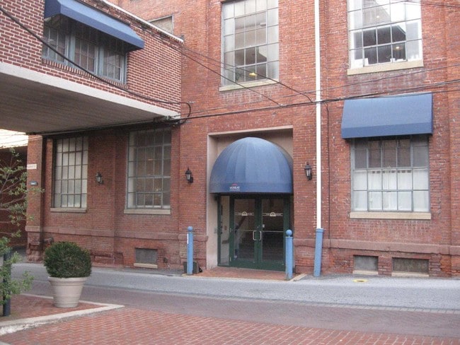
Property Record
131 E Grant St, Lancaster, PA 17602

Save to a Folder
{{folder.Name}}
{{folder.ListingIds.length}} Properties
{{folder.ListingIds.length}} Property
Create a New Folder
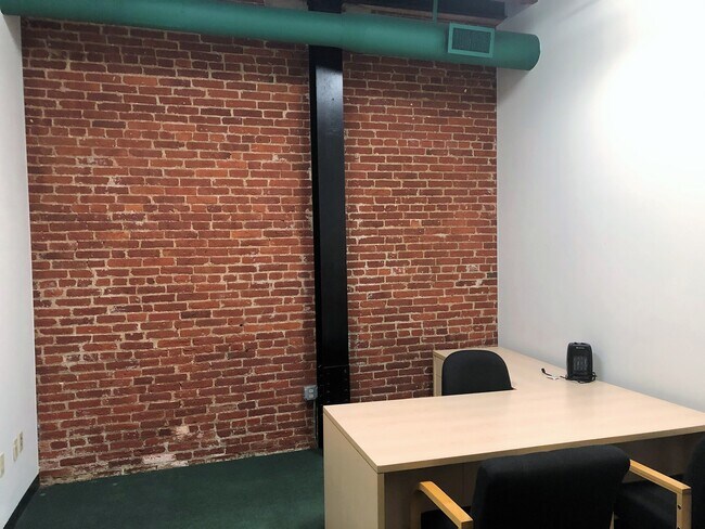
Current Lease Availabilities
Property Detail
131 E Grant St
332-74256-0-0000
131 E GRANT ST
Commercialnec
Lancaster
CB
Pennsylvania
B and X Area of moderate flood hazard, usually the area between the limits of the 100-year and 500-year floods.
6
2025
0.09 AC
2026
Lancaster County
000100
Philadelphia
12,246 SF
Lancaster, PA
NEARBY LISTINGS FOR SALE OR LEASE
DEMOGRAPHICS near 131 E Grant St
1 mile
3 mile
5 mile
2025 Total Population
46,966
111,625
192,035
2030 Population
47,592
113,145
195,271
Pop Growth 2025-2030
+ 1.33%
+ 1.36%
+ 1.69%
Average Age
36
39
41
2025 Total Households
18,210
42,809
73,896
HH Growth 2025-2030
+ 1.41%
+ 1.38%
+ 1.63%
Median Household Inc
$58,418
$71,047
$77,463
Avg Household Size
2.30
2.40
2.40
2025 Avg HH Vehicles
1.00
2.00
2.00
Median Home Value
$220,340
$262,244
$295,257
Median Year Built
1947
1956
1971
Nearby Places
Map Layers
Map Styles
 Street
 Aerial
Layers
 Traffic
 Biking
Places
Listings with unknown addresses are not visible on the map
- Restaurants
- Banks
- Shops
- Fitness
- Groceries
PUBLIC TRANSPORTATION
COMMUTER RAIL
Lancaster (Keystone Service - Amtrak, Pennsylvanian - Amtrak)
Drive
Walk
Distance
Lancaster (Keystone Service - Amtrak, Pennsylvanian - Amtrak)
4 min
1.3 mi
AIRPORT
Harrisburg International
Drive
Walk
Distance
Harrisburg International
44 min
32.9 mi
Freight Ports
Port of Wilmington, RI
Drive
Walk
Distance
Port of Wilmington, RI
94 min
53.1 mi
Nearby Properties
Address
Land Use
TOTAL SIZE
Lot Size
Zoning
Address
Land Use
TOTAL SIZE
Lot Size
Zoning
1,530,100 SF
94.34 AC
C3
Address
Land Use
TOTAL SIZE
Lot Size
Zoning
1,120,221 SF
8.40 AC
Address
Land Use
TOTAL SIZE
Lot Size
Zoning
871,695 SF
69.40 AC
R2
Address
Land Use
TOTAL SIZE
Lot Size
Zoning
206,666 SF
1 AC
CB1
Address
Land Use
TOTAL SIZE
Lot Size
Zoning
715,697 SF
52.50 AC
R2
Address
Land Use
TOTAL SIZE
Lot Size
Zoning
269,860 SF
0.90 AC
CB1
Address
Land Use
TOTAL SIZE
Lot Size
Zoning
315,373 SF
4.73 AC
DF
Address
Land Use
TOTAL SIZE
Lot Size
Zoning
275,959 SF
68.50 AC
IN
Address
Land Use
TOTAL SIZE
Lot Size
Zoning
642,651 SF
2.16 AC
CA
Address
Land Use
TOTAL SIZE
Lot Size
Zoning
308,727 SF
11.37 AC
Address
Land Use
TOTAL SIZE
Lot Size
Zoning
178,234 SF
0.78 AC
CB
Address
Land Use
TOTAL SIZE
Lot Size
Zoning
203,415 SF
10.74 AC
Address
Land Use
TOTAL SIZE
Lot Size
Zoning
99,894 SF
21.88 AC
Address
Land Use
TOTAL SIZE
Lot Size
Zoning
234,386 SF
15.30 AC
MU
Address
Land Use
TOTAL SIZE
Lot Size
Zoning
134,352 SF
28.64 AC
HR
Address
Land Use
TOTAL SIZE
Lot Size
Zoning
254,079 SF
21.54 AC
Address
Land Use
TOTAL SIZE
Lot Size
Zoning
234,681 SF
7.50 AC
MU
Address
Land Use
TOTAL SIZE
Lot Size
Zoning
223,327 SF
21.80 AC
B-4
Address
Land Use
TOTAL SIZE
Lot Size
Zoning
195,708 SF
26.17 AC
Address
Land Use
TOTAL SIZE
Lot Size
Zoning
203,942 SF
21.22 AC
B-4
Address
Land Use
TOTAL SIZE
Lot Size
Zoning
250,229 SF
12.49 AC
B-4
Address
Land Use
TOTAL SIZE
Lot Size
Zoning
125,073 SF
19.07 AC
I
Address
Land Use
TOTAL SIZE
Lot Size
Zoning
302,460 SF
51.80 AC
R4
Address
Land Use
TOTAL SIZE
Lot Size
Zoning
131,110 SF
0.40 AC
CB1
Address
Land Use
TOTAL SIZE
Lot Size
Zoning
128,939 SF
27.39 AC
Address
Land Use
TOTAL SIZE
Lot Size
Zoning
87,502 SF
11.69 AC
MU
Address
Land Use
TOTAL SIZE
Lot Size
Zoning
131,294 SF
11.14 AC
B-4
Address
Land Use
TOTAL SIZE
Lot Size
Zoning
256,905 SF
1.57 AC
CB1
Address
Land Use
TOTAL SIZE
Lot Size
Zoning
10 SF
14.11 AC
CM
Address
Land Use
TOTAL SIZE
Lot Size
Zoning
244,568 SF
8.30 AC
IN
The World's #1 Commercial Real Estate Marketplace
Connect with us
© 2026 CoStar Group
The information above has been obtained from sources believed reliable. While we do not doubt its accuracy we have not verified it and make no guarantee, warranty or representation about it. It is your responsibility to independently confirm its accuracy and completeness. Any projections, opinions, assumptions, or estimates used are for example only and do not represent the current or future performance of the property. The value of this transaction to you depends on tax and other factors which should be evaluated by your tax, financial, and legal advisors. You and your advisors should conduct a careful, independent investigation of the property to determine to your satisfaction the suitability of the property for your needs.