Property Record
131 Fire Tower Rd, Hawkinsville, GA 31036


NEARBY LISTINGS FOR SALE OR LEASE
Property Detail
131 Fire Tower Rd
2T391970002
4Th Ld
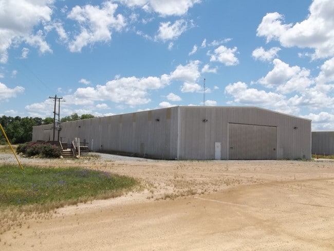
Agriculturalland
34.3AC LL ,197 4TH LD
X
Pulaski
13023C0175B
Georgia
2024
197
2024
34.30 AC
950202
Georgia South Area
24,000 SF
Other Market Areas
DEMOGRAPHICS near 131 Fire Tower Rd
1 Mile
3 Mile
5 Mile
2024 Total Population
272
5,423
7,810
2029 Population
282
5,664
8,064
Pop Growth 2024-2029
+ 3.68%
+ 4.44%
+ 3.25%
Average Age
45
42
42
2024 Total Households
113
2,110
2,808
HH Growth 2024-2029
+ 4.42%
+ 4.64%
+ 3.38%
Median Household Inc
$82,954
$38,333
$44,128
Avg Household Size
2.40
2.40
2.40
2024 Avg HH Vehicles
2.00
2.00
2.00
Median Home Value
$127,778
$108,789
$119,072
Median Year Built
1978
1982
1981
Nearby Places
Map Layers
Map Styles
 Street
 Aerial
- Restaurants
- Banks
- Shops
- Fitness
- Groceries
SALE & LEASE HISTORY
LISTING DATE
SALE/LEASE

Jan 30, 2017
For Sale
Nearby Properties
Address
Land Use
TOTAL SIZE
Lot Size
Zoning
Address
Land Use
TOTAL SIZE
Lot Size
Zoning
1.92 AC
004
Address
Land Use
TOTAL SIZE
Lot Size
Zoning
0.70 AC
002
Address
Land Use
TOTAL SIZE
Lot Size
Zoning
26,400 SF
1.74 AC
004
Address
Land Use
TOTAL SIZE
Lot Size
Zoning
12 AC
002
Address
Land Use
TOTAL SIZE
Lot Size
Zoning
0.20 AC
002
Address
Land Use
TOTAL SIZE
Lot Size
Zoning
19,565 SF
4 AC
001
Address
Land Use
TOTAL SIZE
Lot Size
Zoning
0.46 AC
004
Address
Land Use
TOTAL SIZE
Lot Size
Zoning
25.54 AC
001
Address
Land Use
TOTAL SIZE
Lot Size
Zoning
44,473 SF
7.30 AC
002
Address
Land Use
TOTAL SIZE
Lot Size
Zoning
39,112 SF
3.32 AC
002
Address
Land Use
TOTAL SIZE
Lot Size
Zoning
Address
Land Use
TOTAL SIZE
Lot Size
Zoning
1,869.26 AC
004
Address
Land Use
TOTAL SIZE
Lot Size
Zoning
9,850 SF
2.62 AC
002
Address
Land Use
TOTAL SIZE
Lot Size
Zoning
37,260 SF
3.27 AC
004
Address
Land Use
TOTAL SIZE
Lot Size
Zoning
8,246 SF
2.91 AC
002
Address
Land Use
TOTAL SIZE
Lot Size
Zoning
27,550 SF
6.43 AC
001
Address
Land Use
TOTAL SIZE
Lot Size
Zoning
Address
Land Use
TOTAL SIZE
Lot Size
Zoning
43,473 SF
1.98 AC
001
Address
Land Use
TOTAL SIZE
Lot Size
Zoning
16,100 SF
2.63 AC
001
Address
Land Use
TOTAL SIZE
Lot Size
Zoning
9,100 SF
11.61 AC
002
Address
Land Use
TOTAL SIZE
Lot Size
Zoning
4,992 SF
1.04 AC
002
Address
Land Use
TOTAL SIZE
Lot Size
Zoning
8,380 SF
3.89 AC
002
Address
Land Use
TOTAL SIZE
Lot Size
Zoning
13,000 SF
0.89 AC
001
Address
Land Use
TOTAL SIZE
Lot Size
Zoning
8,565 SF
21.72 AC
001
Address
Land Use
TOTAL SIZE
Lot Size
Zoning
628 AC
004
Address
Land Use
TOTAL SIZE
Lot Size
Zoning
12,386 SF
0.18 AC
001
Address
Land Use
TOTAL SIZE
Lot Size
Zoning
26,325 SF
8.63 AC
001
Address
Land Use
TOTAL SIZE
Lot Size
Zoning
13,818 SF
1.46 AC
002
Address
Land Use
TOTAL SIZE
Lot Size
Zoning
8,332 SF
5.08 AC
002
The World's #1 Commercial Real Estate Marketplace
Connect with us
© 2026 CoStar Group
The information above has been obtained from sources believed reliable. While we do not doubt its accuracy we have not verified it and make no guarantee, warranty or representation about it. It is your responsibility to independently confirm its accuracy and completeness. Any projections, opinions, assumptions, or estimates used are for example only and do not represent the current or future performance of the property. The value of this transaction to you depends on tax and other factors which should be evaluated by your tax, financial, and legal advisors. You and your advisors should conduct a careful, independent investigation of the property to determine to your satisfaction the suitability of the property for your needs.