Property Record
131 Grove St, Clinton, CT 06413
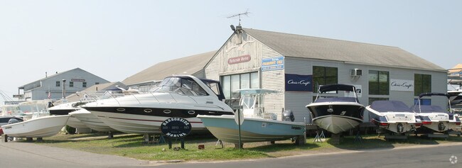

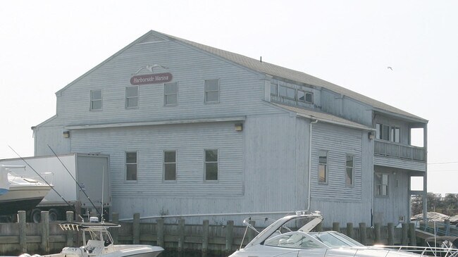
Property Detail
131 Grove St
CLIN-000046A-000037-000001
Lower Ct River Vly
Commercialnec
Connecticut
M-2
1
AE The base floodplain where base flood elevations are provided. AE Zones are now used on new format FIRMs instead of A1-A30 Zones.
2.03 AC
2025
SW Midlsx/Old Saybrk/Rt 9
2025
Hartford
610100
Hartford-West Hartford-East Hartford, CT
NEARBY LISTINGS FOR SALE OR LEASE
-
-
View all Clinton listings for sale on LoopNet.com
DEMOGRAPHICS near 131 Grove St
1 mile
3 mile
5 mile
2025 Total Population
3,117
14,847
28,498
2030 Population
3,221
15,242
29,392
Pop Growth 2025-2030
+ 3.34%
+ 2.66%
+ 3.14%
Average Age
48
47
48
2025 Total Households
1,499
6,593
12,255
HH Growth 2025-2030
+ 3.40%
+ 2.93%
+ 3.39%
Median Household Inc
$90,606
$106,106
$116,046
Avg Household Size
2.00
2.20
2.30
2025 Avg HH Vehicles
2.00
2.00
2.00
Median Home Value
$446,956
$420,934
$479,474
Median Year Built
1962
1966
1970
Nearby Places
Map Layers
Map Styles
 Street
 Aerial
Layers
 Traffic
 Biking
Places
Listings with unknown addresses are not visible on the map
- Restaurants
- Banks
- Shops
- Fitness
- Groceries
PUBLIC TRANSPORTATION
COMMUTER RAIL
Clinton (Commuter Rail - Shore Line East)
Drive
Walk
Distance
Clinton (Commuter Rail - Shore Line East)
3 min
17 min
0.8 mi
Madison (Commuter Rail - Shore Line East, Shore Line East - Shore Line East)
Drive
Walk
Distance
Madison (Commuter Rail - Shore Line East, Shore Line East - Shore Line East)
11 min
4.6 mi
AIRPORT
Tweed/New Haven
Drive
Walk
Distance
Tweed/New Haven
31 min
21.2 mi
Freight Ports
Port of New Haven
Drive
Walk
Distance
Port of New Haven
31 min
21.8 mi
Nearby Properties
Address
Land Use
TOTAL SIZE
Lot Size
Zoning
Address
Land Use
TOTAL SIZE
Lot Size
Zoning
47.11 AC
Address
Land Use
TOTAL SIZE
Lot Size
Zoning
138,909 SF
41.60 AC
R-20
Address
Land Use
TOTAL SIZE
Lot Size
Zoning
87,717 SF
12 AC
Address
Land Use
TOTAL SIZE
Lot Size
Zoning
624 SF
43.91 AC
CB
Address
Land Use
TOTAL SIZE
Lot Size
Zoning
98,963 SF
49.97 AC
Address
Land Use
TOTAL SIZE
Lot Size
Zoning
81,335 SF
8.64 AC
B-4
Address
Land Use
TOTAL SIZE
Lot Size
Zoning
96,949 SF
11.52 AC
Address
Land Use
TOTAL SIZE
Lot Size
Zoning
540 SF
8.25 AC
C
Address
Land Use
TOTAL SIZE
Lot Size
Zoning
54,375 SF
7.01 AC
Address
Land Use
TOTAL SIZE
Lot Size
Zoning
37,619 SF
37.98 AC
RU-2
Address
Land Use
TOTAL SIZE
Lot Size
Zoning
15,446 SF
7.56 AC
B-2
Address
Land Use
TOTAL SIZE
Lot Size
Zoning
822 SF
6 AC
R-2
Address
Land Use
TOTAL SIZE
Lot Size
Zoning
46,536 SF
3.62 AC
Address
Land Use
TOTAL SIZE
Lot Size
Zoning
56,608 SF
1.27 AC
I-1
Address
Land Use
TOTAL SIZE
Lot Size
Zoning
3,872 SF
49.73 AC
R-80
Address
Land Use
TOTAL SIZE
Lot Size
Zoning
5.56 AC
Address
Land Use
TOTAL SIZE
Lot Size
Zoning
3,077 SF
2.86 AC
T
Address
Land Use
TOTAL SIZE
Lot Size
Zoning
24,632 SF
4.48 AC
LI
Address
Land Use
TOTAL SIZE
Lot Size
Zoning
9.32 AC
M-1
Address
Land Use
TOTAL SIZE
Lot Size
Zoning
30,922 SF
1.23 AC
C
Address
Land Use
TOTAL SIZE
Lot Size
Zoning
640 SF
3 AC
T
Address
Land Use
TOTAL SIZE
Lot Size
Zoning
25,080 SF
2.77 AC
B-3
Address
Land Use
TOTAL SIZE
Lot Size
Zoning
13,448 SF
2.14 AC
B-4
Address
Land Use
TOTAL SIZE
Lot Size
Zoning
928 SF
2.60 AC
R-2
Address
Land Use
TOTAL SIZE
Lot Size
Zoning
2.86 AC
R-10
Address
Land Use
TOTAL SIZE
Lot Size
Zoning
124.24 AC
R-30
Address
Land Use
TOTAL SIZE
Lot Size
Zoning
3.28 AC
B-3
Address
Land Use
TOTAL SIZE
Lot Size
Zoning
13,648 SF
1.59 AC
Address
Land Use
TOTAL SIZE
Lot Size
Zoning
99,600 SF
7.62 AC
I-2
Address
Land Use
TOTAL SIZE
Lot Size
Zoning
16,740 SF
0.72 AC
The World's #1 Commercial Real Estate Marketplace
Connect with us
© 2026 CoStar Group
The information above has been obtained from sources believed reliable. While we do not doubt its accuracy we have not verified it and make no guarantee, warranty or representation about it. It is your responsibility to independently confirm its accuracy and completeness. Any projections, opinions, assumptions, or estimates used are for example only and do not represent the current or future performance of the property. The value of this transaction to you depends on tax and other factors which should be evaluated by your tax, financial, and legal advisors. You and your advisors should conduct a careful, independent investigation of the property to determine to your satisfaction the suitability of the property for your needs.