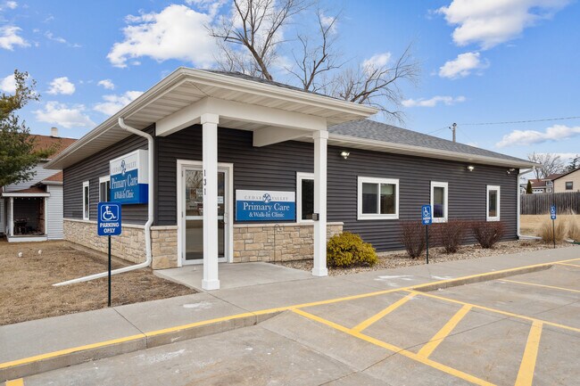
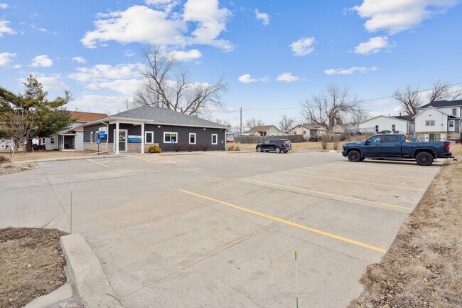
Property Record
131 Main St Nw, Shellsburg, IA 52332

Save to a Folder
{{folder.Name}}
{{folder.ListingIds.length}} Properties
{{folder.ListingIds.length}} Property
Create a New Folder
Property Detail
131 Main St Nw
Cedar Rapids, IA
RUNYONS 1ST ADD LOT 6 & LOT 2 EX N 132' BLK 1
19016850
Benton
Medicalbuilding
Iowa
B and X Area of moderate flood hazard, usually the area between the limits of the 100-year and 500-year floods.
2,6
2025
0.42 AC
2025
Iowa City/Waterloo
960400
Other Market Areas
1,900 SF
NEARBY LISTINGS FOR SALE OR LEASE
-
-
View all Shellsburg listings for sale on LoopNet.com
DEMOGRAPHICS near 131 Main St Nw
1 mile
3 mile
5 mile
2025 Total Population
1,084
2,053
4,538
2030 Population
1,103
2,088
4,617
Pop Growth 2025-2030
+ 1.75%
+ 1.70%
+ 1.74%
Average Age
42
43
41
2025 Total Households
431
810
1,718
HH Growth 2025-2030
+ 1.62%
+ 1.73%
+ 1.75%
Median Household Inc
$70,988
$77,830
$92,720
Avg Household Size
2.50
2.50
2.60
2025 Avg HH Vehicles
2.00
3.00
3.00
Median Home Value
$236,470
$272,297
$307,927
Median Year Built
1977
1980
1992
Nearby Places
Map Layers
Map Styles
 Street
 Aerial
Layers
 Traffic
 Biking
Places
Listings with unknown addresses are not visible on the map
- Restaurants
- Banks
- Shops
- Fitness
- Groceries
PUBLIC TRANSPORTATION
AIRPORT
The Eastern Iowa
Drive
Walk
Distance
The Eastern Iowa
34 min
21.1 mi
Freight Ports
Port Milwaukee
Drive
Walk
Distance
Port Milwaukee
313 min
258.8 mi
SALE & LEASE HISTORY
LISTING DATE
SALE/LEASE

Feb 11, 2025
For Sale
Nearby Properties
Address
Land Use
TOTAL SIZE
Lot Size
Zoning
Address
Land Use
TOTAL SIZE
Lot Size
Zoning
50,649 SF
23.52 AC
Address
Land Use
TOTAL SIZE
Lot Size
Zoning
2,440 SF
35.60 AC
Address
Land Use
TOTAL SIZE
Lot Size
Zoning
14,600 SF
2.33 AC
Address
Land Use
TOTAL SIZE
Lot Size
Zoning
8,320 SF
2.15 AC
Address
Land Use
TOTAL SIZE
Lot Size
Zoning
16,140 SF
5.86 AC
Address
Land Use
TOTAL SIZE
Lot Size
Zoning
Address
Land Use
TOTAL SIZE
Lot Size
Zoning
473.74 AC
Address
Land Use
TOTAL SIZE
Lot Size
Zoning
156.23 AC
Address
Land Use
TOTAL SIZE
Lot Size
Zoning
1,960 SF
1.35 AC
Address
Land Use
TOTAL SIZE
Lot Size
Zoning
1,882 SF
2 AC
Address
Land Use
TOTAL SIZE
Lot Size
Zoning
1,504 SF
214.17 AC
Address
Land Use
TOTAL SIZE
Lot Size
Zoning
Address
Land Use
TOTAL SIZE
Lot Size
Zoning
130 AC
Address
Land Use
TOTAL SIZE
Lot Size
Zoning
1,944 SF
2 AC
Address
Land Use
TOTAL SIZE
Lot Size
Zoning
Address
Land Use
TOTAL SIZE
Lot Size
Zoning
1,447 SF
0.25 AC
Address
Land Use
TOTAL SIZE
Lot Size
Zoning
Address
Land Use
TOTAL SIZE
Lot Size
Zoning
120.03 AC
Address
Land Use
TOTAL SIZE
Lot Size
Zoning
77.08 AC
Address
Land Use
TOTAL SIZE
Lot Size
Zoning
4,368 SF
0.13 AC
Address
Land Use
TOTAL SIZE
Lot Size
Zoning
2,567 SF
0.14 AC
Address
Land Use
TOTAL SIZE
Lot Size
Zoning
117.93 AC
Address
Land Use
TOTAL SIZE
Lot Size
Zoning
149.87 AC
Address
Land Use
TOTAL SIZE
Lot Size
Zoning
3,800 SF
0.73 AC
Address
Land Use
TOTAL SIZE
Lot Size
Zoning
3,360 SF
0.38 AC
Address
Land Use
TOTAL SIZE
Lot Size
Zoning
Address
Land Use
TOTAL SIZE
Lot Size
Zoning
Address
Land Use
TOTAL SIZE
Lot Size
Zoning
93.08 AC
The World's #1 Commercial Real Estate Marketplace
Connect with us
© 2026 CoStar Group
The information above has been obtained from sources believed reliable. While we do not doubt its accuracy we have not verified it and make no guarantee, warranty or representation about it. It is your responsibility to independently confirm its accuracy and completeness. Any projections, opinions, assumptions, or estimates used are for example only and do not represent the current or future performance of the property. The value of this transaction to you depends on tax and other factors which should be evaluated by your tax, financial, and legal advisors. You and your advisors should conduct a careful, independent investigation of the property to determine to your satisfaction the suitability of the property for your needs.