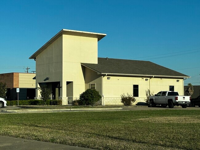
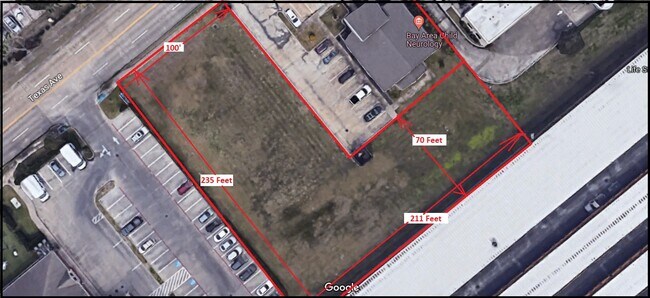
Property Record
0 Mykawa Rd, Houston, TX 77048
NEARBY LISTINGS FOR SALE OR LEASE
Property Detail
0 Mykawa Rd
Houston-The Woodlands-Sugar Land, TX
Waverly Gardens
0361230000101
RES B2 BLK 1 (PR YR IMPS 2015-2017*1193460030005) BAYBROOK PARK SEC 2 R/P AMEND
Vacantlandnec
Harris
X
Texas
48201C0895N
0.19 AC
2024
NASA/Clear Lake
2025
Houston
341001
DEMOGRAPHICS near 0 Mykawa Rd
1 Mile
3 Mile
5 Mile
2024 Total Population
12,877
78,415
181,583
2029 Population
13,040
79,821
185,920
Pop Growth 2024-2029
+ 1.27%
+ 1.79%
+ 2.39%
Average Age
37
38
39
2024 Total Households
5,669
33,036
71,244
HH Growth 2024-2029
+ 1.27%
+ 1.76%
+ 2.45%
Median Household Inc
$62,677
$67,653
$85,416
Avg Household Size
2.20
2.30
2.50
2024 Avg HH Vehicles
2.00
2.00
2.00
Median Home Value
$186,378
$242,189
$271,660
Median Year Built
1983
1983
1987
Nearby Places
Map Layers
Map Styles
 Street
 Aerial
- Restaurants
- Banks
- Shops
- Fitness
- Groceries
PUBLIC TRANSPORTATION
AIRPORT
William P Hobby
DRIVE
WALK
Distance
William P Hobby
12 min
4.5 mi
George Bush Intcntl/Houston
DRIVE
WALK
Distance
George Bush Intcntl/Houston
46 min
30.8 mi
SALE & LEASE HISTORY
LISTING DATE
SALE/LEASE

Feb 23, 2023
For Sale
Feb 06, 2023
For Sale
Nearby Properties
Address
Land Use
TOTAL SIZE
Lot Size
Zoning
Address
Land Use
TOTAL SIZE
Lot Size
Zoning
1,226,700 SF
92.85 AC
Address
Land Use
TOTAL SIZE
Lot Size
Zoning
603,780 SF
36.94 AC
Address
Land Use
TOTAL SIZE
Lot Size
Zoning
375,863 SF
16.35 AC
Address
Land Use
TOTAL SIZE
Lot Size
Zoning
589,830 SF
47.20 AC
Address
Land Use
TOTAL SIZE
Lot Size
Zoning
359,985 SF
12.56 AC
Address
Land Use
TOTAL SIZE
Lot Size
Zoning
421,680 SF
23.44 AC
Address
Land Use
TOTAL SIZE
Lot Size
Zoning
309,102 SF
16.81 AC
Address
Land Use
TOTAL SIZE
Lot Size
Zoning
316,800 SF
16.03 AC
Address
Land Use
TOTAL SIZE
Lot Size
Zoning
72,543 SF
22.64 AC
Address
Land Use
TOTAL SIZE
Lot Size
Zoning
14.93 AC
Address
Land Use
TOTAL SIZE
Lot Size
Zoning
291,181 SF
11.07 AC
Address
Land Use
TOTAL SIZE
Lot Size
Zoning
285,328 SF
40.75 AC
Address
Land Use
TOTAL SIZE
Lot Size
Zoning
353,676 SF
19.86 AC
Address
Land Use
TOTAL SIZE
Lot Size
Zoning
199,360 SF
11.13 AC
Address
Land Use
TOTAL SIZE
Lot Size
Zoning
161,000 SF
9.82 AC
Address
Land Use
TOTAL SIZE
Lot Size
Zoning
89.23 AC
Address
Land Use
TOTAL SIZE
Lot Size
Zoning
433,760 SF
52.70 AC
Address
Land Use
TOTAL SIZE
Lot Size
Zoning
195,856 SF
20.81 AC
Address
Land Use
TOTAL SIZE
Lot Size
Zoning
164,515 SF
Address
Land Use
TOTAL SIZE
Lot Size
Zoning
165,880 SF
19.20 AC
Address
Land Use
TOTAL SIZE
Lot Size
Zoning
67,755 SF
19.53 AC
Address
Land Use
TOTAL SIZE
Lot Size
Zoning
157,128 SF
10 AC
0041
Address
Land Use
TOTAL SIZE
Lot Size
Zoning
85,323 SF
37.81 AC
Address
Land Use
TOTAL SIZE
Lot Size
Zoning
114,828 SF
7.94 AC
Address
Land Use
TOTAL SIZE
Lot Size
Zoning
71,340 SF
47.16 AC
Address
Land Use
TOTAL SIZE
Lot Size
Zoning
67,218 SF
30.11 AC
Address
Land Use
TOTAL SIZE
Lot Size
Zoning
221,377 SF
26.83 AC
Address
Land Use
TOTAL SIZE
Lot Size
Zoning
44,546 SF
7.54 AC
Address
Land Use
TOTAL SIZE
Lot Size
Zoning
108,990 SF
7.67 AC
Address
Land Use
TOTAL SIZE
Lot Size
Zoning
45,038 SF
79.61 AC
The World's #1 Commercial Real Estate Marketplace
Connect with us
© 2025 CoStar Group
The information above has been obtained from sources believed reliable. While we do not doubt its accuracy we have not verified it and make no guarantee, warranty or representation about it. It is your responsibility to independently confirm its accuracy and completeness. Any projections, opinions, assumptions, or estimates used are for example only and do not represent the current or future performance of the property. The value of this transaction to you depends on tax and other factors which should be evaluated by your tax, financial, and legal advisors. You and your advisors should conduct a careful, independent investigation of the property to determine to your satisfaction the suitability of the property for your needs.