Property Record
1310 Broad St, Bloomfield, NJ 07003


NEARBY LISTINGS FOR SALE OR LEASE
Property Detail
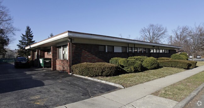
1310 Broad St
Newark, NJ
120 X 129
02-01172-0000-00009
Essex
Officebuilding
New Jersey
X
9
34031C0258G
0.36 AC
2023
Bloomfield/GSP
2025
Northern New Jersey
014800
DEMOGRAPHICS near 1310 Broad St
1 Mile
3 Mile
5 Mile
2024 Total Population
18,775
203,058
639,383
2029 Population
18,516
199,269
623,412
Pop Growth 2024-2029
(1.38%)
(1.87%)
(2.50%)
Average Age
41
40
40
2024 Total Households
6,542
75,870
232,631
HH Growth 2024-2029
(1.65%)
(1.99%)
(2.61%)
Median Household Inc
$152,409
$102,321
$80,415
Avg Household Size
2.80
2.60
2.60
2024 Avg HH Vehicles
2.00
2.00
2.00
Median Home Value
$473,160
$456,382
$439,766
Median Year Built
1949
1952
1953
Nearby Places
Map Layers
Map Styles
 Street
 Aerial
- Restaurants
- Banks
- Shops
- Fitness
- Groceries
PUBLIC TRANSPORTATION
COMMUTER RAIL
Upper Montclair (Montclair-Boonton Line - NJ Transit Commuter Rail (NJ Transit))
DRIVE
WALK
Distance
Upper Montclair (Montclair-Boonton Line - NJ Transit Commuter Rail (NJ Transit))
4 min
1.7 mi
Watchung Avenue (Montclair-Boonton Line - NJ Transit Commuter Rail (NJ Transit))
DRIVE
WALK
Distance
Watchung Avenue (Montclair-Boonton Line - NJ Transit Commuter Rail (NJ Transit))
3 min
1.8 mi
AIRPORT
Newark Liberty International
DRIVE
WALK
Distance
Newark Liberty International
19 min
16.0 mi
LaGuardia
DRIVE
WALK
Distance
LaGuardia
39 min
22.6 mi
John F Kennedy International
DRIVE
WALK
Distance
John F Kennedy International
48 min
30.6 mi
Freight Ports
Port Newark Container Terminal
DRIVE
WALK
Distance
Port Newark Container Terminal
25 min
15.4 mi
SALE & LEASE HISTORY
LISTING DATE
SALE/LEASE

Aug 07, 2020
For Lease
Nearby Properties
Address
Land Use
TOTAL SIZE
Lot Size
Zoning
Address
Land Use
TOTAL SIZE
Lot Size
Zoning
5 AC
H
Address
Land Use
TOTAL SIZE
Lot Size
Zoning
28.33 AC
Address
Land Use
TOTAL SIZE
Lot Size
Zoning
1,589 SF
R4
Address
Land Use
TOTAL SIZE
Lot Size
Zoning
12.54 AC
OPRP
Address
Land Use
TOTAL SIZE
Lot Size
Zoning
Address
Land Use
TOTAL SIZE
Lot Size
Zoning
1.12 AC
M-O
Address
Land Use
TOTAL SIZE
Lot Size
Zoning
20.43 AC
Address
Land Use
TOTAL SIZE
Lot Size
Zoning
Address
Land Use
TOTAL SIZE
Lot Size
Zoning
3.26 AC
PR
Address
Land Use
TOTAL SIZE
Lot Size
Zoning
0.17 AC
BCR1
Address
Land Use
TOTAL SIZE
Lot Size
Zoning
1.67 AC
BCR1
Address
Land Use
TOTAL SIZE
Lot Size
Zoning
1.50 AC
RA
Address
Land Use
TOTAL SIZE
Lot Size
Zoning
1.95 AC
RA
Address
Land Use
TOTAL SIZE
Lot Size
Zoning
3.55 AC
Address
Land Use
TOTAL SIZE
Lot Size
Zoning
9.98 AC
R-1
Address
Land Use
TOTAL SIZE
Lot Size
Zoning
0.22 AC
Address
Land Use
TOTAL SIZE
Lot Size
Zoning
7.22 AC
M-3
Address
Land Use
TOTAL SIZE
Lot Size
Zoning
9.38 AC
B-A
Address
Land Use
TOTAL SIZE
Lot Size
Zoning
25.80 AC
P
Address
Land Use
TOTAL SIZE
Lot Size
Zoning
4.09 AC
M-O
Address
Land Use
TOTAL SIZE
Lot Size
Zoning
17.90 AC
R-G
Address
Land Use
TOTAL SIZE
Lot Size
Zoning
12.52 AC
Address
Land Use
TOTAL SIZE
Lot Size
Zoning
21.80 AC
R-A3
Address
Land Use
TOTAL SIZE
Lot Size
Zoning
11.80 AC
M-0
Address
Land Use
TOTAL SIZE
Lot Size
Zoning
Address
Land Use
TOTAL SIZE
Lot Size
Zoning
5.25 AC
M-1
Address
Land Use
TOTAL SIZE
Lot Size
Zoning
6.30 AC
B
Address
Land Use
TOTAL SIZE
Lot Size
Zoning
1,832 SF
2.18 AC
R3
Address
Land Use
TOTAL SIZE
Lot Size
Zoning
8.08 AC
M-1
Address
Land Use
TOTAL SIZE
Lot Size
Zoning
14.27 AC
RO
The World's #1 Commercial Real Estate Marketplace
Connect with us
© 2026 CoStar Group
The information above has been obtained from sources believed reliable. While we do not doubt its accuracy we have not verified it and make no guarantee, warranty or representation about it. It is your responsibility to independently confirm its accuracy and completeness. Any projections, opinions, assumptions, or estimates used are for example only and do not represent the current or future performance of the property. The value of this transaction to you depends on tax and other factors which should be evaluated by your tax, financial, and legal advisors. You and your advisors should conduct a careful, independent investigation of the property to determine to your satisfaction the suitability of the property for your needs.