Property Record
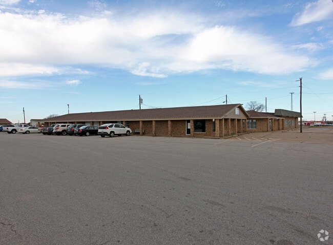
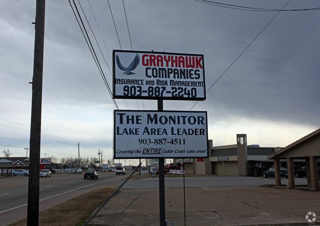
1310 S 3Rd St, Mabank, TX 75147

Property Detail
1310 S 3Rd St
0794-0020-0D00-51
AB 794 G T WALTERS SUR, TRS 2D & 2E (RE:TR 2C2)
Commercialnec
Henderson
B and X Area of moderate flood hazard, usually the area between the limits of the 100-year and 500-year floods.
Texas
2024
3.45 AC
2025
Henderson County
950604
Dallas/Ft Worth
90,493 SF
Athens, TX
NEARBY LISTINGS FOR SALE OR LEASE
-
-
View all Mabank listings for sale on LoopNet.com
DEMOGRAPHICS near 1310 S 3Rd St
1 mile
3 mile
5 mile
2025 Total Population
2,187
10,694
21,571
2030 Population
2,583
12,533
24,631
Pop Growth 2025-2030
+ 18.11%
+ 17.20%
+ 14.19%
Average Age
38
40
42
2025 Total Households
823
4,045
8,349
HH Growth 2025-2030
+ 16.40%
+ 15.60%
+ 13.02%
Median Household Inc
$63,750
$65,343
$63,704
Avg Household Size
2.60
2.60
2.50
2025 Avg HH Vehicles
2.00
2.00
2.00
Median Home Value
$309,873
$255,728
$255,067
Median Year Built
1989
1989
1991
Nearby Places
Map Layers
Map Styles
 Street
 Aerial
Layers
 Traffic
 Biking
Places
Listings with unknown addresses are not visible on the map
- Restaurants
- Banks
- Shops
- Fitness
- Groceries
Nearby Properties
Address
Land Use
TOTAL SIZE
Lot Size
Zoning
Address
Land Use
TOTAL SIZE
Lot Size
Zoning
57,500 SF
21.05 AC
Address
Land Use
TOTAL SIZE
Lot Size
Zoning
132,806 SF
58.54 AC
Address
Land Use
TOTAL SIZE
Lot Size
Zoning
100,720 SF
18.73 AC
Address
Land Use
TOTAL SIZE
Lot Size
Zoning
80,885 SF
6.73 AC
Address
Land Use
TOTAL SIZE
Lot Size
Zoning
38,369 SF
8 AC
Address
Land Use
TOTAL SIZE
Lot Size
Zoning
35,697 SF
9.21 AC
Address
Land Use
TOTAL SIZE
Lot Size
Zoning
161,900 SF
17.83 AC
Address
Land Use
TOTAL SIZE
Lot Size
Zoning
62,044 SF
8.90 AC
Address
Land Use
TOTAL SIZE
Lot Size
Zoning
148,456 SF
21.41 AC
Address
Land Use
TOTAL SIZE
Lot Size
Zoning
1,034 SF
22.77 AC
Address
Land Use
TOTAL SIZE
Lot Size
Zoning
45,576 SF
5.58 AC
Address
Land Use
TOTAL SIZE
Lot Size
Zoning
60,260 SF
21 AC
Address
Land Use
TOTAL SIZE
Lot Size
Zoning
35,084 SF
3.46 AC
Address
Land Use
TOTAL SIZE
Lot Size
Zoning
5,300 SF
39.59 AC
Address
Land Use
TOTAL SIZE
Lot Size
Zoning
6,514 SF
3.77 AC
Address
Land Use
TOTAL SIZE
Lot Size
Zoning
6,115 SF
3.07 AC
Address
Land Use
TOTAL SIZE
Lot Size
Zoning
6,629 SF
6.40 AC
Address
Land Use
TOTAL SIZE
Lot Size
Zoning
32,987 SF
0.15 AC
Address
Land Use
TOTAL SIZE
Lot Size
Zoning
6,734 SF
1.07 AC
Address
Land Use
TOTAL SIZE
Lot Size
Zoning
6,374 SF
1.35 AC
Address
Land Use
TOTAL SIZE
Lot Size
Zoning
6,617 SF
1.01 AC
Address
Land Use
TOTAL SIZE
Lot Size
Zoning
6,608 SF
1.04 AC
Address
Land Use
TOTAL SIZE
Lot Size
Zoning
5,650 SF
2.03 AC
Address
Land Use
TOTAL SIZE
Lot Size
Zoning
19,120 SF
4 AC
Address
Land Use
TOTAL SIZE
Lot Size
Zoning
Address
Land Use
TOTAL SIZE
Lot Size
Zoning
5,760 SF
1.35 AC
Address
Land Use
TOTAL SIZE
Lot Size
Zoning
61,419 SF
5.19 AC
Address
Land Use
TOTAL SIZE
Lot Size
Zoning
14,300 SF
7.26 AC
Address
Land Use
TOTAL SIZE
Lot Size
Zoning
69,048 SF
1.77 AC
The World's #1 Commercial Real Estate Marketplace
Connect with us
© 2026 CoStar Group
The information above has been obtained from sources believed reliable. While we do not doubt its accuracy we have not verified it and make no guarantee, warranty or representation about it. It is your responsibility to independently confirm its accuracy and completeness. Any projections, opinions, assumptions, or estimates used are for example only and do not represent the current or future performance of the property. The value of this transaction to you depends on tax and other factors which should be evaluated by your tax, financial, and legal advisors. You and your advisors should conduct a careful, independent investigation of the property to determine to your satisfaction the suitability of the property for your needs.