Property Record
1310 W Baptist Rd, Colorado Springs, CO 80921

NEARBY LISTINGS FOR SALE OR LEASE
Property Detail
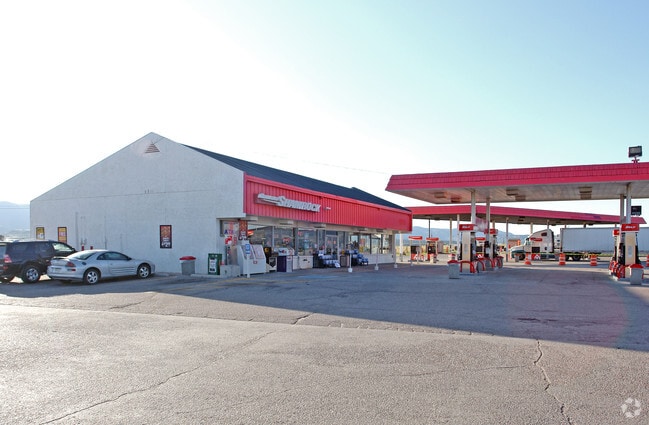
1310 W Baptist Rd
71260-02-006
Monument Add
Commercialbuilding
THAT TRACT IN SE4 SEC 26-11-67 AS FOLS: COM AT A PT ON WLY R/W LN OF I-25 WHICH BEARS N 62<01 W 1077.9 FT FROM SE COR OF SEC, TH S 01<41 W 72.3 FT TO NELY COR OF STUCKY TRACT DES IN BK 2103-63 FOR POB, RUN N 88<19 W ALG NLY LN OF SD TRACT 250.0 FT TO
X
El Paso
08041C0286G
Colorado
2024
2.04 AC
2025
Northwest
007401
Colorado Springs
4,099 SF
Colorado Springs, CO
DEMOGRAPHICS near 1310 W Baptist Rd
1 Mile
3 Mile
5 Mile
2024 Total Population
2,550
27,326
54,459
2029 Population
2,674
28,680
57,109
Pop Growth 2024-2029
+ 4.86%
+ 4.95%
+ 4.87%
Average Age
39
41
40
2024 Total Households
863
9,600
19,218
HH Growth 2024-2029
+ 5.21%
+ 5.16%
+ 5.08%
Median Household Inc
$118,636
$127,929
$134,844
Avg Household Size
2.90
2.80
2.80
2024 Avg HH Vehicles
2.00
2.00
2.00
Median Home Value
$462,499
$562,760
$631,931
Median Year Built
2004
2000
2001
Nearby Places
Map Layers
Map Styles
 Street
 Aerial
- Restaurants
- Banks
- Shops
- Fitness
- Groceries
PUBLIC TRANSPORTATION
AIRPORT
City of Colorado Springs Municipal
DRIVE
WALK
Distance
City of Colorado Springs Municipal
36 min
23.6 mi
Nearby Properties
Address
Land Use
TOTAL SIZE
Lot Size
Zoning
Address
Land Use
TOTAL SIZE
Lot Size
Zoning
136,906 SF
25.22 AC
PRD-4
Address
Land Use
TOTAL SIZE
Lot Size
Zoning
112,266 SF
0.24 AC
RR3
Address
Land Use
TOTAL SIZE
Lot Size
Zoning
57,619 SF
3.26 AC
SFD-2
Address
Land Use
TOTAL SIZE
Lot Size
Zoning
10,000 SF
23.39 AC
PUD
Address
Land Use
TOTAL SIZE
Lot Size
Zoning
45,186 SF
8.91 AC
PUD
Address
Land Use
TOTAL SIZE
Lot Size
Zoning
22,970 SF
5.45 AC
PUD
Address
Land Use
TOTAL SIZE
Lot Size
Zoning
49,258 SF
3.68 AC
PUD
Address
Land Use
TOTAL SIZE
Lot Size
Zoning
154,703 SF
14.29 AC
BP HR
Address
Land Use
TOTAL SIZE
Lot Size
Zoning
53,026 SF
17.20 AC
RR-5
Address
Land Use
TOTAL SIZE
Lot Size
Zoning
23,378 SF
3.34 AC
PUD
Address
Land Use
TOTAL SIZE
Lot Size
Zoning
222,850 SF
20.55 AC
PUD
Address
Land Use
TOTAL SIZE
Lot Size
Zoning
21,695 SF
1.17 AC
BP
Address
Land Use
TOTAL SIZE
Lot Size
Zoning
347,470 SF
15.42 AC
PDZ HR
Address
Land Use
TOTAL SIZE
Lot Size
Zoning
51,034 SF
11.01 AC
PDZ HR
Address
Land Use
TOTAL SIZE
Lot Size
Zoning
119,596 SF
19.25 AC
PDZ HR
Address
Land Use
TOTAL SIZE
Lot Size
Zoning
98,428 SF
16.92 AC
PUD
Address
Land Use
TOTAL SIZE
Lot Size
Zoning
150,335 SF
28 AC
LI
Address
Land Use
TOTAL SIZE
Lot Size
Zoning
13.14 AC
PUD
Address
Land Use
TOTAL SIZE
Lot Size
Zoning
86,779 SF
10.62 AC
PCD
Address
Land Use
TOTAL SIZE
Lot Size
Zoning
16,608 SF
1.14 AC
P
Address
Land Use
TOTAL SIZE
Lot Size
Zoning
12,167 SF
1.40 AC
DB
Address
Land Use
TOTAL SIZE
Lot Size
Zoning
272.98 AC
RR-5
Address
Land Use
TOTAL SIZE
Lot Size
Zoning
17,655 SF
7.01 AC
R-4
Address
Land Use
TOTAL SIZE
Lot Size
Zoning
14,684 SF
5 AC
RS-20000
Address
Land Use
TOTAL SIZE
Lot Size
Zoning
16,235 SF
6.08 AC
RR-5
Address
Land Use
TOTAL SIZE
Lot Size
Zoning
9.62 AC
PID
Address
Land Use
TOTAL SIZE
Lot Size
Zoning
16,230 SF
2.81 AC
Address
Land Use
TOTAL SIZE
Lot Size
Zoning
222,866 SF
14.40 AC
RM-30
Address
Land Use
TOTAL SIZE
Lot Size
Zoning
198,725 SF
10.39 AC
PUD
Address
Land Use
TOTAL SIZE
Lot Size
Zoning
179,346 SF
9.88 AC
PUD
The World's #1 Commercial Real Estate Marketplace
Connect with us
© 2026 CoStar Group
The information above has been obtained from sources believed reliable. While we do not doubt its accuracy we have not verified it and make no guarantee, warranty or representation about it. It is your responsibility to independently confirm its accuracy and completeness. Any projections, opinions, assumptions, or estimates used are for example only and do not represent the current or future performance of the property. The value of this transaction to you depends on tax and other factors which should be evaluated by your tax, financial, and legal advisors. You and your advisors should conduct a careful, independent investigation of the property to determine to your satisfaction the suitability of the property for your needs.