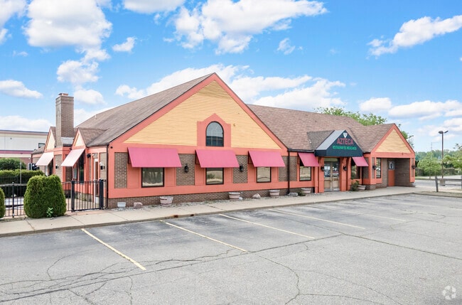
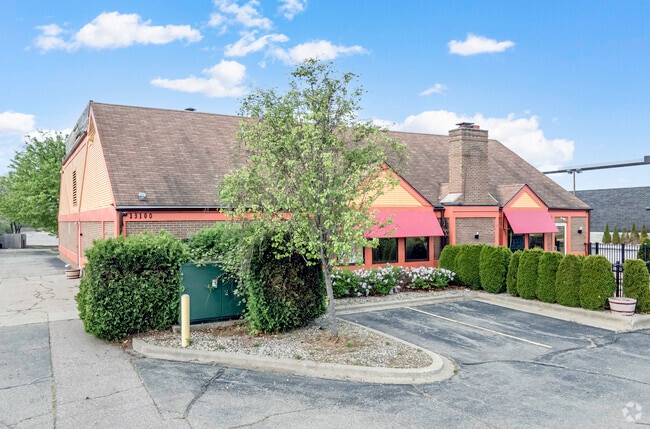
Property Record
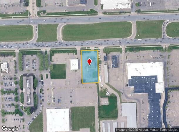
13100 Hall Rd, Sterling Heights, MI 48313
Current Lease Availabilities
NEARBY LISTINGS FOR SALE OR LEASE
Property Detail
13100 Hall Rd
10-10-02-200-038
T2N R12E SEC 2; COMM AT N 1/4 POST SEC 2; TH N89*55' 15" E 1326.48 FT; TH S00*00'45" E 60.00 FT TO PT OF BEG; TH S00*00'45" E
Restaurantbuilding
Macomb
X
Michigan
26099C0238G
1.18 AC
2024
Macomb West
2025
Detroit
230300
Detroit-Warren-Dearborn, MI
6,000 SF
DEMOGRAPHICS near 13100 Hall Rd
1 Mile
3 Mile
5 Mile
2024 Total Population
9,755
99,293
248,078
2029 Population
9,543
97,934
245,064
Pop Growth 2024-2029
(2.17%)
(1.37%)
(1.21%)
Average Age
44
43
42
2024 Total Households
4,272
41,732
99,020
HH Growth 2024-2029
(2.39%)
(1.41%)
(1.25%)
Median Household Inc
$58,898
$73,182
$78,667
Avg Household Size
2.20
2.30
2.50
2024 Avg HH Vehicles
1.00
2.00
2.00
Median Home Value
$210,916
$235,689
$258,130
Median Year Built
1981
1983
1986
Nearby Places
- Restaurants
- Banks
- Shops
- Fitness
- Groceries
PUBLIC TRANSPORTATION
AIRPORT
Windsor International
DRIVE
WALK
Distance
Windsor International
62 min
36.8 mi
Freight Ports
Port of Toledo
DRIVE
WALK
Distance
Port of Toledo
112 min
87.4 mi
Nearby Properties
Address
Land Use
TOTAL SIZE
Lot Size
Zoning
Address
Land Use
TOTAL SIZE
Lot Size
Zoning
42.79 AC
B-4
Address
Land Use
TOTAL SIZE
Lot Size
Zoning
20,560 SF
37.09 AC
R2
Address
Land Use
TOTAL SIZE
Lot Size
Zoning
447,434 SF
23.29 AC
LM
Address
Land Use
TOTAL SIZE
Lot Size
Zoning
92.30 AC
MHP
Address
Land Use
TOTAL SIZE
Lot Size
Zoning
401,014 SF
32.54 AC
RML
Address
Land Use
TOTAL SIZE
Lot Size
Zoning
2,058,062 SF
141.65 AC
M-2
Address
Land Use
TOTAL SIZE
Lot Size
Zoning
30.08 AC
RM-2
Address
Land Use
TOTAL SIZE
Lot Size
Zoning
22.52 AC
RMH
Address
Land Use
TOTAL SIZE
Lot Size
Zoning
283,249 SF
M-2
Address
Land Use
TOTAL SIZE
Lot Size
Zoning
182,708 SF
10.69 AC
RMH
Address
Land Use
TOTAL SIZE
Lot Size
Zoning
1,150 SF
25.68 AC
CK MAP
Address
Land Use
TOTAL SIZE
Lot Size
Zoning
438,578 SF
36.60 AC
MXD
Address
Land Use
TOTAL SIZE
Lot Size
Zoning
25.18 AC
RM-2
Address
Land Use
TOTAL SIZE
Lot Size
Zoning
23.78 AC
RML
Address
Land Use
TOTAL SIZE
Lot Size
Zoning
182,102 SF
11.04 AC
SP-1
Address
Land Use
TOTAL SIZE
Lot Size
Zoning
15.94 AC
RMH
Address
Land Use
TOTAL SIZE
Lot Size
Zoning
237,108 SF
10.30 AC
R-12
Address
Land Use
TOTAL SIZE
Lot Size
Zoning
29.93 AC
RM-2
Address
Land Use
TOTAL SIZE
Lot Size
Zoning
15.90 AC
RML
Address
Land Use
TOTAL SIZE
Lot Size
Zoning
79,504 SF
SP-2
Address
Land Use
TOTAL SIZE
Lot Size
Zoning
17.40 AC
CK MAP
Address
Land Use
TOTAL SIZE
Lot Size
Zoning
554,374 SF
22.15 AC
M-2
Address
Land Use
TOTAL SIZE
Lot Size
Zoning
73.49 AC
CK MAP
Address
Land Use
TOTAL SIZE
Lot Size
Zoning
210,080 SF
14.35 AC
RM-2
Address
Land Use
TOTAL SIZE
Lot Size
Zoning
50,577 SF
21.43 AC
C-2
Address
Land Use
TOTAL SIZE
Lot Size
Zoning
40.11 AC
C-4
Address
Land Use
TOTAL SIZE
Lot Size
Zoning
176,212 SF
16.46 AC
MXD
Address
Land Use
TOTAL SIZE
Lot Size
Zoning
45,000 SF
7.58 AC
B-4
Address
Land Use
TOTAL SIZE
Lot Size
Zoning
15.46 AC
RMH
Address
Land Use
TOTAL SIZE
Lot Size
Zoning
118,890 SF
2.51 AC
C-3
The World's #1 Commercial Real Estate Marketplace
Connect with us
© 2025 CoStar Group
The information above has been obtained from sources believed reliable. While we do not doubt its accuracy we have not verified it and make no guarantee, warranty or representation about it. It is your responsibility to independently confirm its accuracy and completeness. Any projections, opinions, assumptions, or estimates used are for example only and do not represent the current or future performance of the property. The value of this transaction to you depends on tax and other factors which should be evaluated by your tax, financial, and legal advisors. You and your advisors should conduct a careful, independent investigation of the property to determine to your satisfaction the suitability of the property for your needs.