Property Record
13102 Appleton Blvd, Port Charlotte, FL 33981
NEARBY LISTINGS FOR SALE OR LEASE
Property Detail
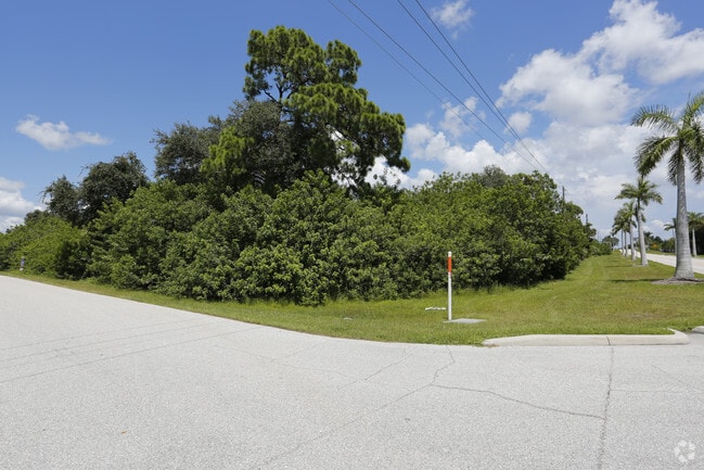
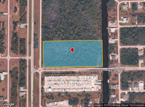
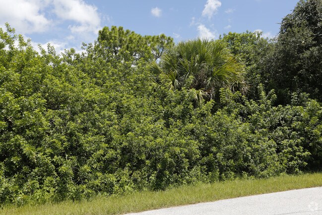
13102 Appleton Blvd
Punta Gorda, FL
Port Charlotte
412129326001
PORT CHARLOTTE SEC85 BLK4617 TRACT P 7.71A 1506/1381 2178/1648 2538/1718 AFF2944/1043 3332/1907 3332/1912 3534/443 3536/118 3814/370 AFF4147/1448 4481/1807
Commercialacreage
Charlotte
AE
Florida
12015C0213G
7.71 AC
2024
Charlotte County
2025
Southwest Florida
030102
DEMOGRAPHICS near 13102 Appleton Blvd
1 Mile
3 Mile
5 Mile
2024 Total Population
2,587
15,364
39,032
2029 Population
3,291
19,007
47,642
Pop Growth 2024-2029
+ 27.21%
+ 23.71%
+ 22.06%
Average Age
60
58
56
2024 Total Households
1,258
7,126
18,486
HH Growth 2024-2029
+ 27.50%
+ 23.93%
+ 22.24%
Median Household Inc
$69,192
$72,317
$62,772
Avg Household Size
2.10
2.10
2.10
2024 Avg HH Vehicles
2.00
2.00
2.00
Median Home Value
$414,822
$350,657
$289,184
Median Year Built
2010
2006
1998
Nearby Places
Map Layers
Map Styles
 Street
 Aerial
- Restaurants
- Banks
- Shops
- Fitness
- Groceries
PUBLIC TRANSPORTATION
AIRPORT
Punta Gorda
DRIVE
WALK
Distance
Punta Gorda
42 min
24.6 mi
Freight Ports
Port Manatee
DRIVE
WALK
Distance
Port Manatee
92 min
66.6 mi
SALE & LEASE HISTORY
LISTING DATE
SALE/LEASE

Aug 21, 2017
For Sale
Nearby Properties
Address
Land Use
TOTAL SIZE
Lot Size
Zoning
Address
Land Use
TOTAL SIZE
Lot Size
Zoning
42,935 SF
167.66 AC
RE1
Address
Land Use
TOTAL SIZE
Lot Size
Zoning
1,200 SF
29.50 AC
CG
Address
Land Use
TOTAL SIZE
Lot Size
Zoning
20.12 AC
CG
Address
Land Use
TOTAL SIZE
Lot Size
Zoning
24,708 SF
14.89 AC
CT
Address
Land Use
TOTAL SIZE
Lot Size
Zoning
11,718 SF
0.15 AC
WDR4*
Address
Land Use
TOTAL SIZE
Lot Size
Zoning
38.14 AC
IG
Address
Land Use
TOTAL SIZE
Lot Size
Zoning
12,300 SF
5.02 AC
IG
Address
Land Use
TOTAL SIZE
Lot Size
Zoning
6,476 SF
17.26 AC
II
Address
Land Use
TOTAL SIZE
Lot Size
Zoning
4,776 SF
20 AC
II
Address
Land Use
TOTAL SIZE
Lot Size
Zoning
2,940 SF
332.40 AC
RSF5
Address
Land Use
TOTAL SIZE
Lot Size
Zoning
16.53 AC
CG
Address
Land Use
TOTAL SIZE
Lot Size
Zoning
20,650 SF
1.61 AC
CG
Address
Land Use
TOTAL SIZE
Lot Size
Zoning
1,430 SF
5.98 AC
CG
Address
Land Use
TOTAL SIZE
Lot Size
Zoning
12,907 SF
165.69 AC
RSF5
Address
Land Use
TOTAL SIZE
Lot Size
Zoning
576 SF
5 AC
II
Address
Land Use
TOTAL SIZE
Lot Size
Zoning
11,550 SF
1.18 AC
CG
Address
Land Use
TOTAL SIZE
Lot Size
Zoning
11,708 SF
9.99 AC
II
Address
Land Use
TOTAL SIZE
Lot Size
Zoning
13.29 AC
CG
Address
Land Use
TOTAL SIZE
Lot Size
Zoning
15,787 SF
1.46 AC
IG
Address
Land Use
TOTAL SIZE
Lot Size
Zoning
630 SF
10 AC
II
Address
Land Use
TOTAL SIZE
Lot Size
Zoning
Address
Land Use
TOTAL SIZE
Lot Size
Zoning
Address
Land Use
TOTAL SIZE
Lot Size
Zoning
10.21 AC
II
Address
Land Use
TOTAL SIZE
Lot Size
Zoning
21.21 AC
CG
Address
Land Use
TOTAL SIZE
Lot Size
Zoning
2,612 SF
6.76 AC
II
Address
Land Use
TOTAL SIZE
Lot Size
Zoning
224 SF
8.23 AC
II
Address
Land Use
TOTAL SIZE
Lot Size
Zoning
1,368 SF
7.46 AC
II
Address
Land Use
TOTAL SIZE
Lot Size
Zoning
53.95 AC
CG
Address
Land Use
TOTAL SIZE
Lot Size
Zoning
10,700 SF
165.49 AC
RSF5
The World's #1 Commercial Real Estate Marketplace
Connect with us
© 2025 CoStar Group
The information above has been obtained from sources believed reliable. While we do not doubt its accuracy we have not verified it and make no guarantee, warranty or representation about it. It is your responsibility to independently confirm its accuracy and completeness. Any projections, opinions, assumptions, or estimates used are for example only and do not represent the current or future performance of the property. The value of this transaction to you depends on tax and other factors which should be evaluated by your tax, financial, and legal advisors. You and your advisors should conduct a careful, independent investigation of the property to determine to your satisfaction the suitability of the property for your needs.