Property Record
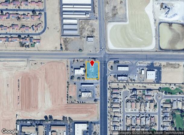
13105 W Glendale Ave, Glendale, AZ 85307
NEARBY LISTINGS FOR SALE OR LEASE
Property Detail
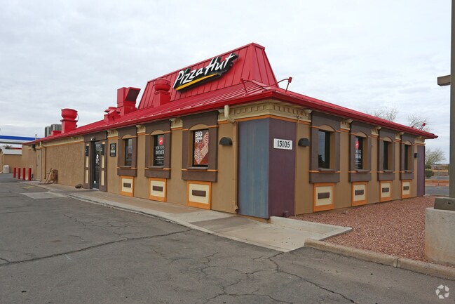
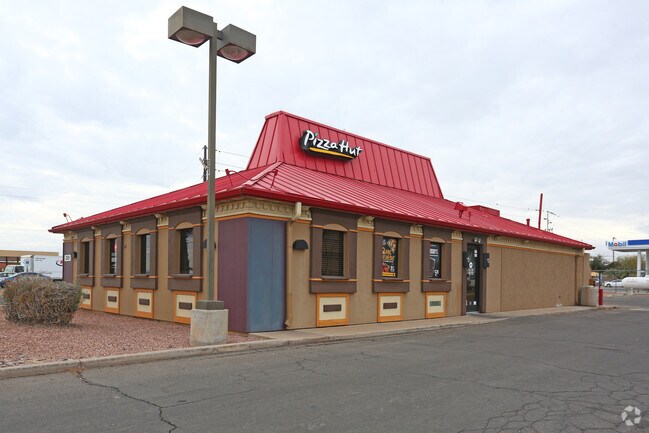
13105 W Glendale Ave
501-57-002J
E 190F OF N 240F OF NE4 EX N 55F RD & EX E 55F RD
Restaurantbuilding
Maricopa
X
Arizona
04013C1690M
0.57 AC
2025
Sun City
2025
Phoenix
061046
Phoenix-Mesa-Scottsdale, AZ
2,605 SF
DEMOGRAPHICS near 13105 W Glendale Ave
1 Mile
3 Mile
5 Mile
2024 Total Population
11,533
36,401
182,402
2029 Population
12,849
39,978
198,878
Pop Growth 2024-2029
+ 11.41%
+ 9.83%
+ 9.03%
Average Age
33
35
38
2024 Total Households
3,704
11,579
63,150
HH Growth 2024-2029
+ 11.23%
+ 9.84%
+ 9.26%
Median Household Inc
$86,001
$97,855
$80,322
Avg Household Size
3.00
3.00
2.80
2024 Avg HH Vehicles
2.00
2.00
2.00
Median Home Value
$382,394
$413,159
$339,517
Median Year Built
2002
2003
2001
Nearby Places
Map Layers
Map Styles
 Street
 Aerial
- Restaurants
- Banks
- Shops
- Fitness
- Groceries
PUBLIC TRANSPORTATION
AIRPORT
Phoenix Sky Harbor International
DRIVE
WALK
Distance
Phoenix Sky Harbor International
37 min
26.8 mi
Freight Ports
Port of San Diego
DRIVE
WALK
Distance
Port of San Diego
385 min
344.5 mi
SALE & LEASE HISTORY
LISTING DATE
SALE/LEASE

Oct 18, 2022
For Lease
Oct 18, 2022
For Sale
Nearby Properties
Address
Land Use
TOTAL SIZE
Lot Size
Zoning
Address
Land Use
TOTAL SIZE
Lot Size
Zoning
138.98 AC
Address
Land Use
TOTAL SIZE
Lot Size
Zoning
71.40 AC
Address
Land Use
TOTAL SIZE
Lot Size
Zoning
35.74 AC
Address
Land Use
TOTAL SIZE
Lot Size
Zoning
303,419 SF
31.47 AC
Address
Land Use
TOTAL SIZE
Lot Size
Zoning
Address
Land Use
TOTAL SIZE
Lot Size
Zoning
1,188,764 SF
631.19 AC
AP
Address
Land Use
TOTAL SIZE
Lot Size
Zoning
1,433,378 SF
317.58 AC
AP
Address
Land Use
TOTAL SIZE
Lot Size
Zoning
52.99 AC
Address
Land Use
TOTAL SIZE
Lot Size
Zoning
510,342 SF
51.45 AC
LUKEAFB
Address
Land Use
TOTAL SIZE
Lot Size
Zoning
570,080 SF
36.76 AC
Address
Land Use
TOTAL SIZE
Lot Size
Zoning
844,524 SF
130.66 AC
LUKEAFB
Address
Land Use
TOTAL SIZE
Lot Size
Zoning
351,775 SF
53.72 AC
AP
Address
Land Use
TOTAL SIZE
Lot Size
Zoning
634,560 SF
36.84 AC
PAD
Address
Land Use
TOTAL SIZE
Lot Size
Zoning
282,993 SF
14.16 AC
PF
Address
Land Use
TOTAL SIZE
Lot Size
Zoning
531,110 SF
124.24 AC
I-1
Address
Land Use
TOTAL SIZE
Lot Size
Zoning
294,360 SF
21.69 AC
EI
Address
Land Use
TOTAL SIZE
Lot Size
Zoning
198,109 SF
79 AC
R-43
Address
Land Use
TOTAL SIZE
Lot Size
Zoning
113,020 SF
16.37 AC
R-43
Address
Land Use
TOTAL SIZE
Lot Size
Zoning
109,856 SF
25.18 AC
R-43
Address
Land Use
TOTAL SIZE
Lot Size
Zoning
102,431 SF
17.63 AC
R-10
Address
Land Use
TOTAL SIZE
Lot Size
Zoning
187,815 SF
160 AC
AP
Address
Land Use
TOTAL SIZE
Lot Size
Zoning
120,289 SF
13.69 AC
C-S
Address
Land Use
TOTAL SIZE
Lot Size
Zoning
93,832 SF
79 AC
AG
Address
Land Use
TOTAL SIZE
Lot Size
Zoning
3,237 SF
1.09 AC
I-1
Address
Land Use
TOTAL SIZE
Lot Size
Zoning
302,000 SF
15.11 AC
M-H
Address
Land Use
TOTAL SIZE
Lot Size
Zoning
82,153 SF
14.22 AC
R-43
Address
Land Use
TOTAL SIZE
Lot Size
Zoning
116,323 SF
17.38 AC
R-8
Address
Land Use
TOTAL SIZE
Lot Size
Zoning
91,600 SF
18.61 AC
R-43
Address
Land Use
TOTAL SIZE
Lot Size
Zoning
152,254 SF
13.49 AC
C2
Address
Land Use
TOTAL SIZE
Lot Size
Zoning
82,320 SF
36.07 AC
AP
The World's #1 Commercial Real Estate Marketplace
Connect with us
© 2025 CoStar Group
The information above has been obtained from sources believed reliable. While we do not doubt its accuracy we have not verified it and make no guarantee, warranty or representation about it. It is your responsibility to independently confirm its accuracy and completeness. Any projections, opinions, assumptions, or estimates used are for example only and do not represent the current or future performance of the property. The value of this transaction to you depends on tax and other factors which should be evaluated by your tax, financial, and legal advisors. You and your advisors should conduct a careful, independent investigation of the property to determine to your satisfaction the suitability of the property for your needs.