Property Record
13107 N 113Th Ave E, Collinsville, OK 74021


NEARBY LISTINGS FOR SALE OR LEASE
Property Detail
13107 N 113Th Ave E
Tulsa, OK
Unplatted
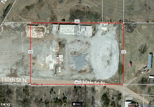
92432-24-32-56010
N/2 N/2 NW SW LYING E US HWY 169 LESS E509 THEREOF SEC 32 22 14 2ACS
Taxexempt
Tulsa
X
Oklahoma
40131C0250H
2 AC
0
Northeast
2025
Tulsa
005403
DEMOGRAPHICS near 13107 N 113Th Ave E
1 mile
3 mile
5 mile
2024 Total Population
2,460
22,874
55,855
2029 Population
2,541
23,871
58,341
Pop Growth 2024-2029
+ 3.29%
+ 4.36%
+ 4.45%
Average Age
36
37
38
2024 Total Households
893
8,422
20,563
HH Growth 2024-2029
+ 3.36%
+ 4.36%
+ 4.45%
Median Household Inc
$82,069
$74,110
$76,959
Avg Household Size
2.80
2.70
2.70
2024 Avg HH Vehicles
2.00
2.00
2.00
Median Home Value
$179,232
$192,568
$213,765
Median Year Built
2003
2001
1999
Nearby Places
Map Layers
Map Styles
 Street
 Aerial
Transit
 Traffic
 Biking
Places
Listings with unknown addresses are not visible on the map
- Restaurants
- Banks
- Shops
- Fitness
- Groceries
PUBLIC TRANSPORTATION
AIRPORT
Tulsa International
Drive
Walk
Distance
Tulsa International
21 min
14.1 mi
Freight Ports
Tulsa Port Of Catoosa
Drive
Walk
Distance
Tulsa Port Of Catoosa
24 min
17.0 mi
Nearby Properties
Address
Land Use
TOTAL SIZE
Lot Size
Zoning
Address
Land Use
TOTAL SIZE
Lot Size
Zoning
299,471 SF
64.32 AC
AG
Address
Land Use
TOTAL SIZE
Lot Size
Zoning
47,798 SF
5.13 AC
CS
Address
Land Use
TOTAL SIZE
Lot Size
Zoning
115,952 SF
19.30 AC
RS3
Address
Land Use
TOTAL SIZE
Lot Size
Zoning
43,882 SF
10 AC
AG
Address
Land Use
TOTAL SIZE
Lot Size
Zoning
246,823 SF
12.77 AC
Address
Land Use
TOTAL SIZE
Lot Size
Zoning
25,603 SF
4.64 AC
RM1
Address
Land Use
TOTAL SIZE
Lot Size
Zoning
22,679 SF
0.77 AC
CBD
Address
Land Use
TOTAL SIZE
Lot Size
Zoning
40,100 SF
4.36 AC
IM
Address
Land Use
TOTAL SIZE
Lot Size
Zoning
22,874 SF
1.29 AC
CBD
Address
Land Use
TOTAL SIZE
Lot Size
Zoning
41,764 SF
17.87 AC
AG
Address
Land Use
TOTAL SIZE
Lot Size
Zoning
40,822 SF
11.39 AC
AG
Address
Land Use
TOTAL SIZE
Lot Size
Zoning
40,206 SF
3.72 AC
RS3
Address
Land Use
TOTAL SIZE
Lot Size
Zoning
28,400 SF
12.66 AC
AG
Address
Land Use
TOTAL SIZE
Lot Size
Zoning
42,211 SF
0.65 AC
RS3
Address
Land Use
TOTAL SIZE
Lot Size
Zoning
133,301 SF
21.09 AC
RS3
Address
Land Use
TOTAL SIZE
Lot Size
Zoning
24,435 SF
4.41 AC
RE
Address
Land Use
TOTAL SIZE
Lot Size
Zoning
20,952 SF
5.01 AC
AG
Address
Land Use
TOTAL SIZE
Lot Size
Zoning
3,679 SF
33.74 AC
AG
Address
Land Use
TOTAL SIZE
Lot Size
Zoning
103,300 SF
13.81 AC
CS
Address
Land Use
TOTAL SIZE
Lot Size
Zoning
61,622 SF
13.96 AC
CG
Address
Land Use
TOTAL SIZE
Lot Size
Zoning
1,389 SF
20.25 AC
Address
Land Use
TOTAL SIZE
Lot Size
Zoning
33,157 SF
3.82 AC
AGR
Address
Land Use
TOTAL SIZE
Lot Size
Zoning
8,334 SF
46.11 AC
AG
Address
Land Use
TOTAL SIZE
Lot Size
Zoning
14,934 SF
9.15 AC
AG
Address
Land Use
TOTAL SIZE
Lot Size
Zoning
10,701 SF
0.96 AC
CBD
Address
Land Use
TOTAL SIZE
Lot Size
Zoning
143,419 SF
29.73 AC
IM
Address
Land Use
TOTAL SIZE
Lot Size
Zoning
6,035 SF
0.35 AC
CBD
Address
Land Use
TOTAL SIZE
Lot Size
Zoning
17,044 SF
5.28 AC
RD
Address
Land Use
TOTAL SIZE
Lot Size
Zoning
34,568 SF
4.26 AC
RM2
Address
Land Use
TOTAL SIZE
Lot Size
Zoning
36,647 SF
1.93 AC
AGR
The World's #1 Commercial Real Estate Marketplace
Connect with us
© 2026 CoStar Group
The information above has been obtained from sources believed reliable. While we do not doubt its accuracy we have not verified it and make no guarantee, warranty or representation about it. It is your responsibility to independently confirm its accuracy and completeness. Any projections, opinions, assumptions, or estimates used are for example only and do not represent the current or future performance of the property. The value of this transaction to you depends on tax and other factors which should be evaluated by your tax, financial, and legal advisors. You and your advisors should conduct a careful, independent investigation of the property to determine to your satisfaction the suitability of the property for your needs.