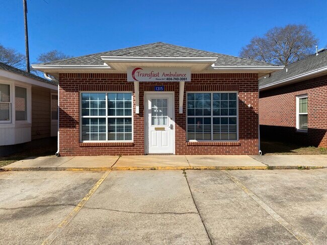
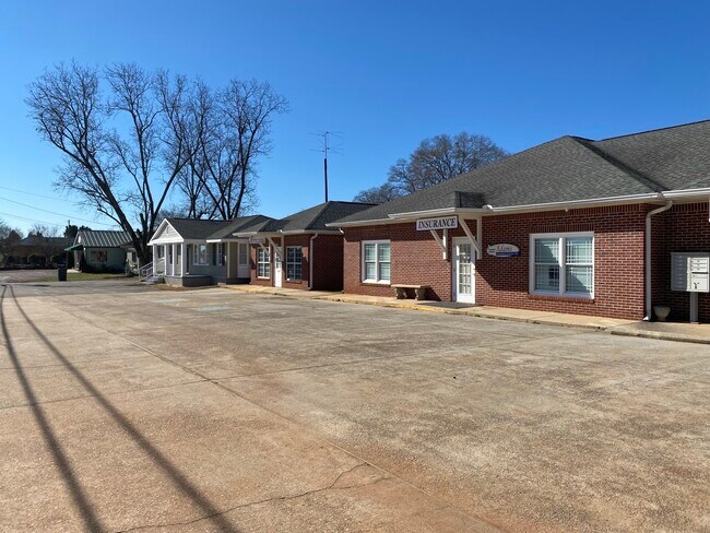
Property Record
1311 Highway 19 N, Thomaston, GA 30286
NEARBY LISTINGS FOR SALE OR LEASE
Property Detail
1311 Highway 19 N
Thomaston, GA
North Thomaston Commercial
043B-057 01
LOTS 3 & 4 BLOCK B PB 13/71
Officebuilding
Upson
X
Georgia
13171C0150C
3,4
2024
0.82 AC
2025
Georgia South Area
010201
Other Market Areas
4,417 SF
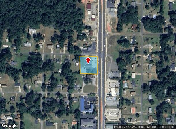
DEMOGRAPHICS near 1311 Highway 19 N
1 Mile
3 Mile
5 Mile
2024 Total Population
2,450
11,694
21,099
2029 Population
2,492
12,049
21,800
Pop Growth 2024-2029
+ 1.71%
+ 3.04%
+ 3.32%
Average Age
40
41
41
2024 Total Households
982
4,803
8,554
HH Growth 2024-2029
+ 1.63%
+ 2.89%
+ 3.18%
Median Household Inc
$48,145
$44,257
$42,621
Avg Household Size
2.40
2.40
2.40
2024 Avg HH Vehicles
2.00
2.00
2.00
Median Home Value
$120,122
$110,553
$131,863
Median Year Built
1972
1971
1970
Nearby Places
Map Layers
Map Styles
 Street
 Aerial
- Restaurants
- Banks
- Shops
- Fitness
- Groceries
SALE & LEASE HISTORY
LISTING DATE
SALE/LEASE

May 23, 2018
For Lease
Jul 12, 2017
For Lease
Aug 20, 2020
For Lease
Nearby Properties
Address
Land Use
TOTAL SIZE
Lot Size
Zoning
Address
Land Use
TOTAL SIZE
Lot Size
Zoning
1,850 SF
94.56 AC
M2
Address
Land Use
TOTAL SIZE
Lot Size
Zoning
61,594 SF
31.44 AC
M1
Address
Land Use
TOTAL SIZE
Lot Size
Zoning
58,908 SF
104.55 AC
M1
Address
Land Use
TOTAL SIZE
Lot Size
Zoning
174,343 SF
18.48 AC
C2
Address
Land Use
TOTAL SIZE
Lot Size
Zoning
103,020 SF
11.06 AC
C2
Address
Land Use
TOTAL SIZE
Lot Size
Zoning
48,476 SF
17.80 AC
ES2
Address
Land Use
TOTAL SIZE
Lot Size
Zoning
140,288 SF
31.67 AC
M2
Address
Land Use
TOTAL SIZE
Lot Size
Zoning
322,698 SF
72.25 AC
M2
Address
Land Use
TOTAL SIZE
Lot Size
Zoning
125,647 SF
15.67 AC
C2
Address
Land Use
TOTAL SIZE
Lot Size
Zoning
34,537 SF
6.65 AC
C2
Address
Land Use
TOTAL SIZE
Lot Size
Zoning
24,662 SF
1.09 AC
DT
Address
Land Use
TOTAL SIZE
Lot Size
Zoning
28,266 SF
2.44 AC
PD
Address
Land Use
TOTAL SIZE
Lot Size
Zoning
488 SF
11.97 AC
MR
Address
Land Use
TOTAL SIZE
Lot Size
Zoning
61,916 SF
8.93 AC
C2
Address
Land Use
TOTAL SIZE
Lot Size
Zoning
247,227 SF
18.54 AC
M2
Address
Land Use
TOTAL SIZE
Lot Size
Zoning
4,704 SF
172.30 AC
M2
Address
Land Use
TOTAL SIZE
Lot Size
Zoning
44,356 SF
5.75 AC
AR
Address
Land Use
TOTAL SIZE
Lot Size
Zoning
21,373 SF
2.77 AC
C2
Address
Land Use
TOTAL SIZE
Lot Size
Zoning
5,640 SF
5 AC
MR
Address
Land Use
TOTAL SIZE
Lot Size
Zoning
7,444 SF
5.44 AC
MR
Address
Land Use
TOTAL SIZE
Lot Size
Zoning
12,810 SF
1.73 AC
R1
Address
Land Use
TOTAL SIZE
Lot Size
Zoning
19,520 SF
4.03 AC
C2
Address
Land Use
TOTAL SIZE
Lot Size
Zoning
107,468 SF
7.21 AC
M2
Address
Land Use
TOTAL SIZE
Lot Size
Zoning
600 SF
6 AC
MR
Address
Land Use
TOTAL SIZE
Lot Size
Zoning
30,052 SF
35.54 AC
C2
Address
Land Use
TOTAL SIZE
Lot Size
Zoning
44,793 SF
9 AC
R2
Address
Land Use
TOTAL SIZE
Lot Size
Zoning
263,413 SF
20.59 AC
M2
Address
Land Use
TOTAL SIZE
Lot Size
Zoning
32,629 SF
27.99 AC
C2
Address
Land Use
TOTAL SIZE
Lot Size
Zoning
5,041 SF
1.38 AC
C2
Address
Land Use
TOTAL SIZE
Lot Size
Zoning
18,496 SF
0.32 AC
PI
The World's #1 Commercial Real Estate Marketplace
Connect with us
© 2026 CoStar Group
The information above has been obtained from sources believed reliable. While we do not doubt its accuracy we have not verified it and make no guarantee, warranty or representation about it. It is your responsibility to independently confirm its accuracy and completeness. Any projections, opinions, assumptions, or estimates used are for example only and do not represent the current or future performance of the property. The value of this transaction to you depends on tax and other factors which should be evaluated by your tax, financial, and legal advisors. You and your advisors should conduct a careful, independent investigation of the property to determine to your satisfaction the suitability of the property for your needs.