Property Record
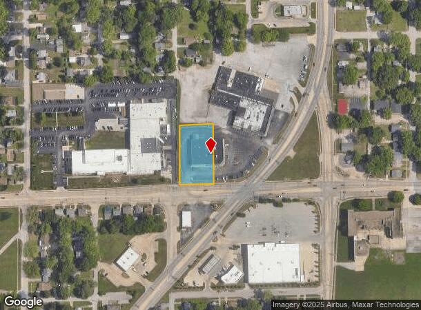
1311 E North St, Decatur, IL 62521

NEARBY LISTINGS FOR SALE OR LEASE
Property Detail
1311 E North St
Decatur, IL
County Clerks Sub
04-12-09-284-009
COUNTY CLERKS SUBD SE1/4 NE1/4~N259.15 LOT 8 ~ 271.15X147 ~
Commercialacreage
Macon
X
Illinois
17115C0305E
8
2024
0.92 AC
2024
Springfield/Decatur
000200
Other Market Areas
DEMOGRAPHICS near 1311 E North St
1 Mile
3 Mile
5 Mile
2024 Total Population
11,062
49,484
73,717
2029 Population
10,956
48,702
71,992
Pop Growth 2024-2029
(0.96%)
(1.58%)
(2.34%)
Average Age
38
40
41
2024 Total Households
4,694
21,340
32,145
HH Growth 2024-2029
(1.07%)
(1.66%)
(2.43%)
Median Household Inc
$35,464
$38,411
$42,956
Avg Household Size
2.20
2.10
2.10
2024 Avg HH Vehicles
1.00
1.00
2.00
Median Home Value
$62,282
$77,079
$91,226
Median Year Built
1952
1956
1960
Nearby Places
Map Layers
Map Styles
 Street
 Aerial
- Restaurants
- Banks
- Shops
- Fitness
- Groceries
Nearby Properties
Address
Land Use
TOTAL SIZE
Lot Size
Zoning
Address
Land Use
TOTAL SIZE
Lot Size
Zoning
1.03 AC
MUNICIPAL
Address
Land Use
TOTAL SIZE
Lot Size
Zoning
1.40 AC
MUNICIPAL
Address
Land Use
TOTAL SIZE
Lot Size
Zoning
6.60 AC
MUNICIPAL
Address
Land Use
TOTAL SIZE
Lot Size
Zoning
3.88 AC
MUNICIPAL
Address
Land Use
TOTAL SIZE
Lot Size
Zoning
12.24 AC
MUNICIPAL
Address
Land Use
TOTAL SIZE
Lot Size
Zoning
6.68 AC
MUNICIPAL
Address
Land Use
TOTAL SIZE
Lot Size
Zoning
18.50 AC
MUNICIPAL
Address
Land Use
TOTAL SIZE
Lot Size
Zoning
6.89 AC
MUNICIPAL
Address
Land Use
TOTAL SIZE
Lot Size
Zoning
19.95 AC
MUNICIPAL
Address
Land Use
TOTAL SIZE
Lot Size
Zoning
7.82 AC
MUNICIPAL
Address
Land Use
TOTAL SIZE
Lot Size
Zoning
3.35 AC
MUNICIPAL
Address
Land Use
TOTAL SIZE
Lot Size
Zoning
1.10 AC
MUNICIPAL
Address
Land Use
TOTAL SIZE
Lot Size
Zoning
78.13 AC
MUNICIPAL
Address
Land Use
TOTAL SIZE
Lot Size
Zoning
4.82 AC
MUNICIPAL
Address
Land Use
TOTAL SIZE
Lot Size
Zoning
6.35 AC
MUNICIPAL
Address
Land Use
TOTAL SIZE
Lot Size
Zoning
3.93 AC
MUNICIPAL
Address
Land Use
TOTAL SIZE
Lot Size
Zoning
14.33 AC
MUNICIPAL
Address
Land Use
TOTAL SIZE
Lot Size
Zoning
54.49 AC
MUNICIPAL
Address
Land Use
TOTAL SIZE
Lot Size
Zoning
4.30 AC
MUNICIPAL
Address
Land Use
TOTAL SIZE
Lot Size
Zoning
0.97 AC
MUNICIPAL
Address
Land Use
TOTAL SIZE
Lot Size
Zoning
3.50 AC
MUNICIPAL
Address
Land Use
TOTAL SIZE
Lot Size
Zoning
1.73 AC
MUNICIPAL
Address
Land Use
TOTAL SIZE
Lot Size
Zoning
14.76 AC
MUNICIPAL
Address
Land Use
TOTAL SIZE
Lot Size
Zoning
3.86 AC
MUNICIPAL
Address
Land Use
TOTAL SIZE
Lot Size
Zoning
14.80 AC
MUNICIPAL
Address
Land Use
TOTAL SIZE
Lot Size
Zoning
5.18 AC
MUNICIPAL
Address
Land Use
TOTAL SIZE
Lot Size
Zoning
7.10 AC
MUNICIPAL
Address
Land Use
TOTAL SIZE
Lot Size
Zoning
9.11 AC
MUNICIPAL
Address
Land Use
TOTAL SIZE
Lot Size
Zoning
35.07 AC
MUNICIPAL
The World's #1 Commercial Real Estate Marketplace
Connect with us
© 2025 CoStar Group
The information above has been obtained from sources believed reliable. While we do not doubt its accuracy we have not verified it and make no guarantee, warranty or representation about it. It is your responsibility to independently confirm its accuracy and completeness. Any projections, opinions, assumptions, or estimates used are for example only and do not represent the current or future performance of the property. The value of this transaction to you depends on tax and other factors which should be evaluated by your tax, financial, and legal advisors. You and your advisors should conduct a careful, independent investigation of the property to determine to your satisfaction the suitability of the property for your needs.