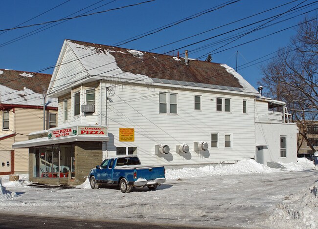
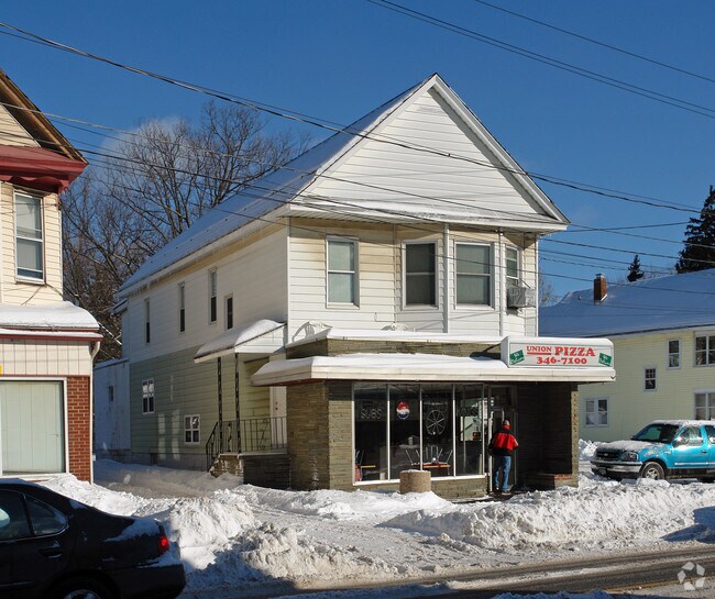
Property Record
1311 Nott St, Schenectady, NY 12308
NEARBY LISTINGS FOR SALE OR LEASE
Property Detail
1311 Nott St
Albany-Schenectady-Troy, NY
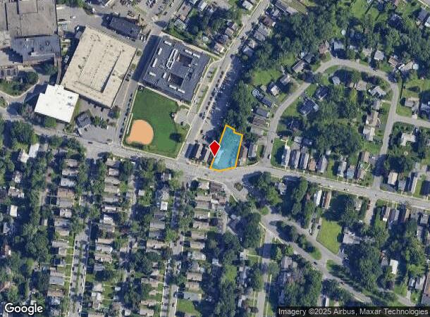
Map #1 Of Lots In The City Of Schenectad
040-053-0002-036-000-0000
AND 1 2 WOOD
Commercialofficeresidentialmixeduse
Schenectady
X
New York
36093C0158D
36.000
2025
0.30 AC
2024
Greater Schenectady
020500
Albany/Schenectady/Troy
3,204 SF
DEMOGRAPHICS near 1311 Nott St
1 Mile
3 Mile
5 Mile
2024 Total Population
20,973
88,809
152,150
2029 Population
22,243
93,494
159,729
Pop Growth 2024-2029
+ 6.06%
+ 5.28%
+ 4.98%
Average Age
38
39
41
2024 Total Households
8,849
36,287
62,688
HH Growth 2024-2029
+ 6.52%
+ 5.55%
+ 5.23%
Median Household Inc
$71,549
$63,425
$74,971
Avg Household Size
2.20
2.30
2.30
2024 Avg HH Vehicles
1.00
1.00
2.00
Median Home Value
$168,924
$174,332
$191,829
Median Year Built
1948
1949
1955
Nearby Places
- Restaurants
- Banks
- Shops
- Fitness
- Groceries
PUBLIC TRANSPORTATION
COMMUTER RAIL
DRIVE
WALK
Distance
5 min
1.8 mi
AIRPORT
Albany International
DRIVE
WALK
Distance
Albany International
18 min
8.7 mi
Freight Ports
Albany, NY Port
DRIVE
WALK
Distance
Albany, NY Port
31 min
19.7 mi
Nearby Properties
Address
Land Use
TOTAL SIZE
Lot Size
Zoning
Address
Land Use
TOTAL SIZE
Lot Size
Zoning
174.70 AC
Address
Land Use
TOTAL SIZE
Lot Size
Zoning
338.40 AC
Address
Land Use
TOTAL SIZE
Lot Size
Zoning
2,068,862 SF
204.52 AC
I-2
Address
Land Use
TOTAL SIZE
Lot Size
Zoning
583,211 SF
9.95 AC
03 - MULTI
Address
Land Use
TOTAL SIZE
Lot Size
Zoning
155,023 SF
18.81 AC
06 - INDUS
Address
Land Use
TOTAL SIZE
Lot Size
Zoning
6,733 SF
100 AC
03 - MULTI
Address
Land Use
TOTAL SIZE
Lot Size
Zoning
600 SF
28.40 AC
06 - INDUS
Address
Land Use
TOTAL SIZE
Lot Size
Zoning
0.01 AC
06 - INDUS
Address
Land Use
TOTAL SIZE
Lot Size
Zoning
11,700 SF
43.80 AC
R2
Address
Land Use
TOTAL SIZE
Lot Size
Zoning
194,403 SF
315.80 AC
06 - INDUS
Address
Land Use
TOTAL SIZE
Lot Size
Zoning
184,878 SF
15.58 AC
03 - MULTI
Address
Land Use
TOTAL SIZE
Lot Size
Zoning
102,862 SF
32.45 AC
CS
Address
Land Use
TOTAL SIZE
Lot Size
Zoning
246,000 SF
9.85 AC
Address
Land Use
TOTAL SIZE
Lot Size
Zoning
120,755 SF
33.88 AC
R1
Address
Land Use
TOTAL SIZE
Lot Size
Zoning
59,240 SF
0.72 AC
05 - COMME
Address
Land Use
TOTAL SIZE
Lot Size
Zoning
123,030 SF
7.21 AC
03 - MULTI
Address
Land Use
TOTAL SIZE
Lot Size
Zoning
249,801 SF
54.35 AC
R1
Address
Land Use
TOTAL SIZE
Lot Size
Zoning
306,803 SF
3.20 AC
Address
Land Use
TOTAL SIZE
Lot Size
Zoning
234,485 SF
42.50 AC
02 - SINGL
Address
Land Use
TOTAL SIZE
Lot Size
Zoning
32,385 SF
5.02 AC
Address
Land Use
TOTAL SIZE
Lot Size
Zoning
19,080 SF
602.20 AC
CON
Address
Land Use
TOTAL SIZE
Lot Size
Zoning
12,528 SF
20.66 AC
R2
Address
Land Use
TOTAL SIZE
Lot Size
Zoning
284,171 SF
16.40 AC
03 - MULTI
Address
Land Use
TOTAL SIZE
Lot Size
Zoning
60,274 SF
12.95 AC
OT
Address
Land Use
TOTAL SIZE
Lot Size
Zoning
23,923 SF
109.83 AC
CON
Address
Land Use
TOTAL SIZE
Lot Size
Zoning
183,759 SF
1.40 AC
05 - COMME
Address
Land Use
TOTAL SIZE
Lot Size
Zoning
181,230 SF
1.02 AC
05 - COMME
Address
Land Use
TOTAL SIZE
Lot Size
Zoning
194.77 AC
Address
Land Use
TOTAL SIZE
Lot Size
Zoning
117,849 SF
5.76 AC
05 - COMME
Address
Land Use
TOTAL SIZE
Lot Size
Zoning
136,722 SF
2.01 AC
05 - COMME
The World's #1 Commercial Real Estate Marketplace
Connect with us
© 2025 CoStar Group
The information above has been obtained from sources believed reliable. While we do not doubt its accuracy we have not verified it and make no guarantee, warranty or representation about it. It is your responsibility to independently confirm its accuracy and completeness. Any projections, opinions, assumptions, or estimates used are for example only and do not represent the current or future performance of the property. The value of this transaction to you depends on tax and other factors which should be evaluated by your tax, financial, and legal advisors. You and your advisors should conduct a careful, independent investigation of the property to determine to your satisfaction the suitability of the property for your needs.