Property Record
1311 Nw 35Th St, Ocala, FL 34475

NEARBY LISTINGS FOR SALE OR LEASE
-
-
View all Ocala listings for sale on LoopNet.com
Property Detail
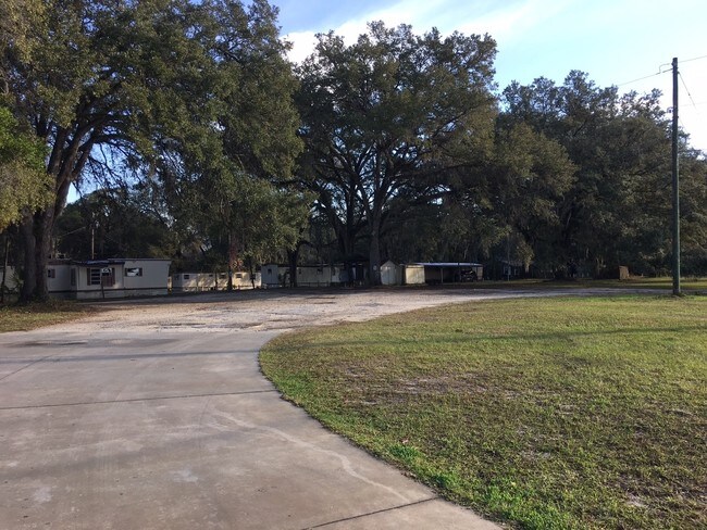
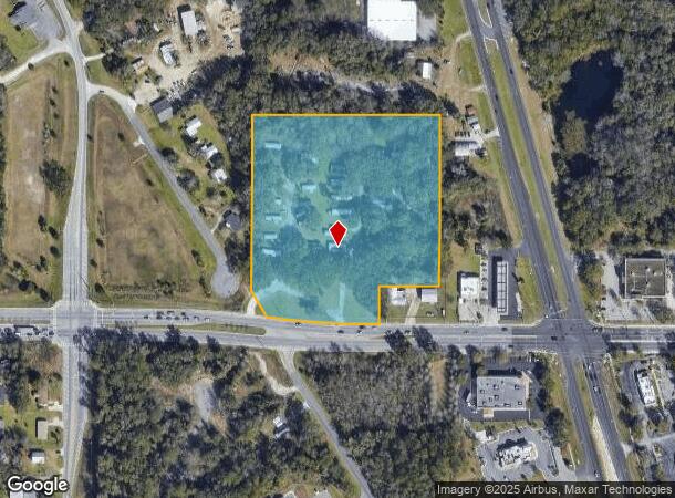
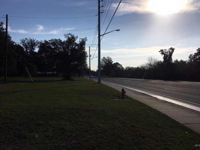
1311 Nw 35Th St
Ocala, FL
Country Oaks Mobile Home Park
15380-000-00
Marion
Mobilemanufacturedhomeregardlessoflandownership
Florida
X
7.83 AC
12083C0507D
Northwest Ocala
22,199 SF
Ocala
DEMOGRAPHICS near 1311 Nw 35Th St
1 Mile
3 Mile
5 Mile
2024 Total Population
2,778
29,165
77,910
2029 Population
3,165
33,016
87,847
Pop Growth 2024-2029
+ 13.93%
+ 13.20%
+ 12.75%
Average Age
39
39
41
2024 Total Households
1,105
11,607
32,055
HH Growth 2024-2029
+ 13.85%
+ 13.20%
+ 12.78%
Median Household Inc
$36,973
$38,595
$47,859
Avg Household Size
2.50
2.40
2.30
2024 Avg HH Vehicles
2.00
2.00
2.00
Median Home Value
$164,210
$160,661
$175,043
Median Year Built
1984
1979
1982
Nearby Places
- Restaurants
- Banks
- Shops
- Fitness
- Groceries
SALE & LEASE HISTORY
LISTING DATE
SALE/LEASE

Oct 11, 2023
For Sale
Feb 15, 2017
For Sale
Nearby Properties
Address
Land Use
TOTAL SIZE
Lot Size
Zoning
Address
Land Use
TOTAL SIZE
Lot Size
Zoning
704,765 SF
71.04 AC
GU
Address
Land Use
TOTAL SIZE
Lot Size
Zoning
1,085,670 SF
89.70 AC
M1
Address
Land Use
TOTAL SIZE
Lot Size
Zoning
612,196 SF
50.06 AC
M1
Address
Land Use
TOTAL SIZE
Lot Size
Zoning
617,520 SF
46.08 AC
M2
Address
Land Use
TOTAL SIZE
Lot Size
Zoning
195,992 SF
5.72 AC
FBC
Address
Land Use
TOTAL SIZE
Lot Size
Zoning
441,040 SF
150.01 AC
M1
Address
Land Use
TOTAL SIZE
Lot Size
Zoning
458,983 SF
35.14 AC
M1
Address
Land Use
TOTAL SIZE
Lot Size
Zoning
444,381 SF
60 AC
M1
Address
Land Use
TOTAL SIZE
Lot Size
Zoning
350,895 SF
27.85 AC
M1
Address
Land Use
TOTAL SIZE
Lot Size
Zoning
482,618 SF
34.54 AC
M2
Address
Land Use
TOTAL SIZE
Lot Size
Zoning
140,920 SF
28.09 AC
M2
Address
Land Use
TOTAL SIZE
Lot Size
Zoning
9,854 SF
55.14 AC
B2
Address
Land Use
TOTAL SIZE
Lot Size
Zoning
29,068 SF
22.30 AC
PD
Address
Land Use
TOTAL SIZE
Lot Size
Zoning
112,663 SF
32.72 AC
INST
Address
Land Use
TOTAL SIZE
Lot Size
Zoning
19,117 SF
0.98 AC
FBC
Address
Land Use
TOTAL SIZE
Lot Size
Zoning
160,796 SF
25.59 AC
M2
Address
Land Use
TOTAL SIZE
Lot Size
Zoning
26,801 SF
5.66 AC
FBC
Address
Land Use
TOTAL SIZE
Lot Size
Zoning
384,930 SF
17.76 AC
M1
Address
Land Use
TOTAL SIZE
Lot Size
Zoning
40,049 SF
1.06 AC
FBC
Address
Land Use
TOTAL SIZE
Lot Size
Zoning
50,199 SF
4.74 AC
FBC
Address
Land Use
TOTAL SIZE
Lot Size
Zoning
94,360 SF
17.51 AC
B5
Address
Land Use
TOTAL SIZE
Lot Size
Zoning
80,571 SF
13.72 AC
INST
Address
Land Use
TOTAL SIZE
Lot Size
Zoning
11,351 SF
3.51 AC
B2
Address
Land Use
TOTAL SIZE
Lot Size
Zoning
47,567 SF
12 AC
INST
Address
Land Use
TOTAL SIZE
Lot Size
Zoning
64,438 SF
12.27 AC
B4
Address
Land Use
TOTAL SIZE
Lot Size
Zoning
116,876 SF
23.78 AC
M2
Address
Land Use
TOTAL SIZE
Lot Size
Zoning
81,174 SF
18.50 AC
B2
Address
Land Use
TOTAL SIZE
Lot Size
Zoning
73,361 SF
23.20 AC
GU
Address
Land Use
TOTAL SIZE
Lot Size
Zoning
15,800 SF
1.15 AC
FBC
Address
Land Use
TOTAL SIZE
Lot Size
Zoning
55,809 SF
6.30 AC
M2
The World's #1 Commercial Real Estate Marketplace
Connect with us
© 2025 CoStar Group
The information above has been obtained from sources believed reliable. While we do not doubt its accuracy we have not verified it and make no guarantee, warranty or representation about it. It is your responsibility to independently confirm its accuracy and completeness. Any projections, opinions, assumptions, or estimates used are for example only and do not represent the current or future performance of the property. The value of this transaction to you depends on tax and other factors which should be evaluated by your tax, financial, and legal advisors. You and your advisors should conduct a careful, independent investigation of the property to determine to your satisfaction the suitability of the property for your needs.