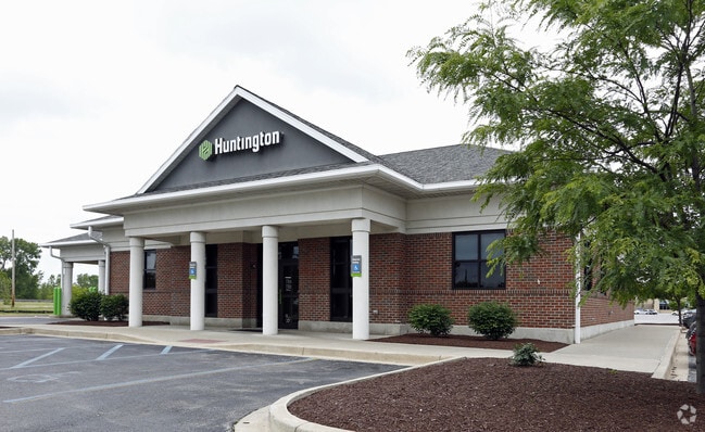
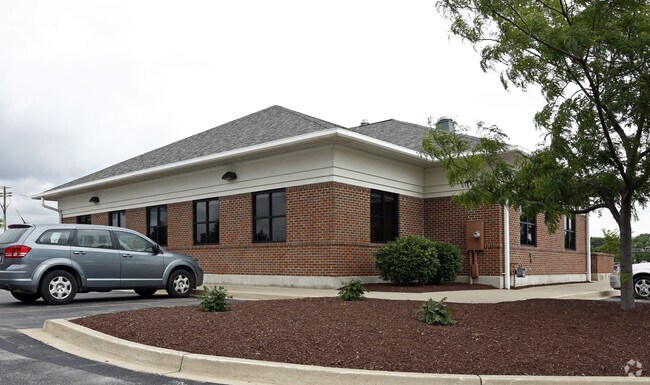
Property Record
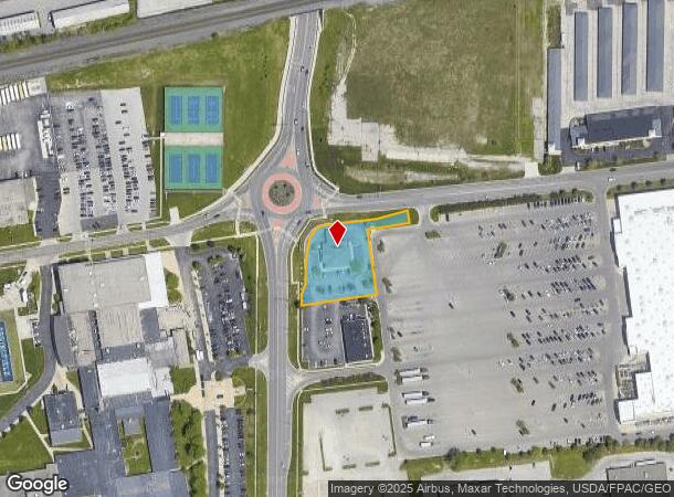
1311 S Mccord Rd, Holland, OH 43528
NEARBY LISTINGS FOR SALE OR LEASE
Property Detail
1311 S Mccord Rd
71-00783
2 15 NW 1/4 PART PLAT OF PREDOM MARTINESTATE LOT 4...IRREG
Financialbuilding
Lucas
X
Ohio
39173C0005D
4
2024
0.92 AC
2024
South/Southwest
008802
Toledo
3,848 SF
Toledo, OH
DEMOGRAPHICS near 1311 S Mccord Rd
1 Mile
3 Mile
5 Mile
2024 Total Population
4,571
53,614
127,964
2029 Population
4,461
53,033
125,882
Pop Growth 2024-2029
(2.41%)
(1.08%)
(1.63%)
Average Age
46
41
41
2024 Total Households
1,982
23,884
56,184
HH Growth 2024-2029
(2.32%)
(0.98%)
(1.57%)
Median Household Inc
$57,982
$58,380
$61,364
Avg Household Size
2.10
2.10
2.20
2024 Avg HH Vehicles
2.00
2.00
2.00
Median Home Value
$185,087
$173,523
$174,768
Median Year Built
1980
1982
1977
Nearby Places
Map Layers
Map Styles
 Street
 Aerial
- Restaurants
- Banks
- Shops
- Fitness
- Groceries
PUBLIC TRANSPORTATION
COMMUTER RAIL
Toledo (Capitol Limited - Amtrak, Lake Shore Limited - Amtrak)
DRIVE
WALK
Distance
Toledo (Capitol Limited - Amtrak, Lake Shore Limited - Amtrak)
16 min
9.4 mi
AIRPORT
Eugene F Kranz Toledo Express
DRIVE
WALK
Distance
Eugene F Kranz Toledo Express
23 min
10.8 mi
Freight Ports
Port of Toledo
DRIVE
WALK
Distance
Port of Toledo
30 min
15.5 mi
SALE & LEASE HISTORY
LISTING DATE
SALE/LEASE

Sep 24, 2016
For Sale
Sep 23, 2016
For Sale
Nearby Properties
Address
Land Use
TOTAL SIZE
Lot Size
Zoning
Address
Land Use
TOTAL SIZE
Lot Size
Zoning
329,064 SF
69.74 AC
10-RS6
Address
Land Use
TOTAL SIZE
Lot Size
Zoning
186,190 SF
14 AC
19-C2
Address
Land Use
TOTAL SIZE
Lot Size
Zoning
196,149 SF
18.69 AC
10-RD6
Address
Land Use
TOTAL SIZE
Lot Size
Zoning
35.94 AC
17-C3
Address
Land Use
TOTAL SIZE
Lot Size
Zoning
211,140 SF
28.92 AC
10-IC
Address
Land Use
TOTAL SIZE
Lot Size
Zoning
138,607 SF
21.30 AC
10-RS12
Address
Land Use
TOTAL SIZE
Lot Size
Zoning
178,915 SF
13 AC
19-R3
Address
Land Use
TOTAL SIZE
Lot Size
Zoning
352,382 SF
62.93 AC
16-M1
Address
Land Use
TOTAL SIZE
Lot Size
Zoning
148,680 SF
8.50 AC
19-M3
Address
Land Use
TOTAL SIZE
Lot Size
Zoning
212,664 SF
21.43 AC
24-B3
Address
Land Use
TOTAL SIZE
Lot Size
Zoning
139,741 SF
30.48 AC
19-RA3
Address
Land Use
TOTAL SIZE
Lot Size
Zoning
200,639 SF
16.39 AC
24-SUP
Address
Land Use
TOTAL SIZE
Lot Size
Zoning
156,420 SF
12 AC
19-R3
Address
Land Use
TOTAL SIZE
Lot Size
Zoning
238,148 SF
18.20 AC
24-B3
Address
Land Use
TOTAL SIZE
Lot Size
Zoning
200,978 SF
13.15 AC
10-RD6
Address
Land Use
TOTAL SIZE
Lot Size
Zoning
214,986 SF
17.55 AC
19-R1
Address
Land Use
TOTAL SIZE
Lot Size
Zoning
111,195 SF
13.64 AC
19-C2
Address
Land Use
TOTAL SIZE
Lot Size
Zoning
78,166 SF
2.08 AC
16-CM
Address
Land Use
TOTAL SIZE
Lot Size
Zoning
120,077 SF
9.53 AC
24-B3
Address
Land Use
TOTAL SIZE
Lot Size
Zoning
131,201 SF
10 AC
10-CUP
Address
Land Use
TOTAL SIZE
Lot Size
Zoning
126,732 SF
15 AC
10-CRSO
Address
Land Use
TOTAL SIZE
Lot Size
Zoning
337,990 SF
17.75 AC
16-M1
Address
Land Use
TOTAL SIZE
Lot Size
Zoning
58.33 AC
10-IL
Address
Land Use
TOTAL SIZE
Lot Size
Zoning
140,008 SF
10 AC
19-R3
Address
Land Use
TOTAL SIZE
Lot Size
Zoning
160,811 SF
10.83 AC
10-MX
Address
Land Use
TOTAL SIZE
Lot Size
Zoning
133,079 SF
15.45 AC
10-CR
Address
Land Use
TOTAL SIZE
Lot Size
Zoning
78,685 SF
14.86 AC
10-RS12
Address
Land Use
TOTAL SIZE
Lot Size
Zoning
103,406 SF
7.55 AC
24-SUP
Address
Land Use
TOTAL SIZE
Lot Size
Zoning
81,676 SF
4 AC
19-C2
Address
Land Use
TOTAL SIZE
Lot Size
Zoning
60,805 SF
9.38 AC
10-RS12
The World's #1 Commercial Real Estate Marketplace
Connect with us
© 2025 CoStar Group
The information above has been obtained from sources believed reliable. While we do not doubt its accuracy we have not verified it and make no guarantee, warranty or representation about it. It is your responsibility to independently confirm its accuracy and completeness. Any projections, opinions, assumptions, or estimates used are for example only and do not represent the current or future performance of the property. The value of this transaction to you depends on tax and other factors which should be evaluated by your tax, financial, and legal advisors. You and your advisors should conduct a careful, independent investigation of the property to determine to your satisfaction the suitability of the property for your needs.